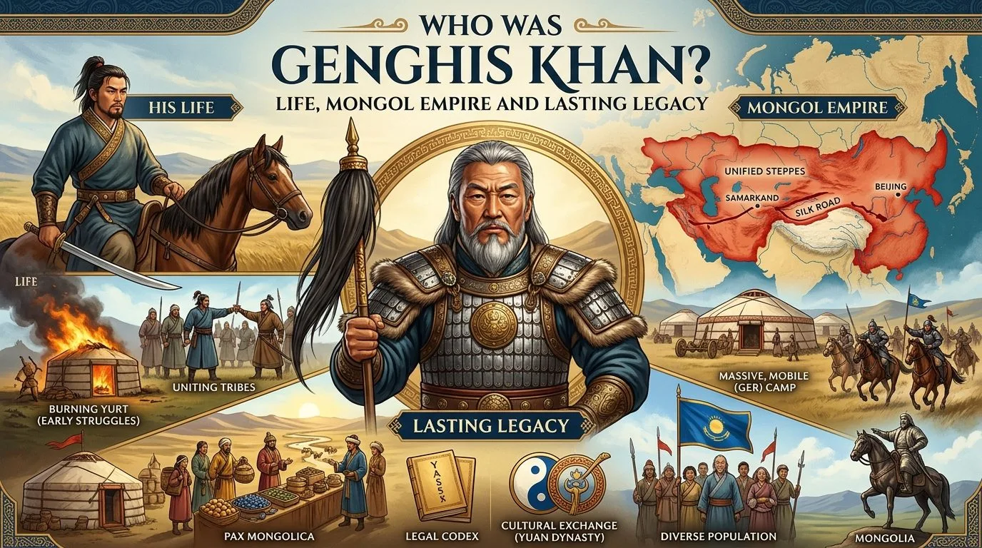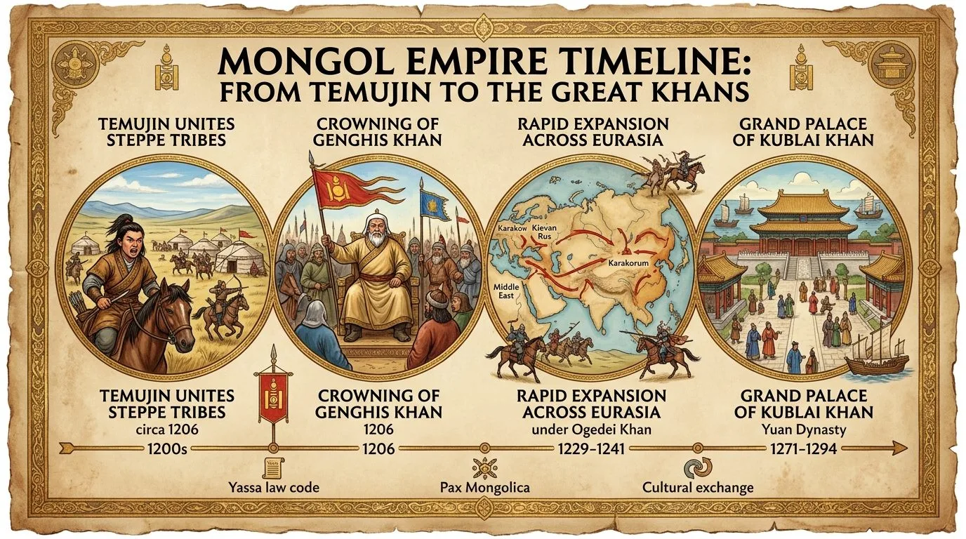
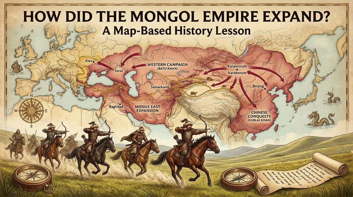
How did the Mongol Empire expand? Between 1206 and the late thirteenth century, Mongol armies grew from a united steppe power in present-day Mongolia into a network of territories stretching across much of Eurasia. Genghis Khan (Chinggis Khan) began the expansion by unifying the Mongolian steppe and attacking neighbouring states in northern China and Central Asia. After his death in 1227, his sons and grandsons expanded Mongol power into the Rus' principalities, eastern and central Europe, western Asia and southern China. The Mongol Empire became the largest contiguous land empire in history, but its farthest reach did not belong to one ruler at one moment.
To understand this history, a map is more revealing than a list of battles. Mountains, rivers, grasslands, cities, distances and political frontiers shaped where armies travelled—and where they could not hold power. A campaign arrow does not necessarily mean permanent conquest: a raid may reach a place without establishing lasting rule. A coloured territory on a modern historical atlas may represent direct administration, tributary dependence or a simplified reconstruction. These categories must be distinguished.
This map-based history lesson follows five stages—1206, 1227, 1241, 1258 and 1279—and includes a reference-map guide, chronological table, classroom activity, answer key and discussion questions. The timeline has been checked against the OpenStax early-Mongol map , the Royal Armouries campaign chronology and Columbia University's expansion overview .
Start here: two historical maps to read alongside this lesson
Map A — The Mongol Empire during Genghis Khan's lifetime (1206–1227): Open OpenStax World History, Figure 14.9 . Find the central Mongolian core, the Jin and Western Xia to the south and east, and the movement westward toward Qara Khitai and Khwarazm. Notice that some arrows reach beyond the boundary of enduring Mongol control.
Map B — The successor realms in the early fourteenth century: Open OpenStax World History, Figure 16.5 . Compare the four major political centres—Yuan China, the Chagatai Khanate, the Golden Horde and the Ilkhanate. This later map does not describe an undivided empire at Genghis Khan's death.
These are linked scholarly reference maps, not images reproduced without checking their reuse terms. OpenStax marks its map figures with a CC BY-NC-SA 4.0 attribution; any website that wishes to republish the underlying artwork should review licence compatibility and credit requirements first. For another set of atlas links, Columbia University's Mongol history maps directory points to maps of the early empire and its later breakup.
Map-reading key: what should each symbol mean?
| Symbol to draw on a worksheet | Meaning | Important caution |
|---|---|---|
| Solid colour | Territory held or governed at the date shown | Control could be uneven across remote areas |
| Dashed arrow | Campaign, expedition or raid direction | An arrow is not proof of permanent occupation |
| Open circle | City or political centre | Use its historical and modern names when known |
| Star | Important battle or siege | Battle victory does not necessarily end a war |
| Hatching | Tributary or contested region | Different atlases may draw boundaries differently |
| Different colour for each period | Newly added territory or area of influence | Record whether it was added by Genghis or his successors |
Draw a separate map for each phase rather than painting every conquest in one colour. A map labelled “the Mongol Empire, 1294” answers a different question from one labelled “conquests under Genghis Khan, to 1227”.
Mongol Empire expansion timeline: dates and destinations
| Date | Campaign or turning point | Place to find on a map |
|---|---|---|
| 1206 | Temüjin recognised as Genghis Khan after steppe unification | Mongolian steppe |
| 1209 | Major Western Xia campaign; submission without final destruction of the dynasty | North-western China |
| 1211–1215 | War with the Jin; Zhongdu (near today's Beijing) fell in 1215 | Northern China |
| 1218 | Mongol capture of the Qara Khitai realm | Central Asia, near the Tian Shan region |
| 1219–1221 | Conquest of key Khwarazmian territories and cities | Otrar, Bukhara, Samarkand and farther southwest |
| 1223 | Raid and victory at the Kalka River by Mongol commanders | North of the Black Sea; not permanent conquest of all Rus' |
| 1227 | Genghis Khan dies during the final Western Xia campaign | Western Xia, now north-western China |
| 1234 | Jin dynasty falls under his successors | Northern China |
| 1236–1240 | Batu's armies advance through Volga Bulgaria and the Rus' lands; Kyiv falls in 1240 | Volga River basin and Kyiv |
| 1241–1242 | Armies win major battles in Poland and Hungary, then withdraw from Hungary | Legnica, Mohi and the Danube basin |
| 1256–1258 | Hülegü's western campaign; Baghdad falls in 1258 | Iran and Iraq |
| 1260 | Mongol defeat by the Mamluks at Ain Jalut; succession struggle intensifies | Southern Levant and Mongol ruling centres |
| 1271–1279 | Kublai declares the Yuan dynasty; final Southern Song resistance ends in 1279 | North and south China, including Hangzhou and Yamen |
The timeline synthesises Royal Armouries , Columbia University , and the OpenStax successor-state chapter . Different atlases may date the beginning of a campaign or the surrender of a state slightly differently; the sequence and distinction between generations are more important than artificially precise borders.
Phase 1 — 1206: the Mongolian steppe becomes the imperial centre
Begin with present-day Mongolia, north of China and between the vast Siberian region and the deserts and highlands of Inner Asia. Steppe societies relied heavily on horses and pastoral herds, and political coalitions could cross tribal or kinship boundaries. Temüjin united major rival forces and was proclaimed Genghis Khan at an assembly in 1206. This united leadership provided the military and political foundation for later campaigns.
On your first map, colour the Mongolian core—not all of Asia. Label the steppe, the Gobi Desert to the south and the Altai Mountains to the west. These features help explain both mobility and constraint: riding across open grasslands could be easier than crossing arid, mountainous or heavily fortified regions. Mongol forces had to manage grazing opportunities, remount horses, supplies and the season.
Do not mark the city of Karakorum as the political capital of 1206. It became an important imperial capital under Ögedei, Genghis Khan's successor. This is a useful example of why a location may be historically important at one date but not at an earlier one. The Columbia University teaching module explains the relationship between unification and expansion.
Phase 2 — 1209–1227: expansion into northern China and Central Asia
East and south: Western Xia and the Jin
Draw two arrows moving out of the Mongolian heartland. One points southwest toward the Western Xia (Xi Xia) kingdom; a major Mongol campaign in 1209 forced its submission, but the dynasty was not destroyed until the renewed campaign of 1226–1227. The second points toward the Jurchen-ruled Jin dynasty of northern China, which the Mongols attacked from 1211. They captured Zhongdu, near modern Beijing, in 1215.
At this stage, mark major rivers and the boundary with the Southern Song state. Northern China was not the same as all China. The Jin resisted for years and was only finally defeated in 1234, after Genghis Khan's death. The Southern Song remained independent far longer. The OpenStax campaign map distinguishes the states and campaign routes.
West: Qara Khitai and Khwarazm
On the western side of the map, find the Tian Shan mountains and Central Asian trade cities. The Mongols brought the Qara Khitai realm under their power in 1218, providing access toward the territories of the Khwarazmian Empire. Following the seizure of a trading caravan at Otrar and a diplomatic rupture, Genghis Khan invaded Khwarazm in 1219.
Mark Otrar in modern Kazakhstan and the cities of Bukhara and Samarkand in modern Uzbekistan. These were linked to established trade routes and irrigated urban economies. Mongol forces took major cities during 1219–1221, and campaigns moved into what is now Iran and Afghanistan. Warfare was extremely destructive in places; historical sources describe massacres, deportations and damaged infrastructure. Their precise casualty totals should not be presented as known facts.
Another Mongol force travelled north of the Caspian and Black seas, defeating a Rus' and allied coalition at the Kalka River in 1223. Draw this as a dashed expedition arrow, not as solid-colour control of all later Golden Horde territory. A raid's reach and an empire's durable borders are different. Genghis Khan died in 1227 during the final Western Xia campaign. These are the main territories and routes to show on your 1227 map.
Phase 3 — 1229–1242: successors reach the Rus' lands and central Europe
After Genghis Khan's death, Ögedei became great khan in 1229. His reign saw major further expansion. In East Asia, the Jin dynasty fell in 1234. In the west, Mongol armies under Batu Khan, a grandson of Genghis Khan, and other commanders moved into Volga Bulgaria and the Rus' principalities.
Find the Volga River, then track the 1236–1240 invasions west and southwest. Cities including Ryazan and Vladimir fell during the campaigns; Kyiv fell in 1240. The Mongols proceeded into Poland and Hungary. Important victories followed at Legnica in Poland on 9 April 1241 and Mohi in Hungary in April 1241. The two European campaigns were related but took place along different routes.
In 1242, the Mongol forces withdrew from Hungary. A traditional explanation emphasises Ögedei's death in December 1241 and the politics of choosing a successor. Other scholarship explores occupation costs, fortifications, climate and logistical pressures. The withdrawal's full explanation remains debated: a historical map can show the retreat but cannot settle the motive. A Cambridge historical study stresses succession, while environmental research and a subsequent critique illustrate the debate.
On the 1241 map, mark Legnica and Mohi with stars, and use arrows for the western military advance. Do not fill all of France or Germany as Mongol-controlled simply because troops raided or fought west of the steppe. The Royal Armouries chronology and Columbia's teaching notes cover the western campaigns.
Phase 4 — 1251–1260: campaigns in Iran, Iraq and the Levant
The Mongol imperial leadership changed again when Möngke became great khan in 1251. His brother Hülegü led a major campaign in western Asia, moving through Iran and overcoming Nizari Ismaili strongholds in 1256. In 1258, Mongol forces captured Baghdad, ending the Abbasid caliph's rule there. The siege and its aftermath caused extensive suffering and destruction; medieval death figures vary widely and should not be treated as precise counts.
On your map, locate the Zagros Mountains, the Tigris River, Baghdad and the routes linking the Iranian plateau with Mesopotamia. In 1260, a Mongol force was defeated by the Mamluks at Ain Jalut in the southern Levant. This checked a particular western advance, not every Mongol military operation everywhere. Mongol-led successor states continued to struggle for regional power.
The death of Möngke in 1259 triggered an imperial succession dispute involving Kublai and Ariq Böke. Dynastic conflict accelerated the development of regional khanates rather than a unified command from Mongolia. For the period's military sequence and political split, see the Royal Armouries and OpenStax's account of fragmentation .
Phase 5 — 1260–1279: Kublai Khan and the conquest of southern China
Under Kublai Khan, a grandson of Genghis Khan, Mongol power was consolidated in China. Kublai proclaimed the Yuan dynasty in 1271, while warfare against the Southern Song continued. The Song had strong cities, river defences and naval resources. Unlike the open steppe, the terrain of southern China required Mongol-led armies to adapt, employ engineers, control waterways and use the expertise of Chinese and other non-Mongol soldiers and sailors.
Hangzhou, a major Southern Song political centre in today's Zhejiang Province, surrendered in 1276. Resistance continued elsewhere. The final Song defeat came at the naval battle of Yamen in 1279, in what is now Guangdong Province. This completed Kublai's conquest of China, although that achievement did not restore political unity to the independent Mongol khanates across western and central Eurasia.
On your last chronological map, shade the Yuan-controlled regions and identify the remaining Mongol successor states with separate colours. A map showing all four khanates connected by one unbroken colour can suggest more political unity than existed in practice. OpenStax's Southern Song chapter explains the importance of southern China's rivers and ships; its later khanate map shows the distinct centres of government.
Why could Mongol armies expand so far?
Geography gave the Mongols opportunities, not an automatic victory. Extensive steppe corridors offered pasture and movement routes for cavalry and remount horses. Mongol soldiers could communicate and operate in coordinated units; commanders relied on reconnaissance, local information, mobility and the ability to change tactics.
Imperial organisation also mattered. Decimal military units, experienced commanders, alliance networks and discipline helped combine fighters from different communities. Campaigns could use feigned retreats, multi-directional advances and psychological pressure. Against fortified cities, the Mongols relied on engineers and siege specialists, including people recruited or compelled to serve from conquered societies. As the empire expanded, it had to adapt to environments where cavalry alone was insufficient.
Neighbouring states were not passive. Their political rivalries, alliances and military resources shaped the outcome of campaigns. The Columbia University teaching module explains the importance of organisation and tactics; the Royal Armouries documents changes in campaigning from northern China to Europe and the Middle East.
It would be inaccurate to explain conquest through a single cause such as “Mongols had horses” or “climate made them invincible”. Logistics, leadership, local resistance, siege technology and political decisions all helped determine what happened in a given region.
How far did the empire extend, and what stopped expansion?
At its greatest reach the Mongol-led imperial world extended across a vast continuous area of Eurasia, but historians distinguish the largest contiguous land empire from the largest overseas empire by total land area. Precise area figures depend on the date chosen, the treatment of tributary dependencies and the map's boundary assumptions; broad estimates should not be presented as measurements accurate to the nearest square kilometre.
Conquest faced limits. The Mongols suffered setbacks in the Levant, never incorporated much of western Europe as permanent territory, and Kublai's attempted invasions of Japan in 1274 and 1281 failed. Campaigns in Southeast Asia also encountered major logistical and military difficulties. Terrain, fortifications, maritime conditions, enemy resistance, succession disputes and internal wars affected these outcomes.
Imperial unity weakened after 1259–1260, when rival descendants fought over supremacy. Four powerful successor centres emerged: the Golden Horde in the western steppe and Rus' sphere, the Chagatai Khanate in Central Asia, the Ilkhanate in Iran and Iraq, and the Yuan dynasty in China. They were linked by family history but were not always politically united or peaceful toward one another. The Royal Armouries' successor-state overview and OpenStax's map of the khanates illustrate the transition.
What did expansion change for the people of Eurasia?
Maps of growing states show political control, but they can hide human experience. In parts of Central Asia, northern China, the Rus' lands and western Asia, Mongol invasions involved mass killing, captivity, destruction of settlements and displacement. Exact death tolls reported by medieval chroniclers are disputed and should not be repeated as reliable counts without careful scholarship.
Later Mongol administrations also supported messenger relays, merchants, long-distance travel and the movement of skilled people and artistic techniques. The phrase Pax Mongolica refers to relative security on some routes in parts of the thirteenth and fourteenth centuries, not universal peace. The Silk Roads existed long before the Mongols, and exchange under their rule sometimes occurred alongside coercion and inequality. Oxford's study of Mongol-era trade and OpenStax's regional history provide important balance.
Classroom map activity: create a five-stage Mongol Empire atlas
Suitable for: secondary-school history, introductory world history and independent learners. Time: approximately 35–50 minutes. Materials: five blank outline maps of Eurasia; coloured pencils; ruler; notebook; and the two linked OpenStax reference maps (use the sites as viewing references, subject to their reuse terms).
- Draw the base map. On every sheet label the Mongolian steppe, Gobi Desert, Altai and Tian Shan ranges, Volga, Caspian Sea, Black Sea, Yellow River, Yangtze River and Tigris River. Locate the relevant modern countries as geographic guides, not as medieval political borders.
- Map 1206. Shade the Mongolian political heartland. Write “steppe unification” and note that the later empire had not yet conquered northern China or Khwarazm.
- Map 1227. Add expansion toward Western Xia, Jin territory, Qara Khitai and Khwarazm. Mark Zhongdu, Otrar, Bukhara and Samarkand. Draw the 1223 Kalka expedition as a dashed arrow beyond secure rule.
- Map 1241. Mark the Jin's 1234 defeat, the Volga corridor, Kyiv's fall in 1240, and the 1241 battles at Legnica and Mohi. Use separate symbols for durable political influence and expedition routes.
- Map 1258. Mark Iran, Baghdad and the Tigris, then annotate the fall of Baghdad in 1258. Indicate that the fragmentation of central authority accelerated after 1259.
- Map 1279. Add southern China, Hangzhou and Yamen. Colour the major successor realms separately. Do not imply that the same central authority directly governed them as one unbroken state.
- Write a four-sentence evaluation. Identify one geographic advantage, one military adaptation, one limitation or failed campaign, and one way a static map might mislead someone about control or civilian experiences.
Map-based questions for students
- Which regions were added during Genghis Khan's lifetime, and which were conquered by his successors?
- Why is the 1223 Kalka River expedition not the same as the conquest of Kyiv in 1240?
- How did rivers and fortified cities create different challenges from the open steppe?
- Why should the 1279 map show more than one political colour for the Mongol successor states?
- Which two battles show the western reach of the campaigns in April 1241?
- What does a conquest map fail to show about violence, local resistance or cultural exchange?
Teacher's answer key
1. Genghis Khan's lifetime includes unification and major conquests in parts of northern China and Central Asia; his successors completed the Jin conquest, expanded into the Rus' lands and Europe, conquered Baghdad and finished the Southern Song. 2. Kalka was a long-range 1223 raid and battlefield victory; Kyiv was captured in the major 1240 invasion under Batu. 3. Rivers, walls and ships required engineers, sieges, local allies and adapted techniques. 4. The khanates shared dynastic origins but increasingly had independent politics. 5. Legnica in Poland and Mohi in Hungary. 6. It cannot directly depict killings, displacement, disputed casualty counts, everyday administration or the difference between coerced and voluntary movement.
Optional extension: Compare how the same site appears in maps dated 1227, 1241 and 1335. Ask whether a changed colour represents conquest, tribute, a new ruler, or simply a different historian's cartographic convention. A map is an argument about historical space, not a photograph of medieval borders.
Common mistakes when reading maps of Mongol expansion
| Misconception | Better interpretation |
|---|---|
| “Genghis Khan conquered everything shown on the largest map.” | His successors were responsible for much of the expansion after 1227. |
| “A campaign arrow shows permanent rule.” | Some arrows mark raids, failed invasions or short-term operations. |
| “Mongols controlled all of Europe.” | They raided and fought in parts of Europe, but most of western Europe was not incorporated. |
| “All of China fell in 1215.” | Zhongdu fell in 1215, the Jin dynasty in 1234 and the Southern Song in 1279. |
| “Baghdad fell under Genghis Khan.” | His grandson Hülegü's armies captured Baghdad in 1258. |
| “The four khanates were always one harmonious state.” | Power increasingly fragmented and successor rulers sometimes fought one another. |
| “A large coloured area proves effective control everywhere.” | Borderlands, tributaries and contested zones often had uneven control. |
Frequently asked questions
When did the Mongol Empire begin expanding?
The imperial state was founded in 1206 after Genghis Khan united major steppe peoples. Important campaigns against Western Xia and Jin followed in 1209 and 1211, and expansion westward accelerated after the 1218 conquest of Qara Khitai and the invasion of Khwarazm in 1219.
How far west did Mongol armies travel?
They campaigned through the Rus' lands and into Poland and Hungary in 1241, and separately into the Middle East. Reaching a location did not always mean it was incorporated into stable Mongol administration.
Did Genghis Khan conquer Russia or all of China?
No. He ordered or directed earlier campaigns, but the principal invasions of the Rus' lands in the late 1230s and the final conquest of the Southern Song in 1279 occurred under his successors.
Which leader captured Baghdad?
Hülegü, a grandson of Genghis Khan, led the Mongol campaign that took Baghdad in 1258.
Why did the Mongols leave Hungary in 1242?
The reasons remain debated. Ögedei Khan's death and the succession question are important explanations, while historians have also investigated logistics, environmental conditions and the challenges of long-term occupation.
Why did the Mongol Empire break into khanates?
Succession struggles and increasingly independent regional rulers weakened central control, especially after 1259–1260. Major successor realms developed around China, Central Asia, the western steppe and Iran.
What is the best way to learn the Mongol Empire on a map?
Compare maps from 1206, 1227, 1241, 1258 and 1279, use a consistent legend, label major landforms and distinguish battle locations, expeditions, tributary influence and durable political control.
Conclusion: the map tells a story of expansion and fragmentation
The Mongol Empire expanded through a series of campaigns beginning with the steppe unification of 1206 and continuing well beyond Genghis Khan's death in 1227. Geography shaped the routes armies took; leadership, organisation and the incorporation of technical expertise helped them overcome many defences. Later leaders extended Mongol power to the Rus' lands, Baghdad and southern China, culminating in the conquest of the Southern Song in 1279.
But the largest coloured shape on an atlas is not the entire story. A proper map-based lesson distinguishes short-lived raids from actual governance, one generation from the next, and the united empire from its rival successor states. It also remembers the people whose lives were transformed or destroyed by conquest, alongside the commercial and cultural connections that developed in later Mongol-ruled territories.
References and map-reading resources
- OpenStax World History — Chinggis Khan and the Early Mongol Empire (Figure 14.9) .
- OpenStax World History — The Mongol Empire Fragments .
- OpenStax World History — Asia, North Africa, and Europe in the Early Fourteenth Century (Figure 16.5) .
- Royal Armouries — Rise of the Mongols .
- Royal Armouries — Fall of an Empire .
- Columbia University, Asia for Educators — Expansion Under Chinggis's Successors .
- Columbia University, Asia for Educators — Links to Key Mongol Maps .
- Bulletin of SOAS — The Deaths of Two Khaghans: A Comparison of Events in 1242 and 1260 .
- Scientific Reports (2016) — Climatic and Environmental Aspects of the Mongol Withdrawal from Hungary .
- Scientific Reports (2017) — Climate of Doubt: A Re-evaluation of the Environmental Hypothesis .
- Oxford — Pax Mongolica: Trade and Traders in the Mongol Empire .