

Kuwait is a small, mostly flat desert country at the northwestern end of the Gulf. Its geography is shaped by extreme heat, scarce natural freshwater, shallow coastal waters and sediment arriving near the Tigris–Euphrates river system. Oil transformed its economy and skyline, but maritime trade, fishing, pearl diving, pastoral connections and migration shaped Kuwaiti society long before petroleum exports.
The familiar contrast between glass towers and empty sand is real but incomplete. Kuwait also contains tidal mudflats, islands, salt marshes, desert shrublands and Kuwait Bay, an ecologically productive inlet beside one of the region's largest urban areas.
1. Where Is Kuwait?
Kuwait lies in Western Asia, at the northeastern edge of the Arabian Peninsula. It borders Iraq to the north and west and Saudi Arabia to the south. The Gulf lies to the east.
Kuwait Bay cuts deeply into the coast and helped provide a sheltered setting for Kuwait City. The country's islands include Bubiyan, Warbah, Failaka, Miskan, Auhah, Kubbar, Qaruh and Umm al-Maradim. Bubiyan is the largest, while Failaka is best known for its archaeology and settlement history.
Kuwait City is the capital and the core of a continuous metropolitan area extending through several governorates. Al Ahmadi developed with the oil industry, Al Jahra serves the northwestern region, and ports and industrial districts line parts of the coast.
Kuwait is not an island and does not border the open Arabian Sea. Its Gulf location connects it by water to Iraq, Iran, Saudi Arabia and the wider Indian Ocean trading system.
2. Quick Country Facts
- Official name: State of Kuwait
- Capital: Kuwait City
- Region: Western Asia; Arabian Peninsula and Gulf
- Area: approximately 17,818 square kilometers
- Population: approximately 4.87 million in 2025, World Bank estimate
- 2021 registered census total: 4,385,717, including about 1.49 million Kuwaitis and 2.90 million non-Kuwaitis within the stated coverage
- Currency: Kuwaiti dinar (KWD)
- Official language: Arabic; English is widely used
- Time zone: Arabian Standard Time, UTC+3
- Highest elevation: approximately 306 meters in western Kuwait
- Major coastal feature: Kuwait Bay
- Political system: hereditary constitutional emirate
- Administrative divisions: six governorates
Population numbers require a date and definition because migrant workers and other non-citizen residents form most of the total population. Census and international estimates may also use different reference dates and coverage.
3. Geography and Landscape
Most of Kuwait is a gently sloping desert plain. The surface descends from slightly higher ground in the west toward the Gulf. There are no permanent rivers or natural freshwater lakes, and no mountain ranges.
Gravel and sand cover much of the interior. Shallow depressions collect water after rare rain, and dry channels may briefly flow. Wind forms dunes in some places, but Kuwait is not entirely a sea of high sand dunes; broad stony, silty and compacted surfaces are common.
The coast is varied. Sandy beaches occur in some areas, while northern Kuwait Bay and the shores near Bubiyan and Warbah contain extensive mudflats, tidal channels and salt-tolerant marsh vegetation. Fine sediment from the Shatt al-Arab region contributes to this low, shallow landscape.
Kuwait Bay is a semi-enclosed inlet with limited water exchange compared with the open Gulf. It supports plankton, fish nurseries and birds, but urban runoff, industry, sewage, dredging and coastal construction can place it under stress.
Bubiyan is a low, largely uninhabited island separated from the mainland by tidal channels. Failaka is a low island near the bay's entrance. Southern offshore islands such as Kubbar and Qaruh are much smaller and are associated with coral communities and seabird or turtle habitat.
4. Why Does Kuwait Look Like This?
Kuwait lies on the stable northeastern margin of the Arabian Plate. For millions of years, shallow seas, rivers, wind and coastal processes deposited thick layers of sand, mud, limestone and evaporite minerals across a broad basin.
The land is low and flat because it lacks young folded mountains. Gentle tectonic warping created subtle structures rather than dramatic peaks. One such structure, the Burgan anticline, helped trap hydrocarbons beneath impermeable rock.
Oil forms when buried organic matter is heated and transformed over geological time. It then migrates through porous rock until a seal blocks further movement. Kuwait's giant Burgan field stores oil mainly in porous Cretaceous sandstone; it is not an underground open lake.
Near the coast, tides and currents repeatedly move fine sediment. Salty groundwater and strong evaporation create sabkhas—flat salt-encrusted surfaces—where water evaporates and leaves minerals behind.
Wind erosion removes fine particles from dry exposed ground, while stronger winds transport dust from Kuwait and neighboring regions. Human disturbance, drought and loss of vegetation can increase the amount of loose material available, though not every dust storm originates within Kuwait.
5. Climate
Kuwait has a hot desert climate. Summers are exceptionally hot, long and dry, with daytime temperatures frequently above 40°C. Coastal humidity can make heat more dangerous even when the thermometer is slightly lower than inland.
Winters are short and generally mild, though nights can be cool and cold outbreaks occasionally occur. Most limited rainfall falls between roughly November and April. Totals vary sharply from year to year.
Rain often arrives in brief, intense storms. Hard, dry ground and urban surfaces absorb water slowly, so localized flash flooding can occur despite the arid climate.
The shamal, a northwesterly wind, can bring dry air and widespread dust, especially in late spring and summer. Southerly or southeasterly winds may carry warmer, more humid air from the Gulf.
Climate change intensifies heat exposure and raises coastal risks. Urban surfaces amplify nighttime heat, while warmer seawater stresses marine ecosystems. Kuwait relies heavily on energy-intensive seawater desalination because renewable freshwater is extremely scarce, linking water security closely to electricity and fuel systems.
6. Wildlife and Ecosystems
Kuwait's desert may look sparse, but plants and animals respond rapidly to winter rain. Annual flowers and grasses can germinate, while perennial shrubs survive through deep roots, small leaves or dormancy.
Native or naturally occurring desert animals include jerboas, gerbils, desert hedgehogs, foxes, reptiles and invertebrates. Sand gazelles have declined and are associated mainly with protected or managed areas. Camels shown in cultural imagery are domesticated livestock, not representative wild animals.
Kuwait lies on major bird-migration routes between Eurasia and Africa. Flamingos, herons, shorebirds, gulls, terns, raptors and passerines use mudflats, wetlands, coasts and desert stopovers seasonally. Jahra Pool Nature Reserve and northern tidal habitats are particularly important; birds are not evenly present throughout the year.
Shallow Gulf waters support fish, shrimp, sea snakes, dolphins, turtles, seagrass and coral communities. Green and hawksbill turtles use suitable offshore islands and waters. Dugongs occur in the wider Gulf but should not be assumed common along every Kuwaiti shore.
The 1991 oil-well fires and marine oil spills caused severe air, soil and coastal pollution. Recovery has occurred unevenly, while contaminated soils, industrial emissions, habitat loss, overfishing and warming remain concerns.
Protected sites include Jahra Pool, Sabah Al-Ahmad Nature Reserve and Mubarak Al-Kabeer Marine Reserve around Bubiyan. Effective conservation requires enforcement, monitoring and habitat connections beyond reserve boundaries.
7. Famous Landmarks and Natural Features
The Kuwait Towers, completed in the 1970s, combine water-storage infrastructure with modern sculptural design. Their spheres and patterned surfaces became national symbols. They are on Kuwait's UNESCO Tentative List, not the World Heritage List.
The Grand Mosque of Kuwait is the country's largest mosque and a major religious and architectural landmark. Its design combines modern construction with forms and decoration drawing on Islamic artistic traditions.
Failaka Island contains archaeological layers spanning roughly four millennia. Finds document Dilmun connections, a Hellenistic settlement known as Ikaros, early Christian communities, Islamic periods and twentieth-century village life. Residents were evacuated during Iraq's 1990 invasion, and the island retains war damage as well as archaeological remains.
The Al-Qurain Martyrs Museum preserves a house damaged during resistance to the Iraqi occupation, connecting a physical site to Kuwait's modern history. The Kuwait National Museum and Tareq Rajab Museum preserve archaeology, manuscripts, crafts and art.
Sadu House supports the textile knowledge of Al Sadu weaving. UNESCO inscribed the multinational Al Sadu tradition in 2025 and separately recognizes Kuwait's training program as a safeguarding practice.
Natural features include Kuwait Bay, northern mudflats, Bubiyan's tidal channels and coral-associated southern islands. Kuwait had no properties inscribed on UNESCO's World Heritage List as of September 2026, though it had six Tentative List entries.
8. People, Languages and Culture
Kuwait's residents include Kuwaiti citizens and large communities from South Asia, Southeast Asia, other Arab countries, Africa, Europe and elsewhere. Non-citizens form the majority of residents but have different legal rights and paths to long-term security. A country guide should not treat them as temporary scenery around a citizen-only national story.
Arabic is official, and Kuwaiti Arabic is widely used among citizens. English functions as a common language in business, higher education and communication across multilingual communities. Hindi, Urdu, Malayalam, Bengali, Tagalog, Persian and many other languages are heard in daily life.
Before oil, livelihoods linked town, sea and desert. Merchants connected Kuwait to India, East Africa, Iraq and Iran; sailors worked in trade, fishing and pearl diving; and pastoral communities moved through the regional interior. The wooden dhow represents these shared Gulf and Indian Ocean traditions, not an invention unique to Kuwait.
The diwaniya is a regular gathering in a dedicated reception space for conversation, hospitality, news and social or political exchange. Forms differ by family, neighborhood, gender and generation. UNESCO added “The Diwaniya, a unifying cultural practice in Kuwait” to its intangible heritage list in 2025.
Al Sadu weaving reflects Bedouin women's knowledge of geometric design, fibers and portable furnishings. Modern Kuwait also has theater, television, literature, visual art and popular music scenes. Cultural life cannot be reduced to tents, camels or one style of dress.
Kuwait emerged as an autonomous sheikhdom under the Al Sabah family in the eighteenth century, entered a British protective agreement in 1899 and became independent in 1961. Iraq invaded in August 1990; a United States-led coalition expelled Iraqi forces in 1991. Occupation, deaths, displacement, oil fires and environmental damage remain central to modern memory.
9. Food
Kuwaiti cuisine reflects Arabian, Persian, Iraqi, Indian and maritime connections. Rice, fish, meat, spices, dates and legumes are common foundations, but household traditions vary.
Machboos combines spiced rice with chicken, lamb or fish. Mutabbaq samak pairs seasoned fish with rice, while marag is a stew served with rice or bread. Harees slowly cooks wheat with meat into a smooth dish often associated with Ramadan and communal occasions.
Desserts include lugaimat, small fried dough pieces served with syrup, and sweets flavored with saffron, cardamom or rosewater. Arabic coffee and tea carry hospitality meanings. Many dishes are shared across the Gulf and should not be claimed as exclusively Kuwaiti.
Dates and date palms have cultural importance, but commercial greenery depends on irrigation. The visual's palms do not mean Kuwait naturally supports widespread lush oases.
10. Economy and Major Industries
Oil production, refining and petrochemicals dominate Kuwait's exports and public finances. The discovery and large-scale export of petroleum in the twentieth century funded infrastructure, housing, education, health services and a welfare state for citizens.
The Kuwait Investment Authority manages sovereign investments rooted partly in accumulated oil revenue. These assets provide a buffer, but public finances and economic cycles remain strongly influenced by petroleum prices and production agreements.
Non-oil activities include finance, construction, retail, logistics, telecommunications, public services and food processing. Ports connect Kuwait to regional and international trade. Fisheries remain culturally important but much smaller economically than hydrocarbons.
Agriculture is limited by heat, saline soils and water scarcity. Greenhouses, irrigation and imported inputs support some vegetables, fodder, poultry and dairy, but the country imports much of its food. Desalination supplies most municipal water and consumes substantial energy.
World Bank data estimated Kuwait's 2025 population at 4.87 million and GDP at approximately US$157.2 billion. Diversification, labor-market segmentation, energy use, heat resilience and the environmental cost of water production are long-term challenges.
11. What the 3D Visual Represents
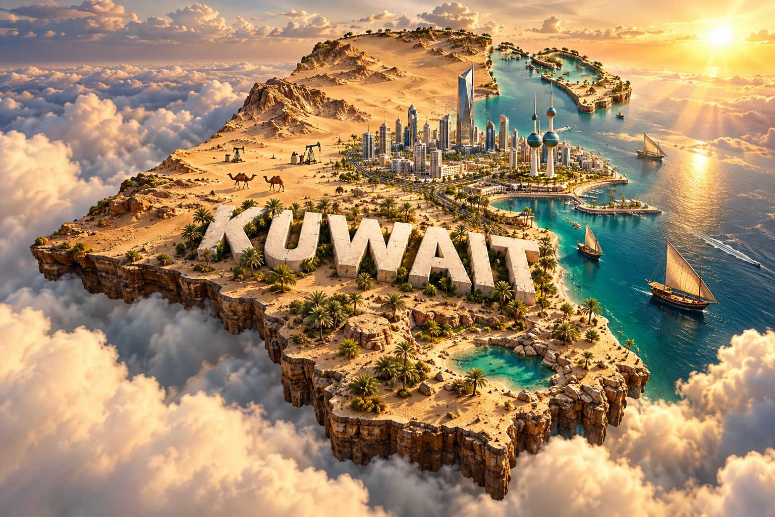
The Kuwait artwork combines a modern skyline, landmark towers, Gulf coast, desert, dhow boats, date palms and camels. The skyline and towers represent metropolitan Kuwait City and oil-era urban development. The shore refers to Kuwait Bay and the shallow northern Gulf rather than one continuous beach landscape.
Dhows evoke historical trade, fishing and pearl diving shared across the Gulf and Indian Ocean. Date palms represent cultivated heritage dependent on water. Camels reference transport and pastoral connections but are domesticated animals and do not describe most modern livelihoods.
The scene omits mudflats, islands, salt marsh, migratory-bird habitat, oil fields, refineries, dense suburbs and Failaka's archaeology.
The image is a conceptual artistic composition. The skyline, towers, coast, desert, boats, palms and camels are combined for educational visualization and are not shown at their true geographic positions or scale. It is a floating micro-world illustration, not a satellite map.
12. Interesting Facts About Kuwait
- Kuwait lies at the northwestern end of the Gulf between Iraq and Saudi Arabia.
- Its land is mostly a low desert plain with no permanent rivers.
- Kuwait Bay is a shallow, semi-enclosed inlet with important nursery habitats.
- Bubiyan is Kuwait's largest island.
- Failaka preserves archaeological evidence from Dilmun, Hellenistic and later periods.
- Kuwait has almost no renewable surface freshwater and depends heavily on desalination.
- The giant Burgan oil field stores petroleum in porous rock, not an underground lake.
- The shamal is a northwesterly wind often associated with dust.
- Migratory birds use Kuwait's tidal flats and wetlands as seasonal stopovers.
- The Kuwait Towers combine a landmark design with water-storage functions.
- Dhows connect Kuwait to shared Gulf and Indian Ocean maritime history.
- Non-citizens constitute most of Kuwait's resident population.
- UNESCO recognized the diwaniya as intangible cultural heritage in 2025.
- Iraq occupied Kuwait from August 1990 until liberation in 1991.
- Kuwait currently has Tentative List sites but no inscribed World Heritage property.
13. Short Quiz
-
What type of landscape covers most of Kuwait? A. Low desert plain B. Glaciated mountains C. Tropical rainforest D. River delta forest
-
Why does Kuwait rely heavily on desalination? A. It has extremely limited renewable freshwater B. Its rivers freeze in winter C. Rain falls every day D. All groundwater is volcanic
-
What is the shamal? A. A northwesterly wind that can carry dust B. A coral species C. A mountain chain D. A freshwater river
-
Which island contains archaeological layers spanning several civilizations? A. Failaka B. Greenland C. Socotra D. Cyprus
-
What do the camels in the artwork represent? A. Pastoral and transport heritage B. Kuwait's main wild predator C. Every modern occupation D. Marine wildlife
Answer key: 1-A, 2-A, 3-A, 4-A, 5-A
14. Related Learning
Suggested internal-link opportunities:
- Iraq Explained: Rivers, Civilizations and Landscapes
- Saudi Arabia Explained: Deserts, Mountains and Culture
- Bahrain Explained: Islands, Pearling and Gulf Geography
- How Oil Formed Beneath Kuwait's Desert
- Why Kuwait Depends on Seawater Desalination
- How the Shamal Creates Dust Storms
- Why Kuwait Bay Is Important for Fish and Migratory Birds
- How Failaka Island Connected Ancient Gulf Trade
- How Pearl Diving Shaped Gulf Societies Before Oil
- What Happened to Kuwait's Environment During the 1991 Oil Fires?
15. Sources
- Kuwait Central Statistical Bureau — Census Population by Governorate, Nationality and Gender , for the registered census total and citizen/non-citizen breakdown
- World Bank — Kuwait Data , for 2025 population and GDP indicators
- World Bank — Water-Energy Nexus in GCC Countries , for desalination, water scarcity and energy connections
- World Bank Climate Change Knowledge Portal — Kuwait Climatology , for historical climate patterns
- Kuwait Environment Public Authority — Protected Area Visitor Rules , for Jahra reserve protection and bird monitoring
- UNESCO World Heritage Centre — Kuwait , for zero inscribed properties and six Tentative List sites
- UNESCO — Failaka Island , for archaeology, island geography and twentieth-century history
- UNESCO Intangible Cultural Heritage — Kuwait , for the diwaniya, Al Sadu and other living traditions
- UNESCO — Traditional Weaving of Al Sadu , for the shared regional craft and women's roles
- Encyclopaedia Britannica — Kuwait , for stable geographic, historical, cultural and economic background
- FAO AQUASTAT — Kuwait Country Profile , for regional water-use methodology and agricultural context