

Kiribati is a Pacific island country with only about 811 square kilometers of land scattered across an ocean area of roughly 3.5 million square kilometers. Its 33 islands span the equator and extend across all four hemispheres, making distance, ocean currents and reef processes more important to daily geography than land borders.
Most islands are narrow coral atolls only a few meters above sea level. They are dynamic landforms built and rearranged by reefs, waves and currents—not motionless rings destined to vanish in exactly the same way. Rising seas nevertheless intensify flooding, erosion, heat and salt contamination, threatening freshwater and habitability long before an island would be permanently submerged.
1. Where Is Kiribati?
Kiribati lies in the central Pacific Ocean, roughly midway between Hawaii and Australia. It has no land borders. Its nearest regional neighbors include Nauru, Tuvalu, the Marshall Islands and several United States Pacific territories.
The country consists of three widely separated island groups: the Gilbert Islands in the west, the Phoenix Islands in the center and the Line Islands in the east. There are 32 atolls or low reef islands plus Banaba, a raised limestone island.
The seat of government is on South Tarawa, a densely populated chain of islets within Tarawa Atoll. Government functions are distributed among places including Bairiki, Ambo and Betio rather than concentrated in one conventional capital district.
Kiritimati, or Christmas Island, lies far to the east in the Line Islands and has the country's greatest land area. It should not be confused with Australia's Christmas Island in the Indian Ocean.
Kiribati shifted the International Date Line eastward around its territory in 1995 so all its islands would share the same calendar day. Kiritimati uses UTC+14 and is among the first inhabited places to enter a new day.
2. Quick Country Facts
- Official name: Republic of Kiribati
- Capital/seat of government: South Tarawa
- Region: Micronesia, central Pacific Ocean
- Land area: approximately 811 square kilometers
- Ocean area: approximately 3.5 million square kilometers
- Population: approximately 136,488 in 2025, World Bank estimate
- Currency: Australian dollar (AUD)
- Official languages: Gilbertese, commonly called Kiribati or te taetae ni Kiribati, and English
- Time zones: UTC+12, UTC+13 and UTC+14
- Highest natural point: on Banaba, approximately 81 meters
- Number of islands: 33
- Political system: presidential republic
- World Heritage property: Phoenix Islands Protected Area
The country's name is pronounced approximately “Kiribas” because the letters ti represent an “s” sound in Gilbertese. A citizen is described as I-Kiribati.
3. Geography and Landscape
An atoll is a ring or broken chain of coral islands and reefs surrounding a lagoon. Kiribati's atolls range from narrow loops to complicated networks of islets, reef flats, channels and enclosed water. Ocean-facing shores experience powerful waves, while lagoons may be calmer, warmer and more variable in salinity.
The islands are built mainly from reef-derived sand, gravel and broken coral resting on ancient volcanic foundations. Soils are thin, porous, salty and nutrient-poor. Coconut, pandanus, breadfruit and salt-tolerant plants are better adapted than most temperate crops.
There are no permanent rivers. Rain filters rapidly through porous ground and floats above denser seawater as a thin freshwater lens. Wells tap this lens, but excessive pumping, waste pollution, drought and seawater overwash can make it unsafe.
Tarawa's causeways connect islets and have changed lagoon circulation and sediment movement. South Tarawa contains a large share of the national population, placing intense pressure on housing, sanitation, water and shoreline space. Outer islands generally have lower population densities and different service access.
Banaba is geologically and visually different. It is a raised coral island whose phosphate deposits were heavily mined during the colonial era, leaving pinnacled terrain and severe damage. Many Banabans were relocated to Rabi Island in Fiji, though Banaba remains part of Kiribati and retains a resident community.
4. Why Does Kiribati Look Like This?
Kiribati's atolls began with volcanoes rising from the Pacific seafloor. Corals grew in warm, sunlit water around their shores. Over millions of years, volcanic islands eroded and subsided while reefs continued growing upward, leaving rings of reef around lagoons. Some foundations are now deep below the surface.
Waves break reef material into sand and rubble. Currents then move this sediment onto reef platforms, building and reshaping islets. Storms can erode one shore while depositing material elsewhere. This explains why atoll islands can change outline, migrate or sometimes gain land even as average sea level rises.
That natural mobility does not eliminate danger. Roads, seawalls, homes and water systems cannot easily move with changing shorelines. Sand mining, causeways and damaged reefs can interrupt sediment supply. Higher mean sea level allows waves to reach farther inland and makes saltwater contamination more frequent.
Banaba followed a different path. Tectonic uplift raised its old reef limestone above the sea. Guano accumulated and chemically interacted with the limestone, creating phosphate-rich deposits later mined for fertilizer.
The Phoenix Islands Protected Area also contains atolls atop volcanoes, submerged reefs and at least 14 known seamounts. These undersea mountains create habitats across an enormous depth range, from sunlit reef to abyssal plain.
5. Climate
Kiribati has a tropical oceanic climate: temperatures are warm throughout the year, moderated by trade winds and the surrounding Pacific. Seasonal temperature differences are small compared with changes in rainfall.
Rainfall varies greatly between islands, years and El Niño–Southern Oscillation phases. The Gilbert Islands lie near a dry equatorial zone and can experience serious drought. Northern islands are generally wetter than southern parts of the group, while conditions on the distant Line Islands follow their own patterns.
Kiribati is usually outside the main tropical-cyclone belts, but it is not free from storm hazards. Distant cyclones and low-pressure systems can generate damaging swell, strong wind and coastal flooding. King tides are exceptionally high tides, not themselves caused by climate change, though sea-level rise raises the baseline from which they occur.
Climate change affects more than coastlines. Ocean warming can bleach coral, acidification makes reef building harder, drought reduces freshwater recharge and extreme rainfall can overwhelm sanitation. Rising seas increase erosion and overwash risks.
It is misleading to say that every island will simply disappear on one predicted date. Reef islands respond differently depending on sediment, waves and human engineering. The immediate educational question is whether communities can maintain safe water, housing, food systems and infrastructure on narrow, changing land.
6. Wildlife and Ecosystems
Kiribati's greatest biological richness lies in the ocean. Coral reefs support reef fish, giant clams, crustaceans, molluscs and algae. Seagrass and lagoon habitats serve as nurseries, while open waters support tuna, sharks, rays, dolphins and whales.
Green and hawksbill turtles occur in Kiribati waters and use suitable beaches, but populations face fishing, plastic, habitat and climate pressures. Coconut crabs survive on some less disturbed islands. Introduced rats, cats and invasive plants can severely affect native wildlife.
Remote islands are globally important for seabirds. Phoenix and Line island colonies include frigatebirds, boobies, terns, noddies, tropicbirds and shearwaters. Each species has specific nesting and feeding requirements; seabirds are not equally abundant on populated Tarawa.
The Phoenix Islands Protected Area, or PIPA, covers 408,250 square kilometers. UNESCO records around 200 coral species, 500 fish species, 18 marine mammals and 44 bird species there. Its remoteness and connected reefs, seamounts and deep water make it a natural laboratory for ocean science.
Protection exists on paper and through management, but governance remains important. Kiribati closed PIPA to commercial fishing in 2015 and reversed that approach in 2021 after its compensation mechanism underperformed. UNESCO has continued reviewing the site's conservation, illustrating the tension between ocean protection and revenue needs.
Healthy reefs reduce wave energy and produce island sediment. Protecting them therefore supports both biodiversity and human resilience, although reefs cannot prevent every impact of sea-level rise.
7. Famous Landmarks and Natural Features
The Phoenix Islands Protected Area is Kiribati's only UNESCO World Heritage property. It includes eight atolls or reef islands, submerged reefs, seamounts and vast deep-ocean habitat. Kanton is the group's only permanently inhabited island, with a very small population.
Kiritimati has the largest land area of any coral atoll and contains an intricate system of lagoons and salt ponds. It is internationally important for seabirds. British and United States atmospheric nuclear tests occurred around Kiritimati in the 1950s and 1960s, exposing service personnel and affecting local historical memory.
Tarawa Atoll is both the political center and a place of intense environmental pressure. Betio was the site of the 1943 Battle of Tarawa between United States and Japanese forces; wartime remains and graves require respectful treatment.
Banaba is a landmark of colonial resource extraction. Phosphate mining removed soil and displaced much of the community. Its scarred landscape is cultural and environmental evidence, not an empty wasteland.
Abemama is associated with the establishment of a British protectorate and later colonial administration. Traditional maneaba, large community meeting houses found across inhabited islands, are more culturally representative than one monumental stone building.
Kiribati's most important natural “landmarks” are living systems: reef passages, lagoons, freshwater lenses, seabird islands and ocean currents. Their significance comes from ecological function and community use rather than height or architectural scale.
8. People, Languages and Culture
Most citizens are I-Kiribati, with ancestry and cultural connections across Micronesia and the wider Pacific. Communities are not identical: the Gilbert, Line and Phoenix groups have different settlement histories, while Banaban identity has been shaped by displacement and continuing ties to both Banaba and Rabi.
Gilbertese is used widely in homes and community life. English is official and used in government and schooling, but fluency varies. Local knowledge is carried through vocabulary for winds, currents, navigation, kinship, land and marine species.
The maneaba is a community meeting house and a social institution. Seating, speaking and decision-making can reflect kinship, island and community structures. Practices vary, so the maneaba should not be presented as one unchanging national ritual.
Dance, song and oral history preserve genealogies, stories and relationships with place. Performances may use controlled movements recalling seabirds and ocean life. Pandanus weaving produces mats, baskets and thatch; canoe knowledge adapts hulls, sails and navigation to reefs and open water.
Micronesian settlement began long before European contact. The Gilbert Islands became part of the British Gilbert and Ellice Islands Colony; the Ellice Islands separated before becoming Tuvalu. Kiribati became independent in 1979, and the United States relinquished claims to several islands through the Treaty of Tarawa.
Christianity is now widespread, especially Roman Catholic and Protestant traditions, while older understandings of ancestry, land and sea continue in varied forms. Modern I-Kiribati life also includes urban employment, overseas seafaring, digital media and international migration.
9. Food
Fish and other seafood are central to food systems, including tuna, reef fish, shellfish and lagoon catch. Availability and safe harvesting vary by island, season and ecosystem health.
Babai, a giant swamp taro, is grown in carefully dug pits where roots can reach moist soil near the freshwater lens. It requires long cultivation and has ceremonial importance. Breadfruit, pandanus fruit, coconut and pumpkin are other locally grown foods.
Coconut provides water, flesh, milk, oil, sap and dried copra. Palusami-style dishes cook greens with coconut cream, while fish may be grilled, boiled, dried or eaten raw when safely handled. Rice, flour, canned meat, sugar and other imported foods are now common, reflecting limited farmland and transport links.
Food security depends on both healthy fisheries and reliable imports. Salt damage, drought, high shipping costs and changing diets create nutritional as well as economic challenges.
10. Economy and Major Industries
Kiribati's economy is constrained by remoteness, dispersed islands, a small domestic market and high infrastructure costs. Government and public services provide substantial employment, while development assistance supports major projects.
The country's vast ocean zone contains valuable tuna fisheries. Fees paid by foreign fleets for fishing access are a major source of government revenue. This creates strong incentives to manage tuna cooperatively while balancing income with long-term stocks and conservation commitments.
Household and small-scale fishing provide food and livelihoods. Coconut growers produce copra, or dried coconut kernel, especially on outer islands. Seaweed, aquaculture, handicrafts and limited tourism add income in some places.
I-Kiribati seafarers and other overseas workers send remittances home. The Revenue Equalization Reserve Fund was created from phosphate income and remains a national financial asset. Air and shipping links, imported fuel and climate-resilient infrastructure are major costs.
World Bank data estimated a 2025 population of 136,488 and GDP of about US$349 million. These figures are dated indicators, not measures of ocean resources or community well-being. Sustainable development depends heavily on fisheries governance, freshwater, education, connectivity and adaptation finance.
11. What the 3D Visual Represents
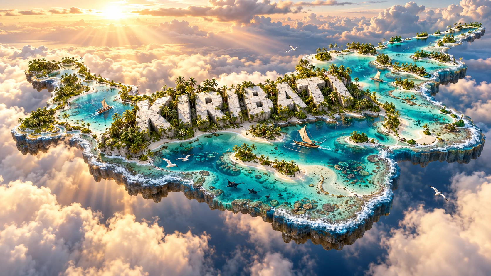
The Kiribati artwork combines low coral atolls, turquoise lagoons, palm-covered islets, reefs, traditional canoes, seabirds and tropical marine life. Atolls and lagoons represent the country's volcanic foundations, reef growth and mobile sediment; canoes evoke navigation and island connections; seabirds reflect globally important colonies.
Palm vegetation largely represents coconut and other strand plants adapted to salt, wind and porous soils. It should not be mistaken for dense continental rainforest. Marine animals shown belong to particular reef, lagoon or open-ocean habitats rather than every shoreline.
No single compact outline can accurately depict Kiribati. Its islands are tiny and scattered across millions of square kilometers, and a scale map must show enormous ocean gaps. The visual compresses three distant archipelagos into one scene.
The image is a conceptual artistic composition. The atolls, lagoons, reefs, vegetation, canoes, seabirds and marine life are combined for educational visualization and are not shown at their true geographic positions or scale. It is a floating micro-world illustration, not a satellite map.
12. Interesting Facts About Kiribati
- Kiribati's 33 islands are scattered across roughly 3.5 million square kilometers of ocean.
- The country spans the equator and all four geographic hemispheres.
- Kiribati moved the International Date Line around its territory in 1995.
- Kiritimati uses UTC+14, among the world's earliest time zones.
- Kiritimati has the greatest land area of any coral atoll.
- Banaba is a raised coral island, unlike the country's low atolls.
- Kiribati has no permanent rivers.
- Fresh groundwater forms thin lenses floating above seawater inside atoll sediments.
- Atoll islets can erode, grow or shift as waves redistribute reef sediment.
- The Phoenix Islands Protected Area covers 408,250 square kilometers.
- PIPA includes at least 14 known seamounts as well as reefs and deep ocean.
- Babai is cultivated in deep pits to reach moist ground.
- Phosphate mining profoundly altered Banaba and displaced many Banabans.
- British and American nuclear tests took place around Kiritimati.
- The name Kiribati is pronounced approximately “Kiribas.”
13. Short Quiz
-
What lies beneath the coral reefs of most Kiribati atolls? A. Ancient volcanic foundations B. Continental glaciers C. Young folded mountains D. River deltas
-
How does freshwater commonly occur on an atoll? A. As a lens floating above denser seawater B. In snowfields C. In permanent rivers D. Through ocean tides
-
Which island is raised well above the low atolls? A. Banaba B. Tarawa C. Abaiang D. Butaritari
-
What is Kiribati's UNESCO World Heritage property? A. Phoenix Islands Protected Area B. Great Barrier Reef C. Galápagos Islands D. Komodo National Park
-
Why can the visual not be treated as a scale map? A. It compresses tiny islands separated by enormous ocean distances B. Kiribati is one continuous continent C. Lagoons never appear on maps D. The country has land borders
Answer key: 1-A, 2-A, 3-A, 4-A, 5-A
14. Related Learning
Suggested internal-link opportunities:
- Tuvalu Explained: Atolls, Climate and Pacific Culture
- Marshall Islands Explained: Lagoons, History and Ocean Life
- Nauru Explained: Phosphate, Raised Reefs and Island Geography
- How Coral Atolls Form Above Sunken Volcanoes
- How Freshwater Lenses Work on Small Islands
- Why Kiribati Spans Three Time Zones
- How Reef Islands Change Shape as Sea Level Rises
- Why the Phoenix Islands Matter for Ocean Conservation
- How Phosphate Mining Transformed Banaba
- How El Niño Changes Rainfall Across Kiribati
15. Sources
- Kiribati National Statistics Office — 2020 Population and Housing Census , for census data and island profiles
- Kiribati National Statistics Office — Census Atlas 2022 , for land, settlement and population geography
- World Bank — Kiribati Data , for 2025 population and economic indicators
- United Nations World Ocean Assessment — Atolls and Their Lagoons , for atoll processes, freshwater lenses and climate risks
- UNESCO World Heritage Centre — Phoenix Islands Protected Area , for area, seamounts, wildlife and ecological significance
- UNESCO — 2026 State of Conservation Decision on PIPA , for current fisheries-management context
- UNESCO World Heritage Centre — Kiribati , for the country's one inscribed property
- FAO — Kiribati Agriculture and Fisheries Report , for crops, livestock, copra and census context
- FAO — Sustainable Fish Value Chains in Kiribati , for tuna, lobster, livelihoods and food security
- Encyclopaedia Britannica — Kiribati , for stable geographic, historical and cultural background
- United Nations — Kiribati Voluntary National Review , for freshwater and climate-vulnerability context