

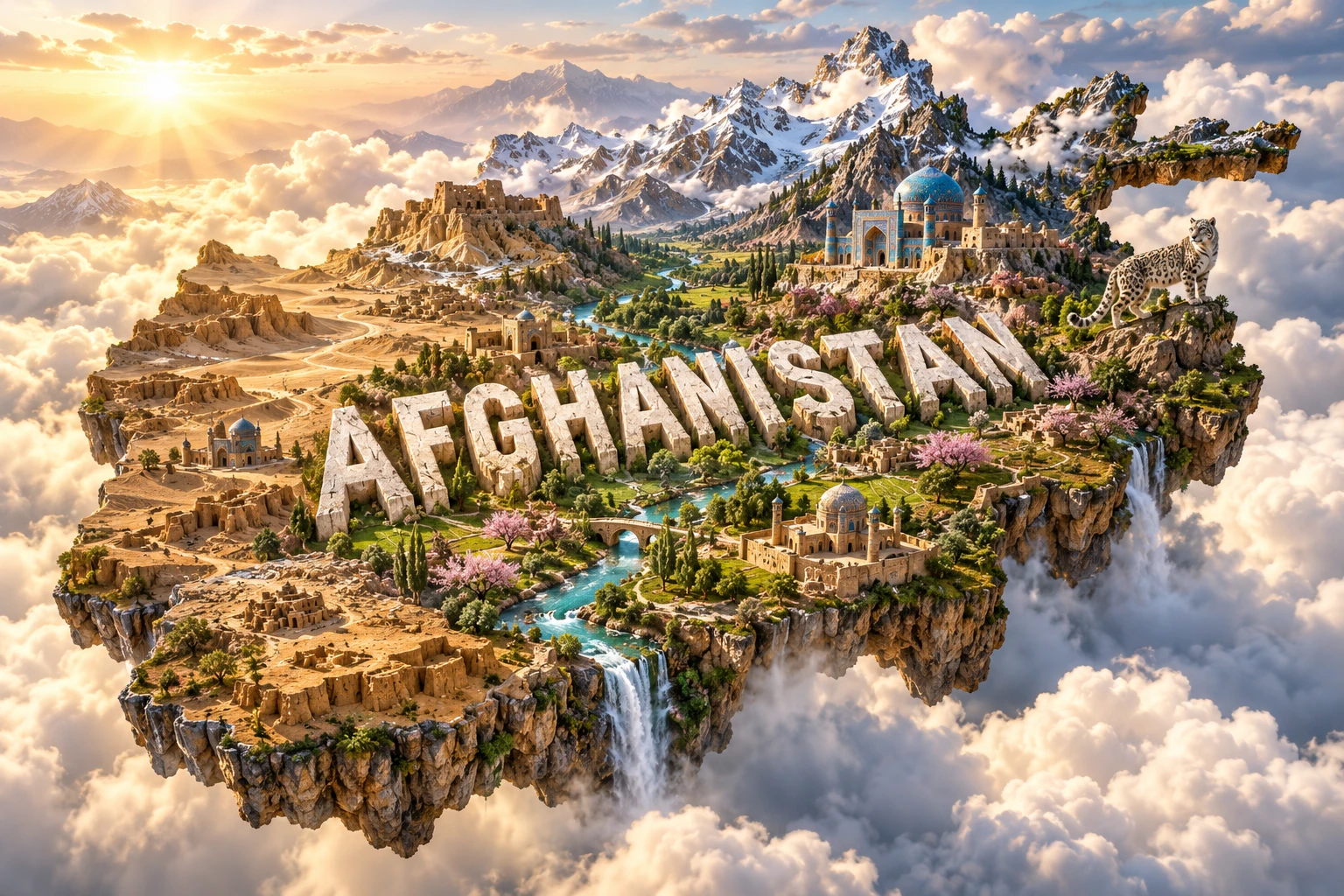
Afghanistan is a landlocked country whose high mountains divide Central, South and Western Asian drainage systems. The Hindu Kush creates deep valleys, high passes and strong climate contrasts, while snowmelt supplies rivers and irrigation to northern plains, central basins and the dry southwest.
Geography has shaped where people farm, build cities and travel, but Afghanistan cannot be reduced to rugged terrain or decades of war. It has ancient urban traditions, multilingual communities, orchard agriculture, distinctive architecture and high-mountain ecosystems that connect several regions of Asia.
1. Where Is Afghanistan?
Afghanistan lies in south-central Asia. It borders Pakistan to the east and south, Iran to the west, Turkmenistan, Uzbekistan and Tajikistan to the north, and China at the narrow eastern end of the Wakhan Corridor.
The country has no coastline. Mountain passes link it with neighboring regions, but high relief and winter snow make many routes difficult. The Wakhan Corridor extends northeast between Tajikistan and Pakistan toward China and separates the main Hindu Kush from the Pamir highlands.
Kabul is the capital and largest city. Kandahar is a major southern center; Herat anchors the west; Mazar-e Sharif is important in the north; Jalalabad lies in a warmer eastern valley; and Bamiyan occupies a high central basin.
2. Quick Country Facts
- Country name: Afghanistan; the de facto authorities use “Islamic Emirate of Afghanistan,” while its international diplomatic status remains contested
- Capital: Kabul
- Region: South-central Asia, with strong historical links to Central, South and Western Asia
- Area: Approximately 652,864 square kilometers
- Population: Approximately 43.84 million in the United Nations' 2025 estimate
- Currency: Afghani (AFN)
- Principal official languages: Dari and Pashto; Uzbek, Turkmen, Balochi, Pashayi, Nuristani and other languages are also spoken
- Time zone: Afghanistan Time, UTC+4:30
- Highest point: Noshaq, approximately 7,492 meters, in the Hindu Kush near Pakistan
- Major rivers: Amu Darya, Helmand, Kabul, Hari Rud and Murghab
- Major lake and wetland regions: Band-e Amir lakes, Hamun wetlands and high mountain lakes
Population measurement is difficult because of displacement, migration, return movements and limited census coverage. Figures are estimates and should always be dated.
3. Geography and Landscape
The Hindu Kush runs from northeast toward central Afghanistan and forms the country's dominant physical divide. Peaks exceed 7,000 meters in the northeast, while ranges spread into lower but still rugged central highlands. Valleys provide routes, farmland and settlement but are vulnerable to earthquakes, landslides, avalanches and flash floods.
North of the main mountains, foothills descend toward plains drained by rivers flowing to the Amu Darya or disappearing into desert basins. These northern areas contain important farmland and pasture. The Amu Darya marks part of Afghanistan's border with Central Asian states.
The southwest contains the Sistan Basin, stony plateaus, sand deserts and salt flats. The Registan and Dasht-e Margo are extremely dry. The Helmand River crosses this region toward the Hamun wetlands on the Iran–Afghanistan border, but dams, irrigation, drought and evaporation strongly affect how much water reaches them.
Eastern Afghanistan includes the Kabul River basin and warmer valleys opening toward Pakistan. Monsoon influence reaches some eastern mountains, especially in Nuristan and neighboring provinces, supporting conifer and broadleaf forests unlike the sparse vegetation of much of the interior.
Afghanistan's rivers are fed mainly by winter snow and spring melt. Some reach seas only after crossing neighboring countries; others terminate in inland wetlands or desert depressions. Irrigated valley floors can appear green and productive beside barren slopes because water, not simply soil, controls much of the landscape.
4. Why Does Afghanistan Look Like This?
Afghanistan lies within the broad collision zone created by the Indian Plate moving north into Eurasia. The collision thickened and fractured the crust across the Himalaya, Pamir and Hindu Kush region. Compression, uplift and sideways movement along major faults continue today.
The Hindu Kush is therefore not an inactive ancient backdrop. Earthquakes occur at shallow depths along crustal faults and at unusual intermediate depths beneath the northeast, where remnant slabs of lithosphere descend into the mantle. Shaking can trigger landslides in steep valleys and damage buildings made vulnerable by construction conditions.
Uplift gives rivers energy to cut deep gorges. Frost shatters exposed rock at high elevation, while gravity moves debris downslope. Glaciers carved parts of the highest terrain during colder periods and still survive in the northeast, though many are shrinking.
As mountains erode, rivers carry sediment into basins and plains. Alluvial fans spread where fast mountain streams emerge onto flatter land. Villages and farms often use these deposits because they can contain groundwater, but sudden floods can shift channels and bury fields.
The southwest is dry because Afghanistan lies far from oceans and mountain barriers limit moisture. Wind reworks exposed sediment into dunes, while intense evaporation concentrates salts in closed basins. Climate variability changes snowpack and river flow, connecting distant mountains to desert wetlands.
5. Climate
Afghanistan has a mainly dry continental climate with hot summers, cold winters and large differences by altitude. Low southwestern basins can experience extreme summer heat, while high mountain communities endure long, snowy winters.
Most precipitation arrives from winter and spring weather systems moving east from the Mediterranean and Western Asia. Snow accumulates in the Hindu Kush and central highlands, then melts into rivers used for drinking water, irrigation and hydropower. The timing of melt can matter as much as the total snowfall.
Eastern mountains receive some summer monsoon moisture, but its reach is limited and variable. Inner valleys may be dry because surrounding ranges remove moisture. Local thunderstorms can cause destructive flash floods even during an otherwise dry year.
Drought is recurrent and can reduce crops, pasture, groundwater and wetland flow. Climate change is raising temperatures, accelerating snow and glacier loss and altering seasonal water availability. A warmer spring can produce earlier runoff, leaving less water during the main summer irrigation season.
6. Wildlife and Ecosystems
Afghanistan's habitats range from high alpine meadow and cold desert to steppe, pistachio woodland, eastern forest, river wetland and southern sand desert. Wildlife is often restricted to particular elevations and remote areas rather than spread across the country.
Snow leopards inhabit rocky high mountains in the northeast, especially the Wakhan and adjoining ranges. They are elusive, occur at low density and depend on wild prey such as ibex and Marco Polo sheep. The animal in the visual should not imply that snow leopards occupy orchards, cities or all Hindu Kush valleys.
Marco Polo sheep are associated with the high Pamir region, while Siberian ibex use steep mountain terrain. Urial, markhor, wolves, lynx, brown bears and Asiatic black bears occur in different and sometimes fragmented ranges. The eastern forests support species not found in the driest interior.
Band-e Amir's high-altitude lakes form behind natural mineral dams. The Wakhan protects a vast mountain landscape, while Kol-e Hashmat Khan near Kabul is important for migratory waterbirds. The Hamun wetlands fluctuate greatly with river inflow and drought and extend across an international border.
Decades of conflict, hunting, illegal trade, logging, overgrazing, land conversion and weak management have pressured wildlife. Local communities are essential to conservation because they share grazing land and water with protected species. Reliable nationwide population data remain limited.
7. Famous Landmarks and Natural Features
The Bamiyan Valley preserves caves, monastic remains, fortifications and niches where two monumental Buddha statues stood before their destruction in 2001. The site records the movement of Buddhist ideas and artistic traditions along regional trade routes. Its significance extends beyond the lost statues to the whole cultural landscape.
The Minaret of Jam is a richly decorated 12th-century brick tower in a remote river valley. It is associated with the Ghurid period and surrounded by archaeological remains. Flood erosion, structural instability, looting and limited access place it on UNESCO's List of World Heritage in Danger.
Herat contains the citadel, mosques, shrines and remains of the Musalla complex, reflecting centuries of art, scholarship and urban change. Blue-tiled architecture in the artwork may evoke Herat or Mazar-e Sharif, but those styles and buildings belong to specific places and historical periods.
Band-e Amir National Park contains a chain of intensely blue highland lakes held by travertine, a mineral deposit formed as calcium-rich water releases carbon dioxide. The color and barriers result from water chemistry and light, not artificial construction.
Babur's Garden in Kabul is a terraced historic garden associated with the first Mughal emperor. The Wakhan Corridor combines high Pamir and Hindu Kush landscapes, small communities and transboundary wildlife habitat. Neither should be treated as empty land.
8. People, Languages and Culture
Afghanistan includes Pashtun, Tajik, Hazara, Uzbek, Turkmen, Aimaq, Baloch, Nuristani, Pashayi and many other communities. These labels do not capture every local identity, mixed family or language practice. No single form of clothing, music or architecture represents all Afghans.
Dari, a variety of Persian, is widely used across communities and in literature and administration. Pashto is another principal national language with a rich oral and written tradition. Uzbek, Turkmen, Balochi, Nuristani, Pashayi, Pamiri languages and others reflect the country's position among several language regions.
Poetry has exceptional cultural importance, including Persian-language traditions associated with figures such as Rumi, who was born in the wider Balkh region, and Pashto traditions such as those of Khushal Khan Khattak and Rahman Baba. Music includes rubab, dambura, tabla and many regional vocal forms. Carpet weaving, embroidery, woodwork, calligraphy and tilework vary by community.
Afghanistan's history includes ancient Iranian cultures, Greek and Kushan states, Buddhist centers, Islamic dynasties, Mongol conquest, Timurid scholarship and later Afghan empires. The modern state emerged through changing 18th- and 19th-century political structures and borders. Soviet intervention, civil war, Taliban rule, international intervention and the Taliban's return to power in 2021 caused enormous displacement and institutional change.
Current restrictions imposed by the de facto authorities sharply limit women and girls' education, work and public participation. These are present political conditions, not timeless Afghan culture, and Afghan women and men hold diverse views and continue to contribute to family and community life under difficult circumstances.
9. Food
Afghan cuisines combine grains, meat, legumes, dairy, fruit, nuts and herbs. Kabuli palaw layers rice with carrots, raisins and often meat; regional versions differ. Mantu are filled dumplings, while ashak commonly uses a vegetable filling and sauces.
Flatbreads accompany many meals. Qorma refers to a family of stews rather than one recipe. Yogurt, pulses and seasonal vegetables are important, while lamb and other meats depend on household means and occasion.
Afghanistan is known for grapes, pomegranates, apricots, melons, almonds, pistachios and dried fruit grown in suitable irrigated valleys. Orchards are regionally concentrated and vulnerable to drought, damaged irrigation, transport problems and changing markets.
10. Economy and Major Industries
Agriculture remains central to livelihoods. Wheat is the main staple crop, while fruit, nuts, vegetables, livestock, wool and cash crops support rural households and trade. Production depends heavily on snowmelt, irrigation and rainfall, making drought a national economic risk.
Services include trade, transport, telecommunications, public and humanitarian activity and small businesses. Manufacturing includes food processing, textiles, carpets, construction materials and household goods. Mining produces or has potential to produce coal, talc, marble, gemstones, copper, iron and other minerals, but insecurity, weak infrastructure, environmental risk and governance constrain development.
The economy contracted sharply after the political transition of 2021 and loss of much external financing. It has since shown modest aggregate recovery, but rapid population growth, return migration, poverty, food insecurity, weak banking and restrictions on women's participation limit living standards and inclusive growth.
Informal cross-border commerce and remittances matter to many households. Sustainable development depends on reliable water and electricity, education for girls and boys, access to finance, safer transport, accountable resource management and employment that reaches rural as well as urban communities.
11. What the 3D Visual Represents
The Afghanistan artwork combines the Hindu Kush, rugged valleys, blue-tiled Islamic architecture, irrigated orchards, desert plateaus, snow leopards and Afghan-inspired geometric motifs. The floating terrain and monumental “AFGHANISTAN” lettering compress distant regions into a single visual story.
The real features are geographically separate. The highest Hindu Kush and snow leopard habitat lie mainly in the northeast; extensive deserts occupy the southwest; orchards grow in selected irrigated valleys; and blue-tiled monuments belong to particular cities and periods. Traditional geometric motifs also vary by medium and community.
The image is a conceptual artistic composition. The landmarks, wildlife and landscapes are combined for educational visualization and are not shown at their true geographic positions or scale. It is not a satellite map, exact heritage reconstruction or wildlife-range map.
12. Interesting Facts About Afghanistan
- Afghanistan borders six countries and has no coastline.
- The Wakhan Corridor creates Afghanistan's narrow border with China.
- Noshaq rises about 7,492 meters and is the country's highest point.
- Afghanistan uses a half-hour time zone, UTC+4:30.
- The Hindu Kush divides rivers flowing toward Central Asia, Pakistan and inland desert basins.
- Deep earthquakes occur beneath the northeastern Hindu Kush within descending lithosphere.
- The Helmand River ends in the Hamun wetland system rather than reaching an ocean.
- Band-e Amir's lake barriers formed through natural mineral deposition.
- Snow leopards are restricted to remote high-mountain habitat and occur at low density.
- Winter snowpack supplies much of the water used during the agricultural growing season.
- Traditional karez systems carry groundwater through gently sloping underground channels.
- The Bamiyan Valley was an important Buddhist cultural center before Islam reached the region.
- The Minaret of Jam dates to the Ghurid period and stands in a remote river valley.
- Dari and Pashto are principal languages, but Afghanistan is home to many other language communities.
- Orchards produce regionally important pomegranates, grapes, apricots, almonds and other fruit and nuts.
13. Short Quiz
-
Which mountain system dominates Afghanistan's central and northeastern geography? A. Andes B. Hindu Kush C. Alps D. Urals
-
What supplies much of Afghanistan's river and irrigation water? A. Daily ocean tides B. Winter snow and spring melt C. Tropical rain throughout the year D. Artificial seawater canals
-
Where do snow leopards live in Afghanistan? A. Uniformly across the country B. Mainly in remote high mountains of the northeast C. Only in southwestern sand dunes D. In Kabul's urban center
-
Why are the Band-e Amir lakes separated? A. Natural mineral barriers formed from calcium-rich water B. Coral reefs grew in an ocean C. Modern concrete dams created every lake D. Wind built walls of ice
-
How should the 3D artwork be interpreted? A. As an exact geographic map B. As a conceptual combination of distant features C. As a satellite photograph D. As one real valley
Answer key: 1-B, 2-B, 3-B, 4-A, 5-B.
14. Related Learning
Suggested internal-link topics:
- Pakistan Explained: Indus River, Mountains and Monsoon
- Iran Explained: Plateaus, Deserts and Mountain Ranges
- Tajikistan Explained: Pamir Mountains, Glaciers and Rivers
- How the Hindu Kush Formed
- Why Afghanistan Has So Many Earthquakes
- How Snowmelt Supports Afghan Agriculture
- Why the Helmand River Ends in Desert Wetlands
- How Band-e Amir's Natural Dams Formed
- How Snow Leopards Survive in the Wakhan
- How Karez Irrigation Works
15. Sources
- United Nations Data — Afghanistan country profile
- World Bank — Afghanistan overview
- World Bank — Afghanistan economy and current conditions
- United Nations Afghanistan — 2025 annual report
- U.S. Geological Survey — earthquake hazards in Afghanistan
- U.S. Geological Survey — seismotectonic map of Afghanistan
- FAO — agriculture and climate risks in Afghanistan
- FAO — seasonal climate and snowmelt outlook
- UN Environment Programme — Afghanistan environment
- UNESCO — Afghanistan's World Heritage properties
- UNESCO — Minaret and Archaeological Remains of Jam
- UNESCO — Cultural Landscape and Archaeological Remains of Bamiyan