

The Central African Republic is a landlocked country positioned across one of Africa's great environmental transitions. Congo Basin rainforest grows in the southwest, wooded savanna covers much of the center, and drier grasslands extend toward the Sahel. A gentle spine of uplands divides rivers flowing north toward Lake Chad from those flowing south into the Congo system.
Its location has produced exceptional ecological variety, but natural wealth has not translated into broad prosperity. Conflict, displacement, weak transport and limited public services have shaped recent life. Understanding the country therefore means connecting its rivers, ecosystems, cultural diversity and history without treating hardship as its only identity.
1. Where Is the Central African Republic?
The Central African Republic, often shortened to CAR, lies near the geographic center of Africa. It has no coastline. Chad borders it to the north, Sudan to the northeast, South Sudan to the east, the Democratic Republic of the Congo and Republic of the Congo to the south, and Cameroon to the west.
Bangui, the capital and largest city, stands on the north bank of the Ubangi River opposite the Democratic Republic of the Congo. The river is a major transport route and part of the international boundary. Other important towns include Bimbo, Berbérati, Bambari, Bouar, Bossangoa, Bangassou and Bria.
The country's landlocked position and long distances from seaports make imported goods expensive. The main road corridor connects Bangui westward through Cameroon to the port of Douala. Seasonal river transport also matters where roads are sparse or difficult.
2. Quick Country Facts
- Official name: Central African Republic
- Capital: Bangui
- Region: Central Africa
- Area: Approximately 623,000 square kilometers
- Population: Approximately 5.5 million in the World Bank's 2025 estimate
- Currency: Central African CFA franc (XAF)
- Official languages: French and Sango
- Time zone: West Africa Time (UTC+1) throughout the year
- Highest point: Mont Ngaoui, approximately 1,410 meters
- Major rivers: Ubangi, Sangha, Kotto, Mbomou, Ouham and Chari
- Geographic condition: Landlocked
- Major drainage systems: Congo Basin and Lake Chad Basin
Population estimates are unusually uncertain because conflict and displacement make complete enumeration difficult. Current totals should therefore be read as estimates rather than exact counts.
3. Geography and Landscape
Most of CAR is a rolling plateau rather than a flat, featureless plain. A broad watershed crosses the country from east to west. In the west, the Yadé Massif rises toward the Cameroon border and includes Mont Ngaoui. The Fertit Hills form broken uplands in the northeast.
South of the divide, the Mbomou and Uele join to form the Ubangi, one of the Congo River's largest tributaries. The Kotto, Lobaye and other rivers also drain southward. Bangui developed where the Ubangi passes rocky rapids and becomes more navigable downstream.
North of the divide, the Ouham and other streams contribute to the Chari system, which flows through Chad toward Lake Chad. Northern floodplains expand during the rainy season, then contract through the dry months.
Wooded savanna and grassland cover much of the country. Gallery forest follows rivers through otherwise open landscapes. Dense lowland rainforest is concentrated mainly in the southwest and a smaller southeastern zone. The southwest belongs biologically to the Congo Basin and includes wetlands, forest clearings and seasonally flooded forest.
Soils are often deeply weathered and can lose nutrients quickly when forest or woodland cover is removed. Rivers, rainfall and fire help maintain a shifting mosaic of forest, woodland and grassland.
4. Why Does the Central African Republic Look Like This?
CAR occupies an old continental surface built largely from ancient crystalline rocks. Long weathering and erosion lowered former relief into plateaus, rounded hills and broad valleys. Harder rock remains as ridges and isolated uplands.
The central watershed is the key to understanding the landscape. Rain falling on its southern side eventually enters the Atlantic through the Ubangi and Congo. Rain on its northern side travels through the Chari system toward inland Lake Chad. The country therefore links two enormous African drainage basins.
Seasonal movement of the tropical rain belt controls vegetation and river flow. It remains longer over the south, supporting humid forest. Its influence is shorter and less reliable farther north, favoring savanna and increasingly drought-adapted plants.
Fire, grazing and herbivory also help maintain savanna. Some fires are natural, while people have long used controlled burning for farming, pasture, hunting and access. Frequent intense burning can prevent young trees from establishing; reduced fire can allow woodland to thicken. Savanna is therefore a dynamic ecosystem, not simply degraded rainforest.
Rivers erode the plateau, transport sediment and create floodplains. Waterfalls and rapids occur where channels cross resistant rock or step down from higher surfaces. They are scattered features, not a single national waterfall landscape.
5. Climate
CAR has a tropical climate with alternating wet and dry seasons. The south is wetter and has a longer rainy period, often lasting much of the year with a relatively short dry season. The north has one more concentrated rainy season and a much longer dry period.
Temperatures are warm year-round, although elevation and season produce differences. The hottest conditions often develop late in the dry season before rain returns. In northern areas, the dry harmattan can bring dusty air from the Sahara.
Rainfall feeds rivers, pasture and rain-fed crops, so changes in timing matter as much as annual totals. A delayed wet season can disrupt planting; intense rain can wash out roads and isolate communities; and prolonged dry conditions strain pasture and water supplies.
Climate change is increasing heat and may intensify rainfall variability, drought and flooding. Its effects combine with deforestation, soil degradation, conflict and limited infrastructure, which reduce people's capacity to prepare and recover.
6. Wildlife and Ecosystems
The southwestern forest contains western lowland gorillas, chimpanzees, forest elephants, bongos, sitatungas, buffalo and many birds, reptiles and fish. Dzanga-Ndoki National Park is CAR's portion of the Sangha Trinational World Heritage property shared with Cameroon and the Republic of the Congo.
Natural forest clearings called bais expose mineral-rich soil and support grasses and sedges. Dzanga Bai is known for forest-elephant gatherings, but that does not mean forest elephants are common everywhere or easily seen. Poaching and habitat pressures remain serious.
Central and northern savannas historically supported elephants, lions, giraffes, cheetahs, African wild dogs, antelopes and large bird populations. Manovo-Gounda St Floris National Park protects a vast transition between Sudanian and Sahelian environments. However, UNESCO has listed it as World Heritage in Danger since 1997 because poaching, insecurity, grazing and weak management caused major wildlife declines. Historical species lists should not be mistaken for current population surveys.
Rivers and wetlands support hippopotamuses, crocodiles, fish and waterbirds in appropriate regions. Gallery forests provide wildlife corridors between larger habitat blocks.
Conservation must include people. BaAka and other forest communities possess extensive ecological knowledge and depend on forest resources and cultural landscapes. Effective protection requires respect for rights, livelihoods and participation rather than treating inhabited landscapes as empty wilderness.
7. Famous Landmarks and Natural Features
Dzanga-Ndoki National Park and Dzanga Bai protect southwestern rainforest within Sangha Trinational. The wider transboundary system conserves connected habitat for forest elephants, western lowland gorillas, chimpanzees and forest antelopes.
Manovo-Gounda St Floris National Park covers 1.74 million hectares in the northeast. Its grasslands, wetlands, gallery forests and sandstone massifs make it one of Central Africa's largest savanna parks, but its endangered status is essential context.
The Ubangi River at Bangui shapes the capital's location, trade and international boundary. Rapids above the city historically influenced where river navigation and overland routes connected.
Boali Falls lie northwest of Bangui on the Mbali River. The river drops across resistant rock in several cascades, especially dramatic during high water. Hydropower development has altered parts of its flow, so photographs may show different water volumes.
The Bouar megaliths are groups of standing stones in western CAR associated with ancient burial and settlement landscapes. They show that the country's heritage extends far beyond recent political history.
Chinko in eastern CAR is a large savanna–forest mosaic and watershed landscape. Its mixture of open grassland, woodland and gallery forest supports species from different ecological regions.
8. People, Languages and Culture
Sango and French are official languages. Sango developed as a regional river-trade language and now serves as a widely shared language across communities, while French is prominent in government, formal education and some media. Many other languages belong to Ubangian, Bantu, Sara-Bongo-Bagirmi and other language groupings.
The population includes Gbaya, Banda, Mandjia, Ngbaka, Zande, Sara, Yakoma, Mbaka, BaAka, Fulani and many other communities. These broad labels contain internal diversity and should not be used to assign one occupation, belief or art form to every member.
Christianity and Islam are both practiced, alongside Indigenous religious traditions and combinations of belief. Conflict has sometimes been framed in religious terms, but its causes also include political power, armed groups, local grievances, resource control, marginalization and regional intervention. Religious identity alone does not explain it.
The territory became the French colony of Ubangi-Shari within French Equatorial Africa. The Central African Republic gained independence in 1960. Subsequent decades included authoritarian rule, coups and repeated conflict. Violence since 2012–2013 caused extensive displacement and damage, although communities, civil society and cultural institutions continue efforts toward recovery and peace.
Music, dance and oral storytelling differ across regions. Polyphonic singing associated with BaAka forest communities is one of many musical traditions. Sango-language popular music connects local styles with wider African genres. Basketry, pottery, woodwork, woven mats and decorated objects combine practical use with community-specific knowledge.
9. Food
Cassava is a major staple. Its roots may be processed into a firm accompaniment, while properly prepared leaves are cooked in sauces. Processing is important because raw cassava contains naturally occurring compounds that must be reduced before eating.
Kanda refers to seasoned meatballs, often made with ground meat and seeds or nuts, though recipes vary. Gozo is a thick staple preparation commonly eaten with sauces. Groundnuts, sesame, okra, leafy vegetables and palm oil appear in many dishes.
Maize, millet, sorghum, rice, yams, plantains and beans vary in importance by rainfall zone and community. River fish may be fresh, smoked or dried. Livestock products are more important in pastoral and northern areas.
Food traditions have been disrupted in places by displacement, insecurity and poor market access. Describing national cuisine should recognize both regional abundance and present food-security challenges.
10. Economy and Major Industries
Most livelihoods depend directly or indirectly on agriculture, livestock, forests and local trade. Cassava, maize, groundnuts, sorghum, millet, sesame, plantains and yams support household consumption and markets. Cotton and coffee have historically provided cash income but production changes with security, prices and infrastructure.
Diamonds and gold are important mineral resources. Artisanal mining supports incomes but can also involve unsafe work, smuggling, conflict financing and environmental damage. Transparent supply chains and public revenue management are therefore important.
Commercial forestry operates mainly in the southwest. Timber exports provide revenue and jobs, while unsustainable logging and new roads can fragment habitat and affect communities. Services, telecommunications, transport, public administration and small-scale commerce are concentrated around Bangui and regional towns.
The World Bank projected only modest economic recovery in 2025, with electricity shortages, insecurity, weak roads and high poverty constraining growth. Later estimates vary, so any growth rate requires a date and source. Landlocked transport costs and unreliable fuel supply affect nearly every sector.
11. What the 3D Visual Represents
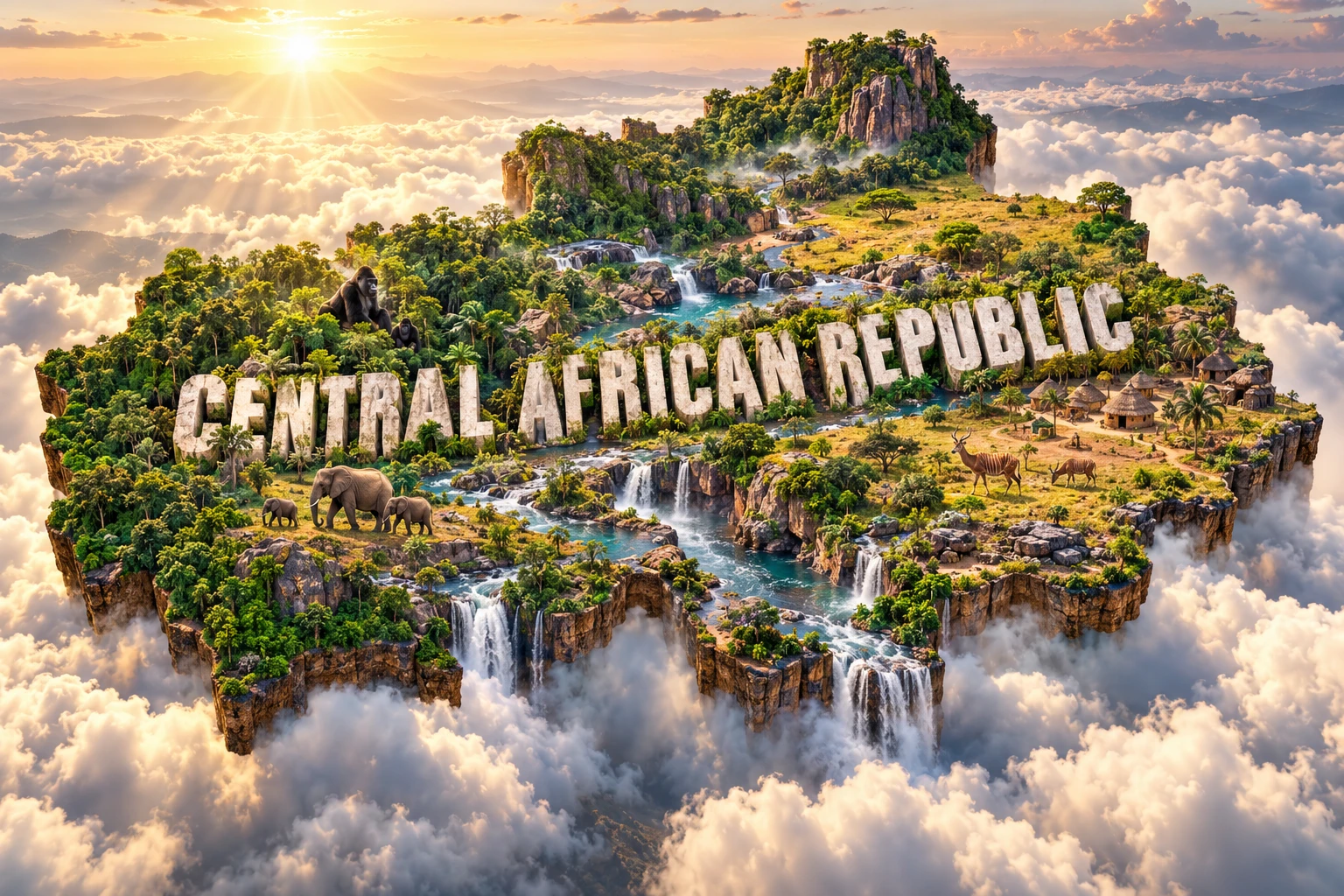
The Central African Republic artwork combines dense equatorial rainforest, open savanna, winding rivers, waterfalls, forest elephants, gorillas, antelope and village-inspired architecture. Large “CENTRAL AFRICAN REPUBLIC” lettering turns distant environments into one floating micro-world.
The visual reflects real geographic themes but compresses them. Gorilla habitat and major forest-elephant concentrations are associated mainly with southwestern Congo Basin forest. Broad savannas cover central and northern regions, while waterfalls occur at particular rocky river sections. Village architecture varies by ecology, available materials, history and community.
The image is a conceptual artistic composition. The landmarks, wildlife and landscapes are combined for educational visualization and are not shown at their true geographic positions or scale. It is not a satellite map and does not show current wildlife abundance.
12. Interesting Facts About the Central African Republic
- CAR is landlocked and borders six countries.
- It covers about 623,000 square kilometers but is sparsely populated.
- A central watershed separates the Lake Chad and Congo drainage basins.
- The Ubangi River forms part of the southern international boundary.
- Bangui developed beside the Ubangi near a break in river navigation.
- Mont Ngaoui is the highest point at about 1,410 meters.
- Rainforest is concentrated mainly in the southwest, not across the whole country.
- CAR's part of Sangha Trinational is Dzanga-Ndoki National Park.
- Forest elephants gather at mineral-rich clearings such as Dzanga Bai.
- Western lowland gorillas live in specific southwestern forests.
- Manovo-Gounda St Floris has been listed as World Heritage in Danger since 1997.
- Sango is both an official language and an important shared language.
- The country became independent from France in 1960.
- Ancient standing stones survive around Bouar.
- The north and south ultimately drain toward different major water systems.
13. Short Quiz
-
Why is the central watershed important? A. It divides rivers flowing toward Lake Chad and the Congo B. It separates two oceans on the coast C. It is an active volcanic ridge D. It blocks all movement between north and south
-
Where is CAR's main rainforest region? A. Mainly the southwest B. Only the far north C. Across every savanna D. Beneath Lake Chad
-
Which river flows past Bangui? A. Nile B. Ubangi C. Niger D. Zambezi
-
Why must historical wildlife lists for Manovo-Gounda be used carefully? A. The park has never been surveyed B. Poaching and insecurity caused major population declines C. All mammals migrate to Europe D. The park is entirely underwater
-
How should the 3D artwork be interpreted? A. As an exact wildlife survey B. As a conceptual combination of distant features C. As a satellite photograph D. As proof that gorillas live nationwide
Answer key: 1-A, 2-A, 3-B, 4-B, 5-B.
14. Related Learning
Suggested internal-link topics:
- Cameroon Explained: Volcanoes, Rainforests, Wildlife and Culture
- Chad Explained: Sahara, Sahel, Lake Basin and Culture
- Democratic Republic of the Congo Explained: River, Rainforest and Minerals
- How One Watershed Divides the Congo and Lake Chad Basins
- Why Rainforest Covers Only Southwestern CAR
- How Forest Clearings Attract Elephants at Dzanga Bai
- Why Manovo-Gounda Is World Heritage in Danger
- How Landlocked Geography Raises Transport Costs
- How Savanna Fire Shapes Central African Landscapes
- Why the Ubangi River Matters to Bangui
15. Sources
- World Bank — Central African Republic overview
- World Bank Data — Central African Republic
- FAO — Central African Republic country overview
- UNESCO World Heritage Centre — Sangha Trinational
- UNESCO World Heritage Centre — Manovo-Gounda St Floris National Park
- UNESCO — Securing Manovo-Gounda St Floris National Park
- United Nations — Central African Republic governance and history