

Algeria is Africa's largest country, stretching from a settled Mediterranean coast across the Atlas Mountains and high steppe to the central Sahara. Although desert covers most of its territory, that desert includes gravel plains, stone plateaus, volcanic highlands, dry valleys and oases as well as great fields of sand dunes.
This scale has shaped settlement, farming, trade and culture. Most Algerians live in the north, where winter rain supports cities and agriculture, while communities have developed distinctive ways of life in the mountains, steppe and Sahara.
1. Where Is Algeria?
Algeria lies in North Africa and faces the Mediterranean Sea. It borders Tunisia and Libya to the east; Niger, Mali and Mauritania to the south; and Morocco to the west. It also adjoins the disputed territory of Western Sahara. That boundary description does not express a position on Western Sahara's political status.
The Mediterranean separates northern Algeria from southern Europe. Algiers, the capital and largest urban center, occupies a bay on the north-central coast. Oran is a major western port, Constantine stands above inland gorges, and Annaba is an eastern coastal city. Ouargla, Ghardaïa, Tamanrasset and Djanet connect Saharan regions.
Algeria extends more than 1,500 kilometers south into the Sahara. Its north–south reach creates strong environmental contrasts.
2. Quick Country Facts
- Official name: People's Democratic Republic of Algeria
- Capital: Algiers
- Region: North Africa; the Maghreb
- Area: Approximately 2,381,741 square kilometers
- Population: Approximately 47.4 million in 2025, according to Algerian and United Nations estimates
- Currency: Algerian dinar (DZD)
- Official languages: Arabic and Tamazight; French is also widely used in education, business, media and administration
- Time zone: Central European Time (UTC+1) throughout the year
- Highest point: Mount Tahat, approximately 2,908 meters, in the Ahaggar Mountains
- Major river: The Chelif, Algeria's longest significant permanent river
- Major lake and wetland types: Chotts, sebkhas, mountain lakes, coastal marshes and Saharan wetlands
Algeria is the tenth-largest country in the world by area. Its average population density is low, but this hides a sharp concentration in the northern coastal and Tell Atlas zone.
3. Geography and Landscape
Northern Algeria belongs to the Mediterranean world. A narrow coastal plain is interrupted by hills and mountains, and fertile basins support much of the country's farming. The Tell Atlas runs roughly parallel to the sea and includes forested slopes, valleys and the Kabylie mountain region.
South of the Tell Atlas lie the High Plateaus, a broad belt of steppe between mountain systems. Rainfall is lower here, and shallow inland depressions hold salt lakes or flats called chotts and sebkhas. Water may spread across them after rain and then evaporate, leaving salts behind.
The Saharan Atlas marks another transition before the land opens into the Sahara. Desert occupies roughly four-fifths of Algeria, but sand does not cover all of it. Ergs are seas of wind-blown dunes; regs are gravel plains; hamadas are bare rocky plateaus; and wadis are channels that may remain dry for long periods but carry sudden floods.
The Grand Erg Occidental and Grand Erg Oriental are major sand seas. Between and beyond them lie plateaus, basins and isolated massifs. In the southeast, Tassili n'Ajjer is a sandstone plateau cut into arches, pillars and maze-like “rock forests.”
Farther southwest, the Ahaggar—also called the Hoggar—is a highland of ancient crystalline rock and younger volcanic landforms. Mount Tahat rises there. The surrounding altitude produces cooler conditions than nearby low desert, especially at night and in winter.
Groundwater makes oasis settlement possible. Some oases occur near natural springs or shallow water tables, while others depend on wells and carefully managed underground channels. Date palms create shade beneath which fruit, vegetables and grains can grow, but oasis water is limited and vulnerable to overuse and salinization.
4. Why Does Algeria Look Like This?
Northern and southern Algeria have different geological histories. In the north, movement between the African and Eurasian plates compressed and folded crust around the western Mediterranean. This created the young Atlas mountain system and active faults. Earthquakes remain a hazard, especially in the populous north.
The High Plateaus sit between mountain belts where drainage often ends in closed basins rather than reaching the sea. Water carries dissolved minerals into these depressions. Strong evaporation removes the water and concentrates salt, producing chotts and sebkhas.
The Sahara became much drier as Earth's climate shifted after the African Humid Period. Changes in Earth's orbit altered the strength and northward reach of the African monsoon over thousands of years. Lakes, grasslands and rivers contracted, vegetation became sparse, and wind increasingly moved exposed sediment.
That history explains why Tassili rock art depicts cattle and water-dependent animals in places now hyper-arid. The art is not evidence that today's Sahara supports the same environments; it records major ecological and human changes through time.
Wind sorts loose sediment, building dunes where sand is available, but it cannot turn every surface into a sand sea. Resistant bedrock remains exposed as plateaus and mountain massifs, while finer material can be removed from gravel plains. Water also shaped the desert: ancient rivers and occasional storms cut channels, gorges and sandstone landforms.
The Ahaggar exposes very old rocks of the African continent together with volcanic features produced during later episodes of uplift and eruption. Differential erosion removed softer materials and left resistant peaks and plugs. Algeria's landscapes therefore record plate collision, ancient continental crust, volcanism, changing monsoons, wind and intermittent water.
5. Climate
The Mediterranean north has hot, dry summers and mild, wetter winters. Most rain arrives between autumn and spring as weather systems cross the Mediterranean. Coastal areas are moderated by the sea, while nearby mountain slopes can receive more precipitation as moist air rises.
Rainfall decreases southward across the High Plateaus and Saharan Atlas. Steppe climates have greater temperature ranges, less dependable rain and frequent drought. Elevation can bring frost and occasional snow to northern mountains and uplands.
The Sahara is extremely arid. Some places may receive little or no rain in a given year, but rare storms can produce dangerous flash floods because hard or dry ground absorbs water slowly. Summer daytime heat can be extreme, while clear skies and dry air allow large falls in temperature after sunset.
The Ahaggar and Tassili highlands are cooler than surrounding lowlands because temperature generally decreases with altitude. Local topography influences wind, runoff and small refuges where relict plants survive.
Climate change is increasing heat, evaporation, drought pressure and wildfire risk while making water planning more difficult. Northern Algeria also faces intense rainfall and floods. In the Sahara, rising demand from cities, farming and industry places additional pressure on aquifers that may recharge very slowly.
6. Wildlife and Ecosystems
Algeria's north supports Mediterranean scrub, cork oak, holm oak, Aleppo pine and cedar in suitable areas. Steppe vegetation includes grasses and shrubs adapted to drought and grazing. The Sahara has sparse but specialized life concentrated around mountains, wadis, wetlands and oases.
Barbary macaques live in limited forest and rocky habitats of northern Algeria and Morocco; they do not occur across the Sahara. Barbary sheep use rugged dry mountains, while wild boar, jackals and several cat species occur in appropriate northern or mountain habitat.
Desert mammals include fennec foxes, dorcas gazelles and other species adapted to heat and scarce water. The Northwest African cheetah survives, if at all, at extremely low densities in remote central Saharan landscapes. It is critically endangered and should never be presented as common. Dama gazelles are likewise critically endangered and now absent from much of their former range.
Reptiles, small mammals and invertebrates often avoid daytime heat by burrowing or becoming active at night. Addax once ranged more widely across the region but has suffered catastrophic decline in the wild. Camels shown in cultural imagery are domesticated dromedaries, not native wild camel populations.
Coastal wetlands and inland chotts provide feeding or resting habitat for flamingos and other migratory waterbirds when water conditions are suitable. The Mediterranean coast supports marine life, but fishing pressure, pollution, coastal development and warming affect habitats.
Protected areas include El Kala in the humid northeast, Chréa and Djurdjura in northern mountains, and the enormous Tassili n'Ajjer and Ahaggar cultural parks. Their ecosystems differ radically; the existence of a protected boundary does not guarantee that every species is abundant or fully secure.
7. Famous Landmarks and Natural Features
The Casbah of Algiers is a historic urban district rising above the harbor. Its dense lanes, houses, palaces, mosques and Ottoman-era fabric developed within a much older Mediterranean setting. UNESCO recognizes it as an example of a traditional human settlement, but conservation, overcrowding and structural decay remain challenges.
Timgad was founded by the Roman emperor Trajan in AD 100 near the Aurès Mountains. Its grid of intersecting streets, public buildings and later expansion demonstrate Roman colonial planning in North Africa. It is an archaeological site, not a complete living Roman city.
Tassili n'Ajjer combines remarkable sandstone geology with more than 15,000 recorded drawings and engravings. The images document environmental change, animals, herding and human life over thousands of years. Weathering and visitors can damage this fragile record.
The M'Zab Valley contains fortified settlements developed by Ibadi communities from the 11th century onward. Their compact layouts, mosques, houses and water systems respond to a harsh desert environment. The valley remains inhabited and should not be treated simply as scenery.
Djémila preserves a Roman town adapted to mountain terrain, while Tipasa combines Phoenician, Roman, early Christian and other archaeological layers near the Mediterranean. These sites show that ancient North Africa was connected to wider Mediterranean networks.
The Ahaggar Mountains rise dramatically from the central Sahara, with volcanic peaks, old crystalline rocks and high desert ecosystems. The Ghout oases of El Oued use deep excavations to bring date-palm roots close to groundwater, an agricultural system recognized by FAO for its heritage value.
8. People, Languages and Culture
Algerian society reflects Amazigh roots, Arabization, African and Mediterranean exchange, Islamic traditions, Ottoman rule, French colonialism and modern migration. “Arab” and “Amazigh” identities can overlap and do not describe every person's language, ancestry or cultural practice.
Arabic and Tamazight are official languages. Algerian Arabic, often called Darja, is widely spoken and differs from Modern Standard Arabic used in formal contexts. Tamazight includes several varieties, including Kabyle, Shawiya, Mozabite and Tuareg varieties. French remains widely understood and used, although proficiency varies.
Most Algerians are Muslim, predominantly Sunni, while the M'Zab has a long-established Ibadi community. Small religious minorities also exist. Religious practice and personal identity vary, so no single observance represents the whole population.
Music illustrates regional diversity. Raï developed especially around Oran, chaâbi is strongly associated with Algiers, and Kabyle music has its own poetic and instrumental traditions. Tuareg communities preserve imzad music centered on a single-stringed bowed instrument; UNESCO recognizes the associated knowledge and practices shared across Algeria, Mali and Niger.
Algeria's history includes ancient Amazigh societies, Phoenician settlements, Numidian kingdoms, Roman rule, late antique and Byzantine periods, Islamic conquests and locally based dynasties. Algiers became the center of an Ottoman regency from the 1500s.
France invaded in 1830 and gradually imposed colonial rule through warfare, land seizure and unequal political systems. The 1954–1962 war of independence caused extensive violence and displacement. Algeria became independent on 5 July 1962. This history remains important to national memory and relations with France.
Contemporary culture includes Arabic-, Tamazight- and French-language literature, cinema, visual art, sport and a large diaspora. Traditional clothing, jewelry, weaving and architecture vary greatly among Kabylie, the Aurès, the M'Zab, Tuareg regions, cities and other communities.
9. Food
Algerian cuisines use grains, vegetables, legumes, olive oil, meat, dates and spices in combinations that differ by region. Couscous is prepared in many forms, often with vegetables and meat or, in some places, with fish. It is a shared North African tradition rather than a dish belonging exclusively to one country.
Chorba is a family of soups commonly served during Ramadan. Rechta pairs thin noodles with a light sauce, chickpeas and often chicken, while chakhchoukha combines torn flatbread with stew. Mahjouba is a filled semolina flatbread associated with several regions.
Coastal cooking includes fish and seafood. Olive oil is important in the north, while Saharan oases produce dates, particularly the Deglet Nour variety in suitable eastern oasis regions. Mint tea and coffee accompany social occasions, but preparation and preferences vary by household.
10. Economy and Major Industries
Oil and natural gas dominate Algeria's exports and contribute heavily to public revenue. The country is a significant gas supplier to domestic users and overseas markets through pipelines and liquefied natural gas facilities. Dependence on hydrocarbons makes government finances and trade vulnerable to global prices and production changes.
The public sector plays a large economic role. Services include retail, transport, telecommunications, finance, education, health and government. Manufacturing produces food, chemicals, fertilizers, steel, cement, pharmaceuticals, textiles and other goods. Construction and public investment also generate substantial activity.
Agriculture is concentrated mostly in the north and in irrigated areas. Wheat, barley, potatoes, vegetables, olives, citrus fruit and livestock are important, while oases produce dates. Rainfall variability, limited arable land, erosion and water scarcity constrain output and contribute to food imports.
Mining includes iron ore, phosphates and other minerals. Solar energy has enormous physical potential, but building generation, storage and transmission systems requires investment and careful land and water planning. Tourism exists around cities, heritage sites, the coast and Sahara, though it is smaller than the hydrocarbon economy.
World Bank analysis reports that hydrocarbons accounted for 13 percent of GDP, 83 percent of exports and 46 percent of government revenue on average from 2020 through 2024. Diversification efforts include agriculture, manufacturing, digital services and non-hydrocarbon exports, but productivity, employment and the transition to a lower-carbon world remain long-term challenges.
11. What the 3D Visual Represents
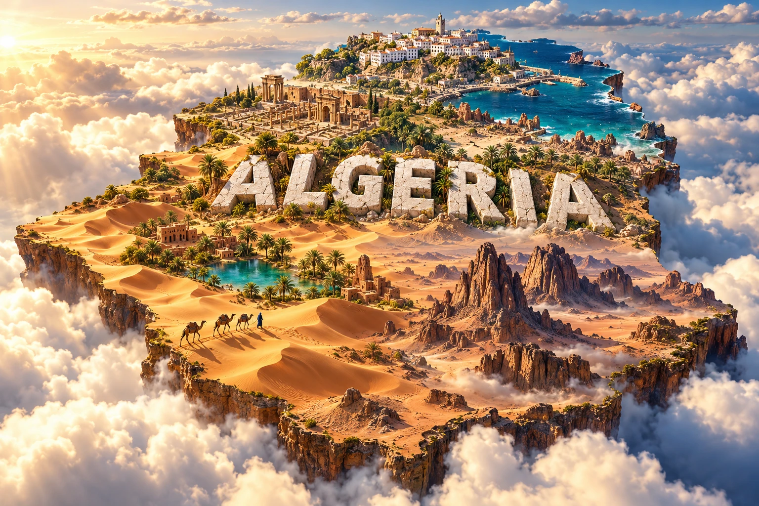
The Algeria artwork combines Sahara dunes, the Ahaggar Mountains, a Mediterranean shoreline, Casbah-inspired buildings, Timgad-style Roman ruins, oases, date palms and domesticated dromedary camels. The floating country outline and monumental “ALGERIA” lettering compress a continent-scale territory into one scene.
These elements belong to widely separated environments. The Casbah and Mediterranean coast are in the far north; Timgad lies near the northeastern Aurès; the Ahaggar rises deep in the central Sahara; and dune fields and oases occur only in particular desert basins. Camels are associated with pastoralism and transport but are not wild animals spread uniformly across Algeria.
The image is a conceptual artistic composition. The landmarks, wildlife and landscapes are combined for educational visualization and are not shown at their true geographic positions or scale. It is not a satellite image, an archaeological reconstruction or a map of vegetation and animal ranges.
12. Interesting Facts About Algeria
- Algeria is Africa's largest country by total area.
- The Sahara covers roughly four-fifths of Algeria, but much of the desert is rock or gravel rather than dunes.
- Algeria has a Mediterranean coastline stretching for more than 1,000 kilometers.
- Mount Tahat in the Ahaggar is the country's highest point at about 2,908 meters.
- Algeria uses UTC+1 throughout the year and does not currently change clocks seasonally.
- The Chelif is the country's longest significant permanent river.
- Tassili n'Ajjer contains more than 15,000 recorded rock drawings and engravings.
- Some Tassili images depict animals associated with the Sahara's wetter past.
- Chotts become saline because water drains into closed basins and then evaporates.
- Arabic and Tamazight are both official languages.
- Timgad began as a Roman military colony founded under Emperor Trajan in AD 100.
- The M'Zab Valley's compact settlements and water systems were adapted to desert conditions.
- Dromedaries in Algeria are domesticated animals, not a surviving wild camel population.
- Most of Algeria's population lives in the much smaller northern part of the country.
- Oil and gas provide most export revenue, making economic diversification a major national challenge.
13. Short Quiz
-
Which sea borders Algeria to the north? A. Red Sea B. Mediterranean Sea C. Black Sea D. Arabian Sea
-
Which statement best describes the Algerian Sahara? A. It consists entirely of dunes B. It includes dunes, gravel plains, plateaus, mountains and oases C. It is covered by tropical rainforest D. It receives rain every week
-
Why do salts accumulate in many chotts? A. Closed-basin water evaporates and leaves minerals behind B. Ocean tides reach the High Plateaus C. Glaciers deposit salt D. Volcanoes produce seawater
-
What does Tassili n'Ajjer's rock art help document? A. Only modern city planning B. Environmental and human change over thousands of years C. The construction of Algiers airport D. Exact modern wildlife ranges
-
How should the 3D Algeria visual be interpreted? A. As an exact satellite map B. As one real landscape C. As a conceptual combination of distant features D. As a wildlife census
Answer key: 1-B, 2-B, 3-A, 4-B, 5-C.
14. Related Learning
Suggested internal-link topics:
- Tunisia Explained: Mediterranean Coast, Atlas Landscapes and Desert
- Libya Explained: Sahara, Mediterranean Coast and Ancient Cities
- Morocco Explained: Atlas Mountains, Deserts and Atlantic Coast
- Niger Explained: Sahel, Sahara and the Niger River
- Mali Explained: Sahel Climate, Niger River and Desert Trade
- Why the Sahara Is Not Just Sand Dunes
- How the Atlas Mountains Formed
- Why the Sahara Was Once Greener
- What Tassili Rock Art Reveals About Climate Change
- How Oasis Agriculture Works in Algeria
15. Sources
- United Nations Data — Algeria country profile
- Algeria National Office of Statistics — demographic estimates, 2020–2023
- World Bank — Algeria overview
- World Bank — Fall 2025 Algeria Economic Update
- FAO — Algeria country overview
- FAO — Ghout Oasis agricultural heritage system
- UNESCO — Algeria's World Heritage properties
- UNESCO — Tassili n'Ajjer
- UNESCO — Timgad
- UNESCO — Casbah of Algiers
- UNESCO — M'Zab Valley
- UNESCO Man and the Biosphere Programme — Tassili N'Ajjer
- Encyclopaedia Britannica — Algeria