

Albania is a small country on Europe's Balkan Peninsula with an unusually varied landscape. Adriatic lagoons and lowlands rise quickly into limestone mountains, while the Ionian coast, ancient Lake Ohrid and the free-flowing Vjosa River support very different ecosystems.
This variety is not accidental. Albania stands within an active zone of crustal deformation, and its folded rocks, steep relief, earthquakes, karst springs and river valleys reveal a long geological story. Human communities have adapted to that terrain through farming, trade, fortified towns, distinctive houses and regional cultural traditions.
1. Where Is Albania?
Albania lies in southeastern Europe, on the western side of the Balkan Peninsula. It borders Montenegro to the northwest, Kosovo to the northeast, North Macedonia to the east and Greece to the south and southeast.
The Adriatic Sea borders its western coast, while the Ionian Sea borders the southwest. The two are connected through the Strait of Otranto, which separates Albania from southern Italy. Albania is therefore a coastal country, not an island, although several small islands lie near its shore.
Tirana, on the central-western lowland, is the capital and largest city. Durrës is the principal port, Shkodër is a major northern center near Lake Shkodër, Vlorë stands near the meeting of the Adriatic and Ionian coasts, and Korçë serves the southeastern uplands. Berat and Gjirokastër are especially important for historic architecture.
2. Quick Country Facts
- Official name: Republic of Albania
- Capital: Tirana
- Region: Southeastern Europe; western Balkans
- Area: Approximately 28,748 square kilometers
- Population: 2,335,930 on 1 January 2026, according to Albania's statistical institute, INSTAT
- Currency: Albanian lek (ALL)
- Official language: Albanian; Greek, Macedonian, Aromanian, Romani and other languages are also used by communities
- Time zone: Central European Time (UTC+1), with summer daylight saving time (UTC+2)
- Highest point: Mount Korab, or Maja e Korabit, about 2,764 meters, on the border with North Macedonia
- Major rivers: Drin, Vjosa, Seman, Shkumbin and Mat
- Major lakes: Shkodër, Ohrid and the Prespa lakes, all shared with neighboring countries
Population figures should be dated because emigration, immigration, births and deaths change the total. The 2026 estimate was 1.16 percent lower than the comparable figure for the previous year.
3. Geography and Landscape
Albania's western edge contains a narrow coastal plain built partly from sediment carried by rivers. Beaches, dunes, river mouths, lagoons and wetlands occur along the Adriatic. The plain contains much of the country's agriculture, transport infrastructure and urban population, but some areas are exposed to flooding and coastal erosion.
Mountains and hills cover most of the interior. In the north, the Albanian Alps—part of the Accursed Mountains—have sharp limestone peaks, deep valleys and high passes. The Valbona and Theth valleys are among their best-known landscapes. Eastern Albania includes the Korab range and high basins, while southern ranges run roughly parallel to the Ionian coast.
The southwest coast, often called the Albanian Riviera, is much steeper than much of the Adriatic shore. Mountains descend toward bays and narrow coastal terraces. Mediterranean shrubs, olive groves and settlements occupy suitable slopes, but this scenery belongs to one region rather than the whole country.
Albania shares Lake Shkodër with Montenegro, Lake Ohrid with North Macedonia and the Prespa lakes with North Macedonia and Greece. Lake Ohrid is exceptionally deep and ancient. Its long isolation allowed many freshwater species to evolve there that live nowhere else.
Rivers generally flow from the mountainous east toward the Adriatic. The Drin system connects waters from the Lake Ohrid region, Kosovo and northern Albania. The Vjosa enters from Greece, crosses southern Albania through a wide and dynamic river corridor, and reaches the Adriatic. The Seman forms from the Devoll and Osum, while the Shkumbin has historically served as an important route across the country.
4. Why Does Albania Look Like This?
Albania belongs to the Albanides, a mountain belt connected to the Dinarides to the north and the Hellenides to the south. These ranges developed as the Adriatic microplate and nearby parts of the African plate converged with Eurasia. Layers of rock that had accumulated in and around the ancient Tethys Ocean were compressed, folded, faulted and lifted.
That deformation continues. Active faults generate earthquakes, including damaging events near the coast and in the interior. The steep mountain fronts and young relief show that tectonic uplift, erosion and sediment movement are still reshaping the country. Rivers cut valleys through rising terrain and deposit gravel, sand and silt where they reach flatter basins or the coast.
Much of Albania contains limestone. Rainwater absorbs carbon dioxide and becomes weakly acidic, slowly dissolving the rock along cracks. This process, called karstification, creates caves, sinkholes, underground drainage and powerful springs. It also helps explain why some limestone mountains have little surface water even where rainfall is substantial.
Lake Ohrid and the Prespa lakes occupy tectonic basins formed by faulting and crustal movement. Lake Ohrid has persisted for roughly two to three million years, according to UNESCO, making it an unusually long-lived freshwater environment. Water moves through the wider lake system partly by underground karst pathways.
Along the coast, waves, currents and river sediment continually rearrange beaches, sandbars and lagoons. Inland, seasonal floods allow rivers such as the Vjosa to shift among channels and build gravel islands and floodplains. Albania's scenery is therefore the combined result of plate movement, dissolving limestone, flowing water, erosion and deposition.
5. Climate
The coastal lowlands have a Mediterranean climate: summers are generally hot and dry, while winters are mild and wetter. The Ionian south typically has a long warm season, but sea breezes and local topography cause variations between bays, slopes and valleys.
Conditions become more continental with distance from the sea and increasing elevation. Interior basins can have hotter summer days and much colder winters than the coast. Snow is common in high mountains, where the growing season is short and winter travel can be difficult.
Mountains force moist air upward, causing it to cool and release rain or snow. This orographic effect makes some western and northern slopes very wet, while enclosed eastern basins can be comparatively dry. Elevation also produces tightly packed climate zones: Mediterranean vegetation may grow relatively close to beech forest, conifer woodland and alpine grassland.
Climate change increases risks from extreme heat, drought, wildfire, intense rainfall and flooding. Lower or less reliable snow cover can change river flow and hydropower production, while sea-level rise and erosion threaten low coastal areas. These pressures differ by region and interact with land use, drainage and forest condition.
6. Wildlife and Ecosystems
Albania's ecosystems include Mediterranean scrub, oak woodland, beech and conifer forests, alpine meadow, freshwater lakes, free-flowing rivers, coastal lagoons and marine habitats. A species associated with one of these environments should not be assumed to occur across the country.
Brown bears, gray wolves, roe deer and wild boar survive mainly in larger forested and mountainous landscapes. Chamois use rocky high terrain. The critically endangered Balkan lynx is restricted to fragmented mountain habitat in the western Balkans; it is exceptionally rare and is not a typical sight throughout Albania.
The golden eagle, Albania's national symbol, nests in suitable cliffs and mountains and ranges over open country. Its symbolic importance does not mean it is common everywhere. Wetlands and lakes support herons, cormorants and migratory waterbirds. Dalmatian pelicans use selected wetlands in the region, including the Prespa system, rather than every Albanian lake or coastline.
Lake Ohrid contains more than 200 endemic plant and animal species according to UNESCO's World Heritage description, including distinctive snails, crustaceans and fish. Because the lake is shared, pollution, shoreline development, fishing and water management require cooperation between Albania and North Macedonia.
The Vjosa and its tributaries support gravel bars, riparian woodland, fish and other river life. In 2023 Albania designated the Vjosa Wild River National Park, described by IUCN as Europe's first Wild River National Park. Protection does not remove every threat; wastewater, extraction, development and management capacity still matter.
Other important protected landscapes include Divjakë-Karavasta's lagoon complex, Prespa National Park, Llogara's mountain and coastal transition, and the Albanian Alps. Habitat connectivity is particularly important for large mammals that move beyond park boundaries.
7. Famous Landmarks and Natural Features
Butrint is an archaeological landscape in southern Albania. Its remains record prehistoric occupation, a Greek-influenced settlement, a Roman colony, an early Christian center and later Byzantine and Venetian phases. UNESCO emphasizes the combination of archaeology and the surrounding wetland environment.
Berat and Gjirokastër are jointly listed by UNESCO for their well-preserved historic centers. Berat contains tiered houses, religious buildings and a fortified citadel, while Gjirokastër is known for stone-roofed tower houses around its citadel. Their architecture reflects particular periods and communities, not a universal Albanian house style.
The Lake Ohrid region is a transboundary natural and cultural World Heritage property. UNESCO extended the property to Albania's side of the lake in 2019. The Lin Peninsula preserves evidence of prehistoric pile dwellings and an early Christian church, while the lake itself protects ancient freshwater biodiversity.
The Albanian Alps contain high limestone peaks, forests, glacially modified valleys and rivers such as the Valbona. Glaciers were more extensive during colder periods and helped carve parts of the dramatic relief visible today.
The Vjosa River is important as a functioning river system rather than a single monument. Its mobile channels, tributaries and floodplain demonstrate how an undammed river can transport sediment and create habitats. The national park protects the river corridor within Albania.
Apollonia preserves remains of an ancient city connected with Greek colonization and the Roman world. Krujë Castle is closely associated with the 15th-century resistance led by Gjergj Kastrioti, known as Skanderbeg, and with later national memory.
8. People, Languages and Culture
Albanian is an independent branch of the Indo-European language family. Its two broad dialect groupings are commonly called Gheg, traditionally associated mainly with the north, and Tosk, mainly with the south. Standard Albanian draws principally on Tosk, but actual speech varies by locality, generation and migration history.
Albania also includes Greek, Macedonian, Aromanian, Romani, Egyptian and other communities and identities. Religious life includes Sunni Muslim, Bektashi, Orthodox Christian and Roman Catholic traditions, as well as people who are nonreligious or do not practice regularly. Religious affiliation should not be treated as a complete description of personal identity.
Albanian folk iso-polyphony uses overlapping vocal parts and a sustained drone in traditions associated especially with southern communities. UNESCO placed it on the Representative List of the Intangible Cultural Heritage of Humanity. Northern epic song, urban music, dance, textile work, wood carving and stone building demonstrate different regional traditions.
Albania's history includes ancient Illyrian societies, Greek coastal settlements, Roman and Byzantine rule, medieval principalities and several centuries within the Ottoman Empire. Skanderbeg became a major figure through resistance to Ottoman expansion in the 1400s. Albania declared independence in 1912.
The 20th century brought changing borders, monarchy, Italian occupation, the Second World War and a highly isolated communist state under Enver Hoxha. Thousands of concrete bunkers remain from that period. Communist rule ended in the early 1990s, followed by rapid political, economic and social change and extensive emigration.
Family networks, hospitality and connections with a large diaspora remain significant, but customs differ between urban and rural settings and among regions. Contemporary Albanian culture also includes film, literature, popular music, modern design and multilingual lives that cannot be represented by one traditional costume or festival.
9. Food
Albanian food reflects Mediterranean, Balkan and Ottoman-era connections as well as local farming and herding. Byrek is filled pastry made in many forms, commonly with cheese, greens or meat. Tavë kosi combines baked lamb and yogurt, while fërgesë usually brings together peppers, tomatoes and dairy ingredients in regional variations.
Beans, bread, vegetables, yogurt and cheese are everyday foods. Olive oil, citrus, seafood and herbs are prominent near suitable southern and coastal areas. Inland and mountain cuisines make greater use of preserved foods, maize, potatoes, meat and dairy, although no boundary is absolute.
Qofte are seasoned meat patties or meatballs found in several neighboring cuisines. Desserts such as ballokume have strong local associations, while coffee is an important social drink. These examples represent selected traditions rather than a single national menu eaten by everyone.
10. Economy and Major Industries
Services account for much of Albania's economic activity. Trade, transport, finance, communications, public services and tourism employ many people. Tourism has expanded around the coast, historic towns and mountain landscapes, bringing income while also increasing pressure on water, waste systems, housing, heritage and sensitive habitats.
Agriculture remains important for rural livelihoods and produces vegetables, fruit, olives, grapes, cereals, dairy products and livestock. Farms are often small and fragmented. Better irrigation, storage, food safety, transport and access to markets can matter as much as total cultivated area.
Manufacturing includes textiles and footwear, food processing, construction materials and light industry. Construction has been a major source of activity. Albania also extracts minerals including chromium and produces oil, although environmental management and market conditions affect these sectors.
Hydropower supplies most domestically generated electricity, so rainfall and river flow strongly influence energy security. New energy sources and stronger regional connections can reduce vulnerability to dry years. Remittances from Albanians living abroad also support many households.
World Bank reporting identifies services and construction as recent growth drivers and notes the importance of tourism, agriculture, digitization and resilience. Long-term challenges include population decline, outward migration, uneven productivity, climate risk, infrastructure needs and ensuring that growth benefits different regions.
11. What the 3D Visual Represents
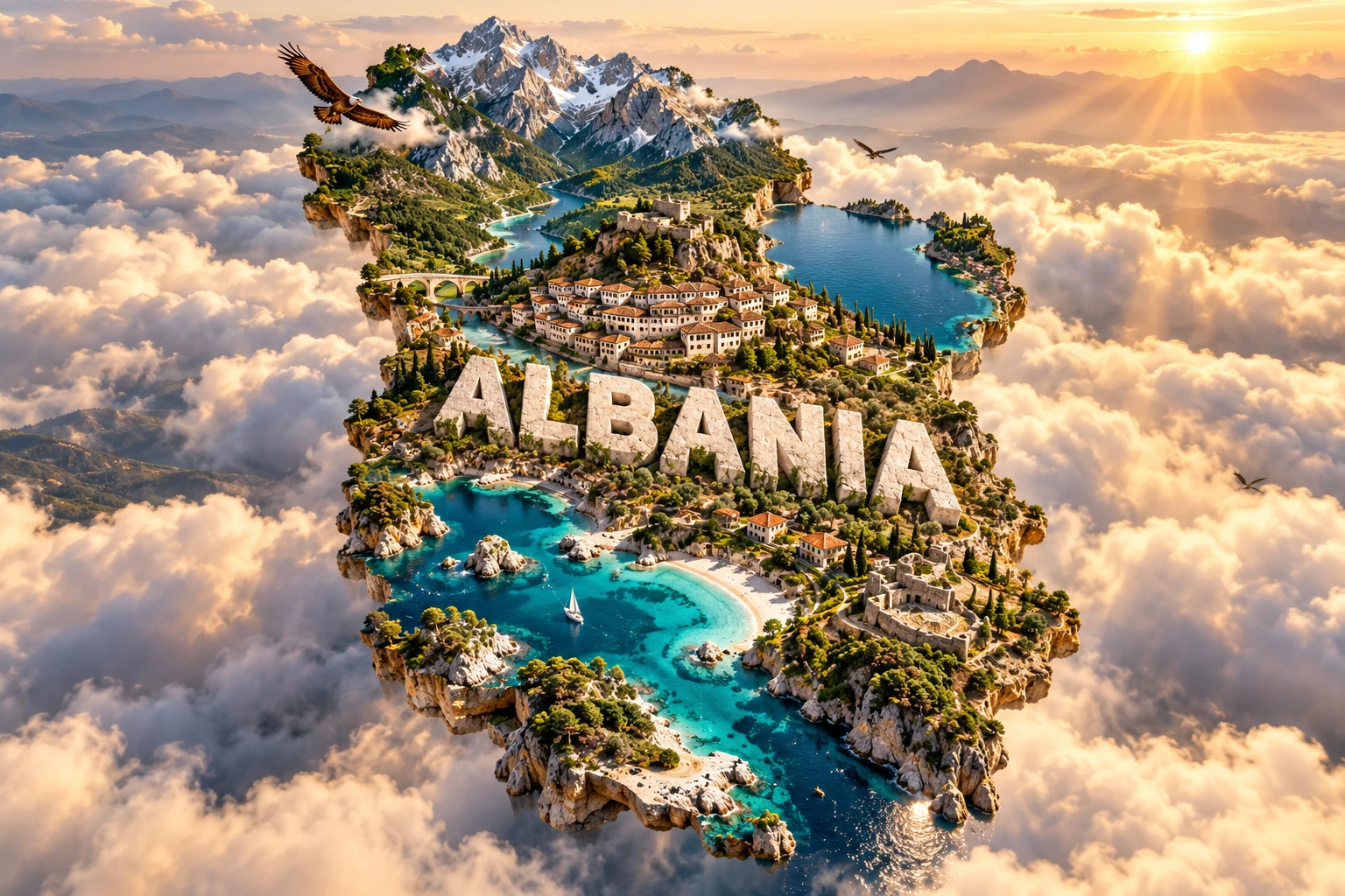
The Albania artwork combines sharp Albanian Alps, a turquoise Riviera shoreline, Lake Ohrid, tiered Berat-style houses, stone villages, golden eagles and Mediterranean vegetation. Monumental “ALBANIA” lettering and the floating micro-world format unite these distant features in one visual narrative.
Each element points to a real theme, but not one real location. The northern Alps are far from the southern Riviera; Lake Ohrid lies on the eastern border; Berat has its own historic urban fabric; and golden eagles use suitable habitats rather than every landscape. Building styles, plants and coastlines also vary greatly by region.
The image is a conceptual artistic composition. The landmarks, wildlife and landscapes are combined for educational visualization and are not shown at their true geographic positions or scale. It is not a satellite map, an exact reconstruction or evidence that all depicted species and traditions occur together.
12. Interesting Facts About Albania
- Albania has coastlines on both the Adriatic and Ionian seas.
- Mountains and hills cover most of the country despite its long coastline.
- Mount Korab, about 2,764 meters high, stands on the border with North Macedonia.
- Albania shares all three of its largest lakes—Shkodër, Ohrid and Prespa—with neighboring countries.
- Lake Ohrid is a tectonic lake roughly two to three million years old.
- More than 200 species in Lake Ohrid are endemic, meaning they occur naturally nowhere else.
- Karst processes dissolve Albania's widespread limestone and create caves, springs and underground drainage.
- The Vjosa became the core of Europe's first Wild River National Park in 2023.
- Albanian forms its own branch of the Indo-European language family.
- Berat and Gjirokastër share one UNESCO World Heritage listing for their historic urban architecture.
- Butrint preserves layers from Greek, Roman, early Christian, Byzantine and Venetian history.
- Albania's golden eagle is a national symbol but is not uniformly distributed across the country.
- Hydropower supplies most of Albania's domestically generated electricity, making rainfall important to the energy system.
- Thousands of small bunkers were built during the country's isolated communist period.
- Albania's steep relief creates Mediterranean, forest and alpine ecosystems within short distances.
13. Short Quiz
-
Which seas border Albania? A. Baltic and North B. Adriatic and Ionian C. Black and Caspian D. Red and Arabian
-
What geological process helped create Albania's mountain belts? A. Plate convergence and crustal compression B. Coral reef growth alone C. Meteor impact D. Wind deposition alone
-
Why is Lake Ohrid especially important for biodiversity? A. It is an artificial reservoir B. Its ancient, isolated waters support many endemic species C. It freezes solid every summer D. It contains seawater
-
Where is the critically endangered Balkan lynx most likely to occur? A. In every Albanian city B. In restricted mountain habitat C. Across all coastal beaches D. Only on offshore islands
-
How should the 3D artwork be understood? A. As a satellite photograph B. As an exact wildlife distribution map C. As a conceptual combination of distant features D. As one real Albanian valley
Answer key: 1-B, 2-A, 3-B, 4-B, 5-C.
14. Related Learning
Suggested internal-link topics:
- Montenegro Explained: Adriatic Coast, Mountains and Lake Shkodër
- North Macedonia Explained: Lakes, Valleys and Balkan Geography
- Greece Explained: Mountains, Islands and Mediterranean Climate
- Kosovo Explained: Basins, Mountains and Cultural Landscapes
- How the Albanian Alps Formed
- Why Lake Ohrid Has So Many Unique Species
- How Karst Landscapes Create Caves and Springs
- How the Vjosa River Builds Floodplains and Gravel Islands
- Why Mediterranean Climates Have Dry Summers
- How Earthquakes Shape the Balkans
15. Sources
- INSTAT — Population of Albania on 1 January 2026
- World Bank — Albania overview
- World Bank — Albania Country Climate and Development Report
- UNESCO — Albania's World Heritage properties
- UNESCO — Butrint
- UNESCO — Historic Centres of Berat and Gjirokastra
- UNESCO — Natural and Cultural Heritage of the Ohrid region
- UNESCO — Albanian folk iso-polyphony
- IUCN — Vjosa becomes Europe's first Wild River National Park
- Vjosa Wild River National Park — official park information
- Encyclopaedia Britannica — Albania