

Tonga is a Polynesian kingdom of roughly 170 islands scattered along an active boundary in the South Pacific. Its eastern islands are mostly low limestone and coral platforms, while western islands rise from a volcanic arc. That contrast explains Tonga’s reefs, cliffs, fertile volcanic soils and serious exposure to eruptions, earthquakes, cyclones and tsunamis.
The ocean is not empty space between these islands. It is a highway, food source, cultural setting and habitat where humpback whales migrate to breed and give birth. Tonga is also the Pacific’s only remaining indigenous monarchy, with a national identity shaped by kinship, Christianity, chiefly traditions and a large overseas community.
1. Where Is Tonga?
The Kingdom of Tonga lies in Polynesia in the southwestern Pacific Ocean. Fiji is generally to the west, Samoa to the north, Niue to the east and New Zealand far to the southwest. Tonga has no land borders.
Its islands form a north–south chain extending about 800 kilometres. The main groups are Tongatapu in the south, Haʻapai in the center, Vavaʻu farther north and the remote Niuas. ʻEua lies southeast of Tongatapu. Counts vary with the treatment of tiny islets and volcanic land that appears or disappears; an official investment agency describes about 170 islands, 36 inhabited.
Nukuʻalofa, the capital, is on Tongatapu, the largest and most populous island. Neiafu is the main town of Vavaʻu, Pangai serves Haʻapai and Haveluloto is part of the larger urban area on Tongatapu. The International Date Line bends east of Tonga so the kingdom can share a calendar day with nearby Pacific partners despite lying east of 180° longitude.
2. Quick Country Facts
- Official name: Kingdom of Tonga
- Capital: Nukuʻalofa
- Region: Polynesia, Oceania
- Land area: Approximately 717 square kilometres according to an official investment profile
- Population: 100,209 people counted in Tonga’s 2021 census
- Currency: Tongan paʻanga (TOP)
- Official languages: Tongan and English
- Time zone: Tonga Standard Time, UTC+13, year-round
- Highest point: Kao volcano, approximately 1,033 metres
- Largest island: Tongatapu
- Main island groups: Tongatapu, Haʻapai, Vavaʻu and the Niuas
- Government: Constitutional hereditary monarchy
- Independence status: Tonga ended British protected-state arrangements in 1970; it was not formally colonized
- UNESCO status: No inscribed World Heritage property; two cultural entries are on the Tentative List
Area and island totals differ among sources because measurements may include reefs, tidal land and changing volcanic islands. Figures should be accompanied by a source and date.
3. Geography and Landscape
Tonga consists of two roughly parallel island chains. The eastern chain includes low islands built from uplifted coral limestone, with reefs, cliffs, caves and fertile but thin soils. Tongatapu is mostly flat and low, while ʻEua is older and higher, with dramatic eastern cliffs and forested terrain.
The western chain is volcanic. Islands including Tofua, Kao, Late and Fonualei are summits of volcanoes rising from the seafloor. Kao is the country’s highest point. Some volcanic islands are uninhabited, difficult to reach or periodically reshaped by eruptions.
Haʻapai contains many small, low coral islands alongside volcanic islands such as Tofua and Kao. Vavaʻu is a raised limestone island group cut by sheltered channels and bays. The Niuas include volcanic Niuafoʻou and Niuatoputapu, whose geology and settlement histories differ.
Coral reefs, lagoons and deep channels surround the archipelago. Beaches form from broken coral, shells, volcanic grains and other sediment. Blowholes on Tongatapu occur where waves force air and water through openings in coastal limestone.
Fresh water is limited. Most islands have no large permanent rivers, so communities depend on rainwater and thin underground freshwater lenses floating above seawater in porous rock. Drought, contamination, over-pumping and storm-driven saltwater intrusion can threaten these supplies.
4. Why Does Tonga Look Like This?
East of the islands, the Pacific Plate bends and sinks beneath the Australian Plate at the Tonga Trench. Water released from the descending slab helps rock melt at depth. Magma rises and creates the Tonga–Kermadec volcanic arc, including many volcanoes hidden below the ocean.
Behind the arc, the crust stretches within the Lau Basin. This combination of subduction and back-arc spreading makes the region exceptionally active. Earthquakes trace the sinking plate, while eruptions build, join or destroy islands. Tonga is therefore not one single island sitting on one volcano; it is an archipelago across a complex plate-boundary system.
The eastern limestone islands developed differently. Coral reefs grew around older volcanic foundations near sea level. Tectonic uplift raised some reefs into dry land, producing coral-limestone terraces and cliffs. Rainwater slowly dissolves limestone, creating caves, fissures and underground drainage.
Hunga Tonga–Hunga Haʻapai demonstrated how quickly this landscape can change. On 15 January 2022, a violent submarine eruption generated ash, atmospheric pressure waves and destructive tsunamis. Multiple processes produced the waves, including water displacement and air–sea coupling. Much of the small island created by earlier eruptions was destroyed.
Low coral islands are especially exposed to storm surge and sea-level rise. Reefs can reduce wave energy, but damaged reefs, sand mining and poorly placed construction weaken natural defenses. On volcanic slopes, ash may eventually enrich soils, while fresh deposits initially smother crops and contaminate water.
5. Climate
Tonga has a warm tropical maritime climate moderated by the surrounding ocean and southeast trade winds. Conditions are generally warmer and wetter in the north and slightly cooler in the south.
The wetter, hotter season usually runs from about November to April. Tropical cyclones are most likely during this period, bringing destructive wind, storm surge and intense rain. The cooler, relatively drier season extends roughly from May to October, although rain can fall throughout the year.
El Niño and La Niña shift rainfall, drought and cyclone patterns across the Pacific. A national average can hide sharp differences among scattered islands, so water planning relies on local observations and seasonal forecasts.
Climate change raises sea level, increases coastal flooding and ocean heat, and may intensify the strongest cyclones. Saltwater intrusion threatens crops and groundwater on low islands. Adaptation includes elevated buildings, safer evacuation routes, rainwater storage, mangrove and reef protection, resilient crops and decisions about where new infrastructure should stand.
6. Wildlife and Ecosystems
Tonga’s ecosystems include coral reefs, seagrass, mangroves, lagoons, deep ocean, limestone forest and volcanic-island forest. Isolation produced native species but also made ecosystems vulnerable to rats, invasive plants, habitat clearing, overharvesting and climate change.
Humpback whales migrate from Antarctic feeding grounds to Tongan waters during the austral winter, commonly from about July to October, to mate and give birth. They are seasonal visitors, not present equally around every island all year. Tonga protects whales, and close encounters must be regulated to reduce disturbance.
Green and hawksbill turtles use Tongan waters, while some females nest on suitable beaches. Both face threats from fishing gear, habitat loss, pollution, warming sand and historical harvesting. Sea turtles do not inhabit every beach shown in an illustration.
Reefs support corals, reef fish, giant clams, sharks, rays and invertebrates. Crown-of-thorns starfish outbreaks, cyclones, sediment, pollution and marine heatwaves can damage coral. Marine protected and locally managed areas aim to sustain habitats and fisheries, but protection quality varies.
Native land animals are less conspicuous. Pacific flying foxes are important pollinators and seed dispersers. Seabirds nest on offshore islands, and Tonga whistlers, megapodes and other birds have restricted distributions. The endangered Tongan megapode survives mainly on remote volcanic islands and has been moved to additional islands for conservation.
ʻEua National Park protects limestone forest and cliffs, while Mount Talau in Vavaʻu conserves a small forest remnant. Tonga’s environmental reporting stresses that protected status must be paired with invasive-species control, monitoring and community stewardship.
7. Famous Landmarks and Natural Features
- Haʻamonga ʻa Maui: A monumental coral-limestone trilithon on Tongatapu, associated with the ancient royal center at Heketā. Its precise purpose remains debated; claims that it functioned as an astronomical instrument should be presented cautiously.
- Ancient Royal Tombs of Lapaha: Terraced stone tombs, or langi, at Muʻa demonstrate the authority and regional connections of the Tuʻi Tonga dynasty. Together with Heketā, they form a UNESCO Tentative List entry, not an inscribed World Heritage property.
- Mapu ʻa Vaea Blowholes: Waves entering cavities in Tongatapu’s limestone coast drive plumes of spray through openings, illustrating erosion and the island’s porous reef rock.
- ʻEua: This raised island has cliffs, caves, forest and some of Tonga’s oldest exposed rocks. Its height offers a landscape different from low Tongatapu.
- Vavaʻu: A network of raised limestone islands, sheltered waterways and reefs. Its bays are important to local navigation, fisheries and seasonal humpback whales.
- Tofua and Kao: Neighboring volcanic islands in Haʻapai show the active western arc; Kao is the highest island and Tofua contains a crater lake.
- Hunga Tonga–Hunga Haʻapai: The submarine volcano is scientifically important because its 2022 eruption produced global atmospheric waves and tsunamis.
- Royal Palace, Nukuʻalofa: The nineteenth-century wooden palace represents the modern monarchy, although it is a working national symbol rather than a complete account of Tongan history.
8. People, Languages and Culture
Most citizens are Indigenous Tongans, part of the wider Polynesian world, but individuals and families have varied backgrounds and experiences. Tongan and English are official languages. Tongan is closely related to Niuean and more distantly to Samoan and other Polynesian languages.
The concept of anga fakatonga, “the Tongan way,” includes respect, reciprocity, family responsibility and social relationships. Extended families and overseas relatives remain connected through visits, communication, gifts and remittances. These values are lived differently; they should not be reduced to an unchanging rulebook.
Fine mats and ngatu, decorated barkcloth made chiefly by women’s groups, carry social and ceremonial meaning. They may be exchanged at weddings, funerals and major public occasions. Taʻovala, woven mats worn around the waist on formal occasions, vary by context and status.
Dance and music include lakalaka, a large-group performance combining poetry, choreography and social commentary. UNESCO recognizes lakalaka as intangible cultural heritage. Church choirs are also prominent because Christianity has shaped public life since the nineteenth century, though denominations and personal practice differ.
Tongan society retains hereditary royal and chiefly institutions. King George Tupou I united the kingdom and promulgated the 1875 Constitution. Tonga entered a British protected-state relationship in 1900 but retained its monarchy and internal government, then ended that arrangement in 1970. Political reforms in 2010 increased the number of elected representatives, while the monarch and nobles retain constitutional roles.
Lapita-speaking voyagers settled Tonga roughly 3,000 years ago. Later Tongan maritime networks reached Fiji, Samoa and other islands, moving people, ideas and prestige goods. Describing this history as a simple modern “empire” can conceal changing relationships; archaeology and oral traditions provide complementary evidence.
9. Food
Root crops remain central. Taro, yam, cassava and sweet potato are commonly paired with coconut, leafy vegetables, pork, chicken or fish. Breadfruit, banana and plantain are also important.
Lu pulu wraps corned beef or another filling with taro leaves and coconut cream before baking, often in an earth oven called an ʻumu. Ota ika uses raw fish cured with citrus and mixed with coconut milk and vegetables. Recipes vary among households and across the Pacific.
Feasts express hospitality and collective work, but everyday meals may be simpler. Imported rice, flour, tinned meat and processed foods are now common. Tonga faces serious noncommunicable-disease challenges, so food culture includes both valued traditions and debates about affordability, nutrition and locally grown produce.
10. Economy and Major Industries
Tonga’s small, remote economy depends on services, agriculture, construction, trade, tourism, fishing, aid and money sent home by Tongans abroad. World Bank data show remittances equal a very large share of national income, helping families pay for food, education, housing and ceremonies while also exposing households to conditions overseas.
Farmers grow squash pumpkin, root crops, coconuts, vanilla, watermelon and other produce. Agriculture is vulnerable to cyclones, drought, pests, transport costs and ashfall. Fisheries supply local food and export income, but tuna and coastal stocks require sustainable management.
Tourism centers on culture, reefs, sailing and seasonal whale encounters. It creates work in accommodation, boats, food and transport, yet visitor numbers can fall sharply after disasters or border closures. Rules are needed so wildlife tourism does not harm the animals on which it depends.
Imports provide much of the fuel, machinery, manufactured goods and food. Shipping between small, scattered islands is expensive. Telecommunications and undersea cables reduce isolation but can be damaged, as the 2022 eruption demonstrated.
Reconstruction after Cyclone Gita in 2018, the 2022 eruption and tsunami, and later shocks has driven public investment. Long-term development depends on resilient infrastructure, skills, renewable energy, healthy ecosystems and opportunities that do not require everyone to migrate.
11. What the 3D Visual Represents
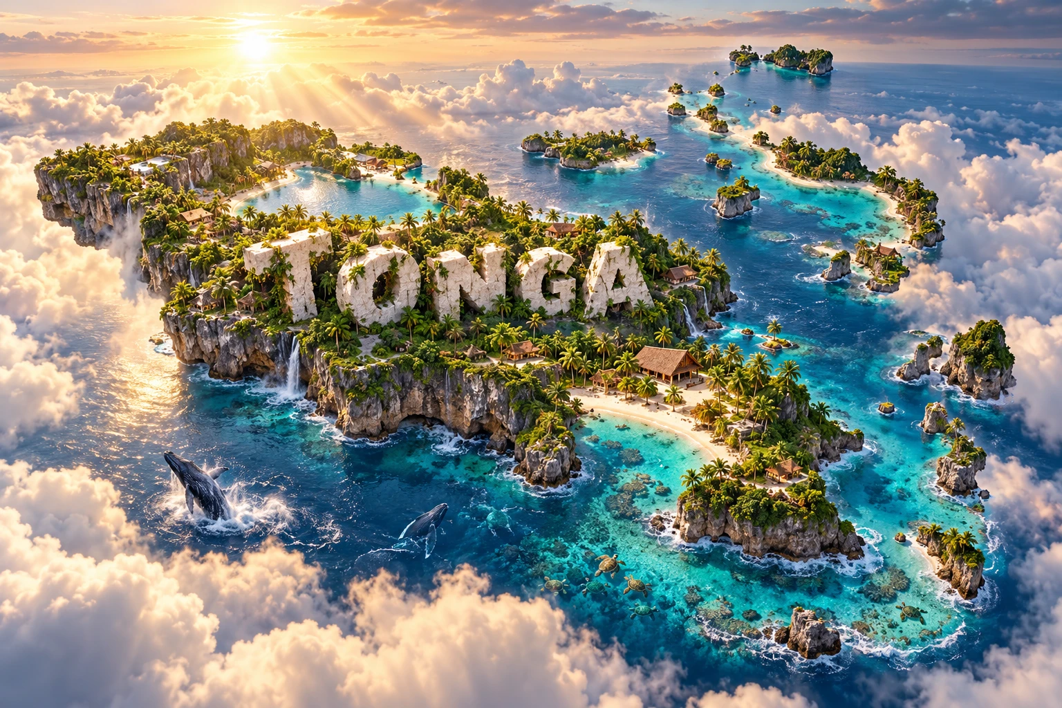
The Tonga artwork combines coral beaches, limestone cliffs, tropical forest, Polynesian-inspired architecture, humpback whales, sea turtles and clear Pacific water. These elements symbolize the raised reef islands, wetter forests, ocean-centered livelihoods, seasonal whale migration and threatened marine ecosystems. The embedded “TONGA” lettering is decorative.
The real country cannot form one continuous landmass shaped like a conventional map: it is an archipelago spread across hundreds of kilometres. Volcanic and limestone islands belong to different chains, whales visit seasonally, turtles use particular habitats, and architecture varies by island, purpose and period.
The image is a conceptual artistic composition. The landmarks, wildlife and landscapes are combined for educational visualization and are not shown at their true geographic positions or scale. It is a floating micro-world rather than a satellite map, ecological survey or claim that every island contains all pictured features.
12. Interesting Facts About Tonga
- Tonga is a Polynesian kingdom with roughly 170 islands, about 36 of them inhabited according to an official profile.
- Its island chain extends approximately 800 kilometres from north to south.
- Tonga is the Pacific’s only remaining indigenous monarchy.
- Nukuʻalofa lies on low-lying Tongatapu, the largest and most populous island.
- The eastern islands are mainly uplifted coral limestone, while the western chain is volcanic.
- Kao volcano is the highest point at approximately 1,033 metres.
- The Tonga Trench marks where the Pacific Plate sinks beneath the Australian Plate.
- The 2022 Hunga eruption generated atmospheric waves and tsunamis detected around the world.
- Humpback whales visit Tongan waters seasonally to breed and give birth.
- Fresh water on many islands depends on rainfall and fragile groundwater lenses.
- Haʻamonga ʻa Maui is built from three enormous coral-limestone slabs.
- Tongan ngatu is decorated barkcloth used in exchange and ceremony.
- UNESCO recognizes lakalaka dance and sung speeches as intangible cultural heritage.
- Tonga retained its monarchy during its British protected-state period and ended that relationship in 1970.
- Tonga had no inscribed UNESCO World Heritage property as of September 2026, although it had two Tentative List entries.
13. Short Quiz
-
Why do Tonga’s western and eastern islands look different? A. Western islands are volcanic, while many eastern islands are uplifted limestone B. Every island was built from river mud C. Eastern islands are artificial D. Glaciers built the western chain
-
What happens at the Tonga Trench? A. The Pacific Plate sinks beneath the Australian Plate B. Two continents move apart above sea level C. Coral changes directly into magma D. A river cuts through Tongatapu
-
Why do humpback whales visit Tonga? A. To breed and give birth in warmer waters B. To live on land all year C. To eat taro crops D. To nest in limestone caves
-
What is ngatu? A. Decorated barkcloth B. A volcanic crater C. The national currency D. A type of coral fish
-
Why is the 3D visual conceptual? A. It combines separated islands, wildlife and landscapes without true position or scale B. It is a measured satellite image C. Tonga is one solid landmass D. Whales occur beside every island every day
Answer key: 1-A, 2-A, 3-A, 4-A, 5-A
14. Related Learning
- Fiji Explained: Islands West of Tonga
- Samoa Explained: Polynesian Connections North of Tonga
- New Zealand Explained: Tonga’s Southern Pacific Neighbor
- Why Tonga Has Both Volcanic and Coral Islands
- How the Tonga Trench Creates Earthquakes and Volcanoes
- What Made the 2022 Hunga Eruption So Unusual?
- Why Humpback Whales Migrate to Tonga
- How Coral Reefs Protect Low Pacific Islands
- What Tongan Ngatu and Taʻovala Communicate
- How Sea-Level Rise Threatens Freshwater Lenses
15. Sources
- Tonga Statistics Department — 2021 Census resources
- Government of Tonga — official portal
- Invest Tonga — official country profile
- World Bank — Tonga data
- World Bank — Pacific Economic Updates
- UNESCO — Ancient Capitals of the Kingdom of Tonga
- UNESCO — Lapita Pottery Archaeological Sites
- UNESCO — Lakalaka, dances and sung speeches of Tonga
- USGS — science of the 2022 Hunga eruption and tsunami
- NOAA Pacific Marine Environmental Laboratory — Lau Basin tectonics
- SPREP — Tonga State of Environment Report
- Convention on Biological Diversity — Tonga country profile
- FAO — Tonga country profile
- Encyclopaedia Britannica — Tonga