

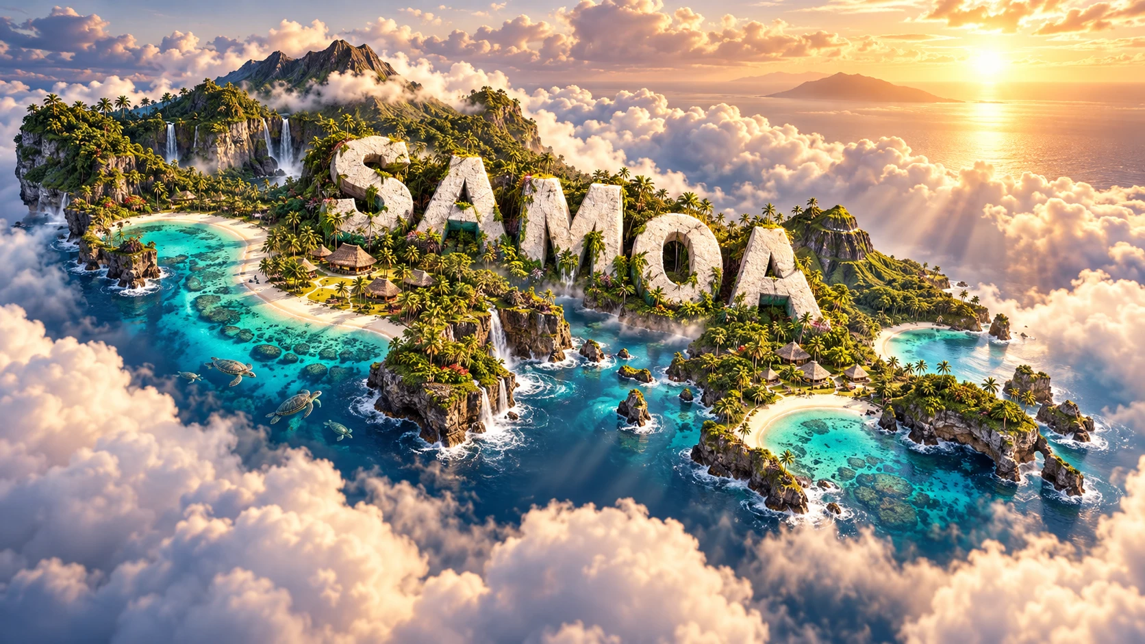
Samoa is a Polynesian island country built by volcanoes above a South Pacific hotspot. Its two main islands, Savai‘i and Upolu, combine basaltic mountains, lava fields, rainforest, waterfalls, reef-fringed coasts and villages organized through enduring Samoan social institutions.
The country is often confused with neighboring American Samoa, but they are politically separate. Samoa is an independent state; American Samoa is an unincorporated territory of the United States. Both belong to the wider Samoan archipelago and share deep linguistic, cultural and family connections.
1. Where Is Samoa?
Samoa lies in Polynesia in the central South Pacific Ocean, roughly halfway between Hawai‘i and New Zealand. American Samoa is about 130 kilometres east of Upolu, Tonga lies to the south, Fiji to the southwest and Wallis and Futuna to the west.
The country includes the large islands of Savai‘i and Upolu plus eight smaller islands: Manono, Apolima, Nu‘ulopa, Fanuatapu, Namu‘a, Nu‘utele, Nu‘ulua and Nu‘usafe‘e. Savai‘i, Upolu, Manono and Apolima are inhabited. The two large islands account for nearly all land area.
Apia, on northern Upolu, is the capital, main port and largest urban area. Most residents live on Upolu, including the rapidly growing northwest corridor. Savai‘i is larger in area but less populous; Salelologa is its main commercial and ferry center.
Samoa has no land borders. Ferries cross the Apolima Strait between Upolu and Savai‘i, while aviation and shipping connect the country with its Pacific neighbors and global diaspora.
2. Quick Country Facts
- Official name: Independent State of Samoa
- Capital: Apia
- Region: Polynesia, Oceania
- Area: Approximately 2,830 square kilometres
- Population: 205,557 in the 2021 Population and Housing Census
- Currency: Samoan tālā (WST)
- Official languages: Samoan and English
- Time zone: UTC+13, west of the International Date Line
- Largest island: Savai‘i
- Most populous island: Upolu
- Highest point: Mount Silisili, approximately 1,858 metres, on Savai‘i
- World Heritage: No inscribed UNESCO property; two sites are on the Tentative List
Samoa moved to the western side of the International Date Line in December 2011, skipping 30 December to align working days more closely with Australia, New Zealand and Asian trading partners.
3. Geography and Landscape
Savai‘i is a broad shield-volcano island about 75 kilometres long. A mountainous spine, dotted with craters and volcanic cones, reaches Mount Silisili. Extensive young lava fields remain visible in the north and northwest. Narrow coastal plains hold most villages and roads because the central interior is steep, forested and sparsely settled.
Upolu is smaller but contains Apia and most of the population. Volcanic ridges, craters and deeply cut valleys occupy its interior. Coastal plains are widest in parts of the north and west, where urban expansion, agriculture and infrastructure are concentrated.
Manono is a low inhabited island in the Apolima Strait, while steep-sided Apolima occupies the remnant of a volcanic crater. The uninhabited Aleipata islands off eastern Upolu provide important forest and seabird habitat. Each island has a distinct land-use and conservation setting.
Heavy tropical rain feeds short streams and waterfalls. Water often sinks into porous basalt, travels through fractures and lava tubes, then emerges at springs or coastal pools. Rivers can rise quickly after downpours but are short because no point lies far from the sea.
Fringing coral reefs surround much of the coast, forming lagoons where reef structure and topography permit. Beaches contain mixtures of coral, shell and volcanic grains. Cliffs, lava shelves and boulder shores occur elsewhere, so “turquoise beaches” describe only certain places and conditions.
Many villages line the coast, where flat land, reefs and access to fishing are favorable. This pattern also exposes homes, churches, roads and plantations to storm surge, sea-level rise and tsunamis.
4. Why Does Samoa Look Like This?
Samoa formed primarily above a volcanic hotspot, where unusually hot mantle material rises and partially melts beneath the Pacific Plate. Basaltic magma erupted on the seafloor, building huge shield volcanoes that eventually emerged as islands. Movement of the Pacific Plate helped produce the elongated Samoan chain.
This setting differs from island arcs created directly above subduction zones. However, Samoa lies close to the northern end of the Tonga Trench, where the Pacific Plate bends and descends. Hotspot melting, plate deformation and the nearby trench interact, making Samoan geology more complex than a simple textbook hotspot trail.
Repeated fluid lava flows built low-angle shield volcanoes. Craters, scoria cones, fissures and lava tubes mark later eruptions. As lava cools, its surface can harden while molten rock continues beneath; emptied channels leave caves and tubes.
Savai‘i remains the youngest and most recently active major island. The Matavanu eruption began in 1905 and continued until 1911. Lava traveled about 12 kilometres to the sea, destroying villages and plantations and forcing relocation. Its dark flows demonstrate that a landscape can remain visibly young in a wet tropical climate.
Upolu's older volcanic surfaces have generally undergone more weathering and stream erosion, creating deeper valleys. Chemical weathering turns basalt into soils, while roots, rain and gravity break down slopes. Waterfalls form where rivers cross hard lava layers, cliffs or abrupt valley steps.
Coral reefs grow upward and outward in warm, sunlit water, while waves break and redistribute carbonate material into beaches. Reef growth must keep pace with subsidence, sea-level change, storms and erosion; it is a biological process, not a permanent stone border.
5. Climate
Samoa has a warm, humid tropical maritime climate. Temperatures change relatively little through the year at sea level, while mountain elevations are cooler. Southeast trade winds influence rainfall, waves and sailing conditions.
The wetter season generally runs from November to April, when tropical cyclones are also most likely. May to October is usually drier, although rain falls year-round and seasons vary. Mountain interiors can receive far more rainfall than sheltered coastal districts because rising air cools and condenses.
Heavy rain can trigger flash flooding, landslides and water contamination. Cyclones bring destructive wind, high waves, storm surge and crop losses. Cyclones Ofa in 1990, Val in 1991 and Evan in 2012 caused major damage, illustrating recurring rather than one-time risk.
The 2009 South Pacific earthquake and tsunami struck southern Upolu and neighboring islands. It was a tectonic disaster rather than a weather event, but it reinforced the importance of coastal evacuation routes, warning systems and community preparedness.
Climate change raises sea level and increases saltwater intrusion, coastal erosion and extreme-heat risks. Changing rainfall threatens water supply and agriculture, while marine heatwaves bleach corals. Ecosystem-based adaptation includes protecting reefs, mangroves, forests and natural drainage alongside stronger buildings and relocated infrastructure.
6. Wildlife and Ecosystems
Samoa's habitats include lowland rainforest, montane forest, cloud forest, freshwater streams, wetlands, caves, coastal forest, mangroves, lagoons, reefs and open ocean. Much lowland forest has been converted or damaged, while steep and remote interiors retain important native vegetation.
The tooth-billed pigeon, or manumea, is Samoa's national bird and exists naturally nowhere else. It is Critically Endangered and may survive only in very small numbers. Forest loss, cyclones, hunting and introduced predators threaten it; its image as a national symbol does not mean it is commonly seen.
Other endemic birds include the Samoan white-eye, restricted to high-elevation Savai‘i, and the Samoan flycatcher. The mao, or ma‘oma‘o, is another threatened endemic forest bird. Island endemics are especially vulnerable because their entire global ranges can fit within one storm path.
Native mammals are bats, including the Samoan flying fox and Pacific sheath-tailed bat. Flying foxes pollinate flowers and disperse seeds, helping forests regenerate. Introduced rats, cats, pigs, mynas and invasive plants alter habitats and prey on native species.
Green and hawksbill sea turtles forage in Samoan waters and nest at particular beaches. They do not occupy every lagoon. Coral reefs support surgeonfish, parrotfish, groupers, invertebrates and many smaller organisms; offshore waters carry tuna and migratory whales and dolphins.
Threats include reef bleaching, disease, cyclones, sediment, sewage, plastics and unsustainable harvest. Village-managed fisheries areas and customary rules can support conservation when monitoring, participation and enforcement remain strong.
7. Famous Landmarks and Natural Features
- Saleaula lava fields on Savai‘i preserve flows from the 1905–1911 Matavanu eruption, including lava that surrounded or damaged buildings and altered the coastline.
- Alofa‘aga blowholes force waves through lava tubes and openings on southern Savai‘i. Their spray depends on swell, tide and wind.
- To Sua Ocean Trench on Upolu is a collapsed or eroded coastal lava feature filled with seawater and connected to the ocean. It is not a tectonic trench.
- Papase‘ea Sliding Rocks are smooth volcanic stream channels near Apia shaped by flowing water.
- Lake Lanoto‘o National Park, a Ramsar wetland on Upolu, protects a volcanic crater lake and upland rainforest.
- O Le Pupu-Pu‘e National Park extends from Upolu's interior toward the coast and protects forest, lava formations and cliffs.
- Robert Louis Stevenson Museum and Mount Vaea preserve a colonial-era home and the writer's burial place while also offering opportunities to discuss Samoa under foreign influence.
- Mulinu‘u Peninsula contains important political and chiefly sites, including the parliament area and historic monuments.
- Fagaloa Bay–Uafato Tiavea combines forested volcanic ridges, villages and customary relationships with land and sea. It is tentative—not inscribed—World Heritage.
Samoa currently has no UNESCO World Heritage property. Its other tentative site is the cultural landscape of Manono, Apolima and Nu‘ulopa.
8. People, Languages and Culture
Samoans are a Polynesian people whose ancestors settled the archipelago roughly 3,000 years ago within the wider Lapita expansion. Generations of navigation, exchange and political development connected Samoa with Tonga, Fiji and other Pacific societies long before Europeans arrived.
Samoan and English are official languages. Samoan, an Austronesian language, is used widely in homes, villages, churches, education, government and media. Formal and everyday registers differ, and respectful speech carries important social meaning.
Fa‘a Samoa, “the Samoan way,” describes a living framework centered on extended families (‘aiga), titled leaders (matai), villages, service, reciprocal obligations and relationships with land. It is not one rigid lifestyle. Gender, age, denomination, migration, town life and personal circumstances shape how people participate.
Most land is held under customary tenure and associated with extended families. Village councils, churches and national law share influence in complex ways. Matai titles carry responsibilities as well as status, and women and men contribute through multiple leadership and service roles.
The open-sided fale is designed around airflow, visibility and communal use. Its posts and roof carry architectural and social meaning, but modern Samoan homes use diverse materials and layouts. A fale in artwork should not imply that everyone lives in one traditional building type.
Christianity became deeply embedded during the nineteenth century and churches remain important institutions. Indigenous knowledge and social structures did not simply disappear; Samoan communities adapted outside influences within local systems.
Germany annexed western Samoa in 1900. New Zealand forces occupied it in 1914 and later administered it under international mandates. The 1918 influenza pandemic, allowed into the territory under New Zealand administration, killed a devastating share of the population. The nonviolent Mau movement campaigned for self-government; New Zealand police killed demonstrators, including leader Tupua Tamasese Lealofi III, on Black Saturday in 1929.
Samoa became independent in 1962, the first Pacific island state to regain independence in the twentieth century. Known internationally as Western Samoa, it changed its constitutional name to Samoa in 1997.
Tattoo traditions include the pe‘a and malu, applied through demanding processes with cultural obligations. Siva dance, oratory, weaving, carving, music and contemporary art continue to evolve. These should be explained in context rather than treated as costumes or decoration shared identically by everyone.
9. Food
Samoan food draws on taro, breadfruit, bananas, coconut, fish, pork, chicken and leafy vegetables. Foods and preparation vary by household, island, season, celebration and access to imports.
An umu is an earth oven in which heated stones cook wrapped foods. Palusami usually combines young taro leaves with coconut cream and may include onion or meat before being baked in an umu. Oka is raw fish marinated with citrus and coconut cream in many variations.
Sapasui, derived from chop suey, reflects Chinese and wider migrant influence and has become distinctly Samoan in local preparation. Panipopo are buns baked with sweet coconut sauce. Cocoa prepared as koko Samoa uses roasted local cacao beans.
Taro has economic and cultural importance, but the taro leaf blight crisis of the 1990s showed the danger of relying on vulnerable crop varieties. Plant breeding, crop diversity and biosecurity are essential to island food resilience.
10. Economy and Major Industries
Samoa's economy combines services, agriculture, fisheries, construction, small manufacturing, tourism and public administration. Its domestic market is small and shipping distances are long, so imported fuel, food, vehicles and machinery strongly affect prices and trade.
Agriculture produces taro, coconuts, bananas, vegetables, cacao, noni, livestock and other foods. Many families combine subsistence production with cash income. Cyclones, pests, diseases, drought and limited land can disrupt output, while processing may add value to coconut, cocoa and fruit products.
Fisheries supply domestic food and export income, especially tuna, but stocks cross national boundaries and require regional management. Reef fisheries need local rules that protect breeding populations and habitat.
Tourism supports accommodation, restaurants, transport, guiding, crafts and cultural businesses. The sector is vulnerable to cyclones, pandemics, airline capacity and damage to reefs and coasts. Construction and commerce expanded during post-pandemic recovery, while public services remain major employers.
Remittances from Samoans overseas form a large share of national income and help families pay for food, housing, education, ceremonies and emergencies. They strengthen resilience but also expose households to labor-market conditions abroad. Development assistance is likewise important for infrastructure and public programs.
The tālā is managed by Samoa's central bank. Long-term priorities include employment for a young population, lower-cost renewable energy, digital connections, climate-resilient infrastructure, healthy oceans and opportunities that do not require all skilled workers to leave.
11. What the 3D Visual Represents
The Samoa artwork combines volcanic peaks, waterfalls, turquoise beaches, rainforest, traditional fale architecture, palms and sea turtles. These elements symbolize hotspot geology, wet mountain catchments, tropical vegetation, coastal ecosystems, community architecture and marine heritage. The embedded “SAMOA” lettering is graphic typography.
The elements do not occupy one exact location. Savai‘i contains the highest peaks and youngest lava fields; Upolu holds Apia and many well-known waterfalls; fale designs vary; and sea turtles use particular feeding and nesting habitats. Palms are only one part of Samoa's diverse vegetation.
The image is a conceptual artistic composition. The landmarks, wildlife and landscapes are combined for educational visualization and are not shown at their true geographic positions or scale. It is a floating micro-world illustration, not a satellite map, exact island outline, architectural plan or turtle-distribution map.
12. Interesting Facts About Samoa
- Samoa and American Samoa are politically separate parts of one wider archipelago.
- Savai‘i is the largest island, but Upolu has most of the population.
- Samoa's islands formed mainly above a mantle hotspot.
- Mount Silisili reaches approximately 1,858 metres on Savai‘i.
- The Matavanu eruption lasted from 1905 to 1911 and sent lava to the sea.
- Only four of the country's ten named islands are inhabited.
- Samoa skipped 30 December 2011 when it changed sides of the Date Line.
- The 2021 census counted 205,557 residents.
- The manumea is endemic and Critically Endangered.
- The Samoan white-eye lives only in high-elevation Savai‘i forest.
- Flying foxes help pollinate plants and disperse forest seeds.
- The 2009 tsunami severely affected southern Upolu.
- Samoa became independent in 1962.
- It changed its name from Western Samoa to Samoa in 1997.
- Samoa has two tentative UNESCO sites but no inscribed World Heritage property.
13. Short Quiz
-
What geological process mainly formed Samoa? A. Hotspot volcanism beneath the Pacific Plate B. Continental glaciers C. River-delta growth D. Windblown sand alone
-
Which island is Samoa's largest? A. Savai‘i B. Manono C. Upolu D. Apolima
-
Why do Samoan mountains receive heavy rainfall? A. They force moist air upward, causing condensation B. Lava manufactures rainwater C. Reefs push clouds inland D. The Date Line creates storms
-
What is the manumea? A. An endemic, Critically Endangered pigeon B. An active underwater volcano C. A coral island D. A type of cyclone
-
Why is the artwork not a literal map? A. It combines separate islands, habitats and cultural elements symbolically B. Every turtle nests beside every fale C. All beaches are identical D. Apia is located on Savai‘i
Answer key: 1-A, 2-A, 3-A, 4-A, 5-A
14. Related Learning
- American Samoa Explained: Shared archipelago, different political status
- Tonga Explained: Polynesian connections and a subduction-arc landscape
- Fiji Explained: Comparing hotspot islands and complex plate boundaries
- New Zealand Explained: Migration, trade and Pacific connections
- How Hotspots Build Volcanic Island Chains
- How the Matavanu Eruption Reshaped Savai‘i
- Why Samoa Changed Sides of the International Date Line
- How Flying Foxes Help Tropical Forests
- How Fa‘a Samoa Organizes Family, Village and Land Relationships
- Why Coral Reefs Matter to Pacific Island Communities
15. Sources
- Samoa Bureau of Statistics, 2021 Census Final Report
- Samoa Bureau of Statistics, national statistical abstract
- Samoa Ministry of Natural Resources and Environment, State of Environment 2023
- NOAA Ocean Exploration, hotspot volcanoes and Samoa
- Smithsonian Global Volcanism Program, Savai‘i
- UNESCO, Samoa World Heritage profile
- UNESCO, Fagaloa Bay–Uafato Tiavea Tentative List
- Convention on Biological Diversity, Samoa country profile
- Ramsar Sites Information Service, Lake Lanoto‘o
- FAO, Samoa country profile
- World Bank, Samoa data
- World Bank, Pacific Economic Update 2025
- Central Bank of Samoa
- IUCN Red List, Samoa species assessments