

Namibia is an exceptionally dry country on Africa's South Atlantic coast. Its landscapes range from fog-fed dunes and gravel plains in the Namib Desert to a high interior plateau, Kalahari sandveld, Etosha's salt pan and wetter river woodlands in the northeast. The cold Benguela Current, descending subtropical air and the Great Escarpment help explain why one of Earth's largest dune fields lies beside an ocean.
The desert is not the whole country. Most people live in the north and in towns, while border rivers support farms and wetlands. Namibia's communities have histories encompassing Indigenous knowledge, colonial genocide, South African rule and independence in 1990.
1. Where Is Namibia?
Namibia lies in southwestern Africa. It borders Angola to the north, Zambia to the northeast, Botswana to the east and South Africa to the south and southeast. The Atlantic Ocean forms its western edge. Zimbabwe approaches the far northeastern end of Namibia's narrow Zambezi Region, but the two countries are separated by the river junction and do not generally count as sharing a land border.
The narrow Zambezi Region extends eastward between Angola and Botswana. This shape, historically called the Caprivi Strip, resulted from colonial boundary-making and reaches much wetter landscapes.
Windhoek, the capital and largest city, stands on the central plateau. Walvis Bay is the principal deep-water port, while Swakopmund, Lüderitz, Oshakati, Rundu and Katima Mulilo are other important urban centers.
2. Quick Country Facts
- Official name: Republic of Namibia
- Capital and largest city: Windhoek
- Region: Southern Africa
- Area: About 825,000 square kilometres; official totals vary slightly by measurement
- Population: 3,022,401 in the 2023 census
- Population density: About 3.7 people per square kilometre in the 2023 census
- Currency: Namibian dollar; the South African rand is also legal tender at equal value
- Official language: English
- Major languages: Oshiwambo varieties, Afrikaans, Khoekhoegowab, Otjiherero, RuKwangali and other Kavango languages, Silozi, German and several San languages
- Time zone: Central Africa Time, UTC+2
- Highest point: Königstein on the Brandberg massif, about 2,573 metres; published figures vary by a few metres
- Major rivers: Orange, Kunene, Okavango, Kwando and Zambezi, all on or near borders
- Major inland feature: Etosha Pan
- Independence: 21 March 1990, from South African administration
- World Heritage: Namib Sand Sea and Twyfelfontein or /Ui-/aes
Namibia is among the world's least densely populated sovereign countries, but settlement is uneven: the wetter north supports far more people than the western desert.
3. Geography and Landscape
Namibia has three broad north–south belts. The Namib coastal plain contains dunes, gravel surfaces, salt pans, rocky hills and dry riverbeds. It is narrow in places and widens into the great Namib Sand Sea south of Walvis Bay. Sossusvlei is a pale clay pan surrounded by high red dunes; nearby Deadvlei holds dark, dead camel-thorn trees on a white pan.
East of the coastal desert, the Great Escarpment rises toward a rugged central plateau. The Brandberg, Erongo Mountains and isolated inselbergs stand above plains shaped by erosion. Windhoek lies in these central highlands, where elevation moderates temperatures.
Farther east is Kalahari sandveld, a semi-arid basin of reddish sand, grass and woodland rather than one continuous desert of bare dunes. Northern and northeastern Namibia receive more summer rain. The Cuvelai drainage system creates shallow seasonal channels called oshanas, while the Kavango and Zambezi regions include perennial rivers, floodplains and woodland.
Etosha Pan is a huge, shallow salt depression within a closed drainage basin. It is usually dry and bright white, but seasonal water may spread across parts of it after sufficient rain. Springs and waterholes around the pan sustain wildlife through dry periods.
Namibia has no perennial river flowing through its central interior to the ocean. The major permanent rivers lie along national boundaries. Interior rivers such as the Kuiseb, Swakop and Ugab normally flow only after rain, yet their dry channels support trees and guide animals across arid land.
4. Why Does Namibia Look Like This?
Namibia's aridity results from several processes acting together. It lies beneath the subtropical high-pressure belt, where descending air discourages clouds and rainfall. Along the coast, the cold Benguela Current cools moist air from the Atlantic. This often creates low fog instead of rain because a stable layer prevents air from rising high enough to form deep storm clouds.
The Great Escarpment adds another barrier. Moisture arriving from the warmer east loses water before reaching the coast, while descending air toward the Namib becomes drier. Rainfall therefore rises dramatically from the coast toward northeastern Namibia.
The Namib's dune sand has traveled a remarkable route. Rivers eroded rock in southern Africa and carried sediment to the Atlantic, especially through the Orange River. Ocean currents transported part of it north along the coast, and prevailing winds then moved sand inland. Wind sorts grains and builds crescent, linear and star dunes. UNESCO describes an older, partly stabilized dune system overlain by younger active dunes.
Sossusvlei formed where the ephemeral Tsauchab River ends among dunes rather than reaching the Atlantic. Exceptional floods spread clay across pans. At Deadvlei, shifting dunes cut an older pan off from the river; extreme dryness slowed decay of the dead trees but did not turn them to stone.
Etosha is a remnant of a much wetter drainage system. Tectonic change, river capture and climate shifts reduced inflow to an enclosed basin. Water that reaches the pan evaporates, leaving salts and pale mineral sediment behind.
5. Climate
Namibia is the driest country in sub-Saharan Africa. Rain is scarce and highly variable, with less than about 20 millimetres annually along parts of the coast and more than 600 millimetres in the far northeast in some long-term descriptions. Most rain falls during the southern summer, roughly November to April.
The Benguela Current keeps the coast cool for its latitude. Inland-moving fog provides essential moisture to lichens, insects, reptiles and plants.
The interior has hot summer days, strong sunshine and much larger day–night temperature ranges. Winter nights can fall below freezing in high or inland areas. The northeast is warmer, wetter and more humid during the rainy season.
Drought is a recurring climatic condition rather than a rare anomaly. Climate change is increasing heat and evaporation and can intensify stress on water, rangelands and wildlife. At the same time, short violent rainstorms can cause flash floods in normally dry riverbeds. Water planning must account for both scarcity and extremes.
6. Wildlife and Ecosystems
Namibian wildlife is adapted to very different habitats. Oryx, springbok, ostriches, brown hyenas and specialized reptiles occur in arid regions, but none is evenly distributed across the country. Fog-basking beetles and other small organisms harvest water from coastal mist, demonstrating that desert survival depends on behavior as well as physiology.
Etosha National Park protects the salt-pan system, grassland, shrubland and woodland. Its waterholes may attract elephants, black and white rhinoceroses, lions, giraffes, zebras and antelopes. The Ministry of Environment records more than 400 bird species in the park; flamingos appear when the pan holds suitable water, not permanently in every season.
Small, fragmented groups of desert-adapted elephants move through ephemeral river valleys in Kunene and Erongo. They are African savanna elephants whose behavior is adapted to dry conditions, not a separate elephant species. A 2024 national report notes calf mortality, local declines, disturbance and human–elephant conflict in some western populations.
Cape fur seals form large colonies at selected sites such as Cape Cross. The Benguela ecosystem supports fish and seabirds, but changing ocean conditions and fishing pressure affect food webs. Critically endangered African penguins breed at limited Namibian sites.
Namibia's communal conservancy system gives participating communities rights and responsibilities involving wildlife and tourism revenue. It has supported conservation in many areas, while difficult questions about benefits, livestock loss, predators, drought and hunting remain. Mining, groundwater demand, fencing, climate change and poorly managed tourism can also damage fragile desert habitats.
7. Famous Landmarks and Natural Features
The Namib Sand Sea is a UNESCO natural World Heritage property entirely within Namib-Naukluft Park. It is the world's only coastal desert with extensive fog-influenced dune fields. Its importance includes active geological processes and organisms adapted to microhabitats created by dunes, gravel plains, inselbergs and fog.
Sossusvlei and Deadvlei lie within that wider sand-sea landscape. Their contrast of red dunes, pale clay and dark tree skeletons has become iconic, but the pans represent intermittent river flooding and dune movement rather than a timeless, unchanging scene.
Etosha Pan dominates Etosha National Park. Salt, seasonal water and surrounding springs create changing conditions for plants, birds and mammals. The name is related to an Oshindonga expression interpreted as “place where no plants grow.”
Twyfelfontein or /Ui-/aes contains one of Africa's largest concentrations of rock engravings. UNESCO attributes the engravings and paintings in the core area to San hunter-gatherers and describes a record of ritual practice extending over at least two millennia. The site should be understood as cultural knowledge, not simply decorative “primitive art.”
The Skeleton Coast combines fog, surf, dunes, gravel plains, shipwreck remains and dry river canyons. Its name evokes maritime danger, while its ecology includes lichens, seals, desert-adapted mammals and the Kunene River mouth wetland.
Fish River Canyon exposes deep layers of southern Namibia's geological history. River incision and long-term erosion produced its branching canyon system, though popular “second-largest canyon” rankings depend on how canyons are measured and should not be treated as a precise scientific title.
Brandberg is Namibia's highest massif and contains important rock art, including the painting commonly called the White Lady. The European nickname can mislead: the figure belongs to a much larger Indigenous rock-art tradition.
8. People, Languages and Culture
Namibia is home to Ovambo communities, Kavango peoples, Herero and Himba communities, Damara, Nama, San peoples, people of the Zambezi Region, Rehoboth Basters, Tswana and residents with mixed, African, European and Asian backgrounds. Each of these labels contains regional, linguistic and individual diversity.
English became the sole official language at independence, chosen partly as a nationally neutral medium. Oshiwambo varieties are widely spoken in the populous north. Afrikaans remains an important lingua franca, and Khoekhoegowab, Otjiherero, RuKwangali, Silozi, German and San languages are among those used in homes, schools, media and cultural life.
Pastoralism is important in several regions, but not all Namibians are herders or rural. Windhoek and other towns have contemporary music, fashion, film, universities and industry. Cultural practices include praise poetry, storytelling, leatherwork, basketry, pottery, beadwork, woodcarving and distinctive textile traditions. Clothing seen at ceremonies may express historical identity without being everyday dress for everyone.
Germany colonized the territory as German South West Africa in 1884. Between 1904 and 1908, German colonial forces carried out genocide against Ovaherero and Nama people, causing mass death through warfare, forced displacement, concentration camps and deliberate exclusion from water and land. South Africa occupied the territory during the First World War and later imposed apartheid rule.
A liberation struggle led by SWAPO and a long United Nations process preceded independence on 21 March 1990. Colonial land dispossession and apartheid continue to influence inequality, settlement and land ownership. Teaching Namibia's history requires recognizing both these injustices and the agency and resilience of its communities.
9. Food
Food varies with rainfall, farming and cultural history. Oshifima, a firm porridge made from pearl millet or maize, is served with vegetables, beans, meat or fermented dairy in many northern households. Pearl millet, often called mahangu, is well suited to relatively dry conditions.
Kapana is grilled meat cut into small pieces and commonly sold in open markets, especially in urban areas. Beef, goat, lamb and game appear in different settings, while fish is important along the coast and northern rivers. Potjiekos, bread, sausages and baked dishes reflect southern African and European influences.
Mopane caterpillars are a seasonal food in some northern communities, not a universal national dish. !Nara melons have long supported Topnaar communities in the coastal Namib. No single menu represents Namibia's many regions or unequal access to food and water.
10. Economy and Major Industries
Mining is central to exports and government revenue. Namibia produces diamonds and uranium as well as gold, zinc and other minerals. Marine diamonds are recovered from seabed deposits created when rivers and coastal processes concentrated gems transported from the interior. Mining can generate income but also raises questions about water use, habitat damage and dependence on global commodity prices.
Services—including trade, finance, government, transport and tourism—make up a large share of the economy. Walvis Bay connects landlocked southern African countries to Atlantic shipping routes. Tourism supports accommodation, guiding, parks and conservancies but is vulnerable to global shocks and must be managed carefully in fragile environments.
Livestock ranching and smallholder crop production support rural livelihoods. Fishing and fish processing are important at the coast. Drought makes agriculture volatile, and access to land, water and markets is unequal.
Namibia is developing renewable-energy and green-hydrogen proposals and evaluating offshore oil discoveries. These projects remain potential sources of change rather than guaranteed broad prosperity. The World Bank emphasizes persistent unemployment, poverty and extreme inequality despite the country's natural resources and infrastructure.
11. What the 3D Visual Represents
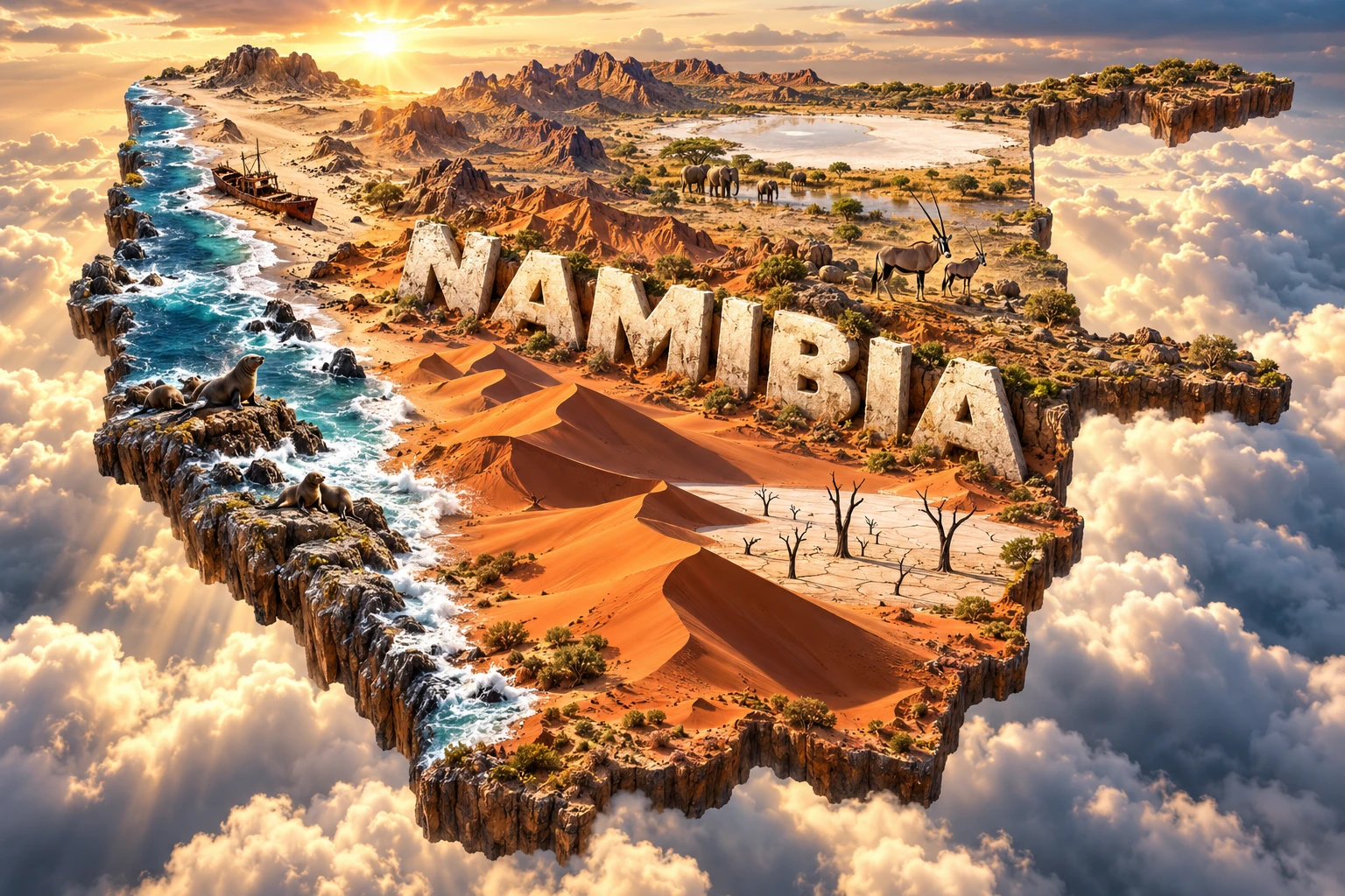
The Namibia artwork combines Sossusvlei dunes, Deadvlei-style trees, the Skeleton Coast, desert mountains, Etosha Pan, oryx, elephants and seals. Red dunes represent wind-transported sand in the Namib Sand Sea. The pale pan and dead trees refer to an old floodplain cut off by moving dunes, while the foggy shore evokes the cold Benguela Current.
Etosha symbolizes an inland salt basin and seasonal wildlife habitat. Oryx represent arid-zone adaptation; elephants refer to particular populations in Etosha and western or northeastern landscapes; seals belong to selected Atlantic colonies. These species do not all occupy the same habitat.
The image is a conceptual artistic composition. The landmarks, wildlife and landscapes are combined for educational visualization and are not shown at their true geographic positions or scale. The floating outline, monumental lettering, clouds and lighting are artistic devices rather than cartographic information.
12. Interesting Facts About Namibia
- Namibia's 2023 census counted 3,022,401 people across an area of about 825,000 square kilometres.
- The country takes its name from the Namib, often described as one of Earth's oldest continuously arid deserts.
- The Namib Sand Sea is the only extensive coastal dune field on the World Heritage List whose ecology is strongly influenced by fog.
- Much Namib dune sand reached the Atlantic through rivers, moved north with coastal currents and was blown inland by wind.
- Deadvlei's dead trees remain standing because intense aridity greatly slows decomposition; they are not petrified.
- Namibia's major perennial rivers occur along its borders rather than crossing the dry central interior.
- Etosha Pan is normally dry but can hold shallow water after strong seasonal rains.
- Desert-adapted elephants are behaviorally adapted African savanna elephants, not a separate species.
- The cold Benguela Current helps produce coastal fog and supports a productive marine food web.
- Namibia was the first African country to include environmental protection principles in its national constitution at independence.
- English is the official language, but it is not the first language of most residents.
- The Namibian dollar is pegged one-to-one with the South African rand, which is also accepted as legal tender.
- Twyfelfontein's rock art records hunter-gatherer knowledge and ritual practices over at least two millennia.
- The Zambezi Region is much wetter than the Namib coast and contains floodplains and river woodland.
- Namibia gained independence in 1990, making it one of Africa's more recently independent states.
13. Short Quiz
-
Which current helps make Namibia's coast unusually dry and foggy? A. Gulf Stream B. Benguela Current C. Kuroshio Current D. Agulhas Return Current
-
What is Etosha? A. An active volcano B. A shallow salt pan and closed basin C. A permanent freshwater lake D. A coral reef
-
How did much of the Namib Sand Sea's sediment reach the dunes? A. Only from meteorites B. Through rivers, coastal currents and wind C. From recent lava flows D. From glacial ice alone
-
Where are Namibia's major perennial rivers located? A. Mostly along its borders B. Only beneath the capital C. Down the center of the Namib D. There are none anywhere
-
What is the status of the country artwork? A. A surveyed habitat map B. A conceptual artistic composition C. A satellite photograph D. A mining map
Answer key: 1-B, 2-B, 3-B, 4-A, 5-B.
14. Related Learning
- Angola Explained: Plateaus, Rivers and Atlantic Coast — follow the Namib environment northward.
- Botswana Explained: Kalahari, Okavango and Wildlife — compare shared drylands and river systems.
- South Africa Explained: Coasts, Plateaus and Biodiversity — follow the Orange River and Benguela ecosystem.
- Zambia Explained: Plateaus, Rivers and Victoria Falls — continue through the Zambezi basin.
- How the Benguela Current Creates Coastal Fog — connect cold water, stable air and desert ecology.
- Where the Namib Desert's Sand Came From — trace sediment from rivers to dunes.
- How Etosha Pan Became a Salt Basin — examine drainage change and evaporation.
- How Fog-Basking Beetles Collect Water — explore desert adaptation.
- Why Deadvlei's Trees Do Not Rot Quickly — connect aridity with decomposition.
- Twyfelfontein Rock Art and San Environmental Knowledge — interpret heritage respectfully.
15. Sources
- Namibia Statistics Agency, 2023 Population and Housing Census
- Namibia Statistics Agency, census main-report media statement
- UNESCO World Heritage Centre, Namib Sand Sea
- UNESCO World Heritage Centre, Twyfelfontein or /Ui-/aes
- Namibia Ministry of Environment, Forestry and Tourism, geography, climate and biodiversity assessment
- Namibia Ministry of Environment, Forestry and Tourism, Etosha National Park
- Namibia Ministry of Environment, Forestry and Tourism, Skeleton Coast Park
- Namibia Ministry of Environment, Forestry and Tourism, wildlife and national parks
- Namibia national wildlife-protection report 2024
- World Bank, Namibia overview