

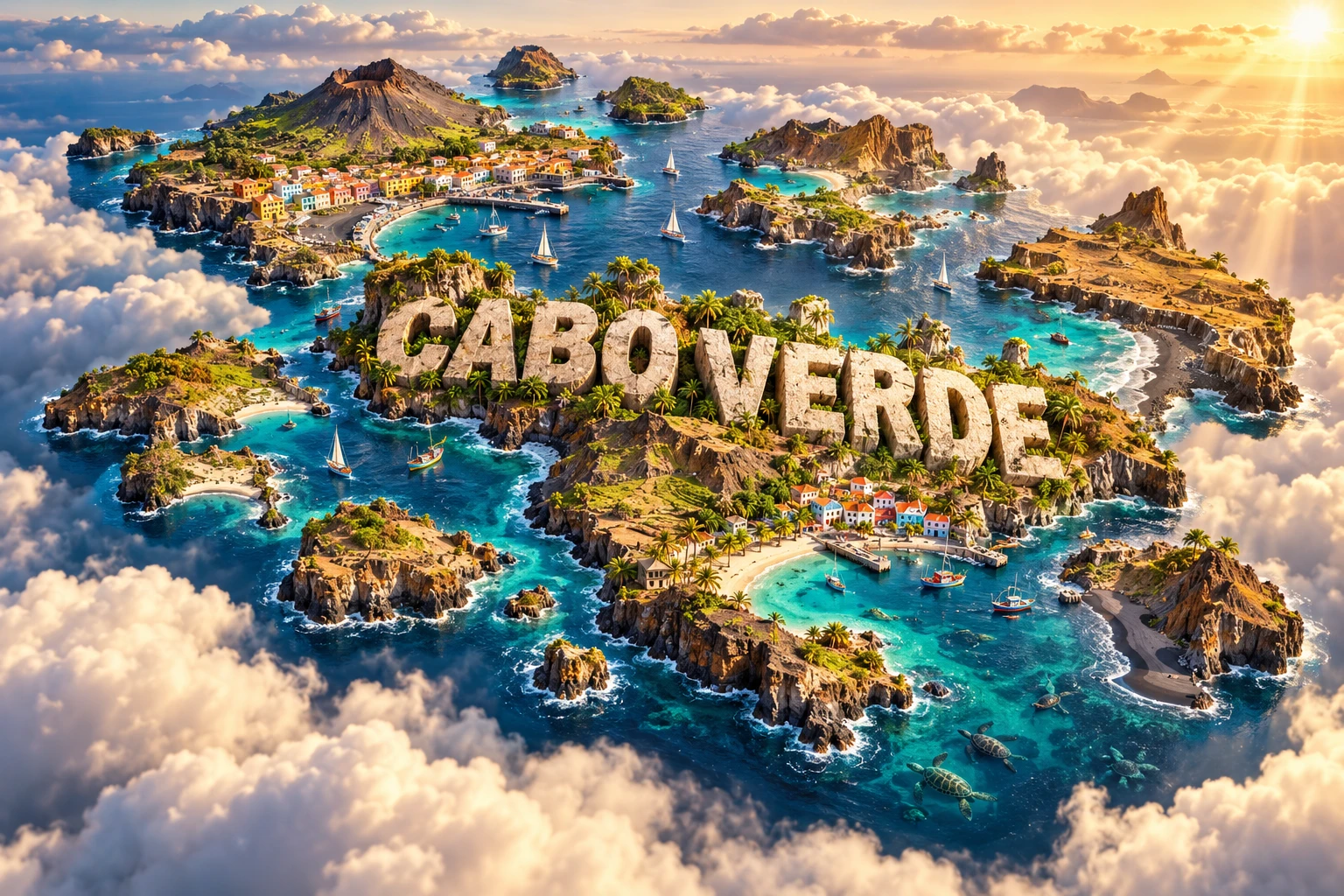
Cabo Verde is a ten-island Atlantic country built by volcanoes off the coast of West Africa. Some islands have steep peaks, deep valleys and black lava, while older eastern islands are lower, flatter and edged by pale beaches. Its tropical latitude might suggest lushness, yet cool ocean water, persistent trade winds and unreliable rain make much of the archipelago dry.
Island separation has also shaped culture, transport and wildlife. Cabo Verdean society developed through African and European encounters, including the violence of Atlantic slavery, and today extends through a global diaspora.
1. Where Is Cabo Verde?
Cabo Verde lies in the eastern North Atlantic, roughly 570 kilometers west of Senegal's Cabo Verde Peninsula. It is part of Macaronesia, an Atlantic island region that also includes the Azores, Madeira and Canary Islands. The country has no land borders.
The archipelago has ten main islands, nine of them inhabited, plus smaller islets. They are traditionally divided into the northern Barlavento, or windward, group and southern Sotavento, or leeward, group. The names describe broad exposure to prevailing trade winds rather than identical weather on every island.
Praia, on Santiago, is the capital and largest city. Mindelo on São Vicente is a major port and cultural center. Other important towns include Assomada, Espargos, Santa Maria, São Filipe, Porto Novo and Ribeira Grande.
2. Quick Country Facts
- Official name: Republic of Cabo Verde
- Capital: Praia
- Region: Atlantic Ocean; politically and historically part of West Africa
- Area: Approximately 4,033 square kilometers
- Population: Approximately 514,000 in Cabo Verde's official 2025 projection
- Currency: Cabo Verde escudo (CVE), pegged to the euro
- Official language: Portuguese
- Widely spoken language: Cabo Verdean Creole, or Kriolu, with island varieties
- Time zone: Cabo Verde Time (UTC−1) throughout the year
- Highest point: Pico do Fogo, 2,829 meters
- Island groups: Barlavento and Sotavento
- Climate: Tropical dry to semi-arid, with strong island and elevation differences
The resident population is smaller than the worldwide Cabo Verdean diaspora. Population estimates vary by source because migration is an important part of national life.
3. Geography and Landscape
The western islands—Santo Antão, São Vicente, São Nicolau, Fogo and Brava—are generally mountainous and deeply eroded. Santo Antão contains spectacular valleys and high ridges, with greener northeastern slopes and much drier rain-shadow terrain. São Vicente is drier and has a broad natural harbor at Porto Grande.
Fogo is dominated by a large volcanic edifice. Pico do Fogo rises from within the older Chã das Caldeiras depression. Lava flows from the 2014–2015 eruption buried buildings, roads and farmland inside the caldera but did not cover the entire island.
Santiago, the largest island, combines rugged interior highlands, plateaus, river valleys and coastal plains. It contains Praia and Cidade Velha. Nearby Maio is much lower and drier.
Sal and Boa Vista in the east are older, flatter and heavily eroded, with extensive beaches, dunes, salt flats and windblown sediment. Santa Luzia is uninhabited and forms part of an important protected island-and-islet system.
Cabo Verde has no permanent large rivers. Short, steep channels called ribeiras may remain dry for long periods and then flood rapidly during intense rain. Groundwater, reservoirs and desalination are therefore critical.
4. Why Does Cabo Verde Look Like This?
The islands are volcanic peaks rising from deep oceanic crust. Magma reached the surface as the African Plate moved over a long-lived zone of mantle melting commonly described as the Cabo Verde hotspot. Eruptions accumulated layers of lava and ash until islands emerged above sea level.
Hotspot volcanism does not produce a perfectly straight age sequence here. Magma has reached different parts of the archipelago over millions of years, and faulting, landslides and erosion complicate each island's history. Fogo remains active, while the eastern islands have been exposed to erosion for much longer.
Rain cuts valleys into volcanic rock, waves carve cliffs, and gravity can collapse unstable slopes. On old, low islands, prolonged erosion removed much original relief. Wind then transported sand derived partly from marine material and Saharan dust, contributing to beaches and dunes.
Black-sand beaches form where waves break down dark basaltic lava. Pale beaches contain more shell, coral-algal and other carbonate fragments. Cabo Verde therefore has both, but not every island or shore has black sand.
The islands alter airflow. Moist air forced up a windward slope cools and may form cloud or rain, while descending air dries on the leeward side. This orographic effect creates sharp local contrasts even in an overall dry archipelago.
5. Climate
Cabo Verde has warm temperatures year-round, moderated by the Atlantic Ocean. Northeastern trade winds are frequent, especially during the cooler part of the year, and exposed islands can be very windy.
Rain is concentrated mainly from August to October, when tropical weather systems occasionally reach the islands. The season is short and extremely variable: some years bring useful rain, while others bring severe drought. A single storm can cause dangerous flash floods in normally dry channels.
The cool Canary Current and stable subtropical air suppress evaporation and cloud growth over the surrounding ocean. The archipelago also lies near the dry Sahel, and harmattan flow can carry Saharan dust westward. These factors help explain why tropical Cabo Verde is semi-arid rather than rainforest-covered.
High mountains capture more moisture than low eastern islands. Cloud and fog can add water to exposed uplands on Santo Antão, São Nicolau, Santiago, Fogo and Brava. Rain shadows remain much drier.
Climate change raises risks from heat, drought, intense rainfall, sea-level rise, coastal erosion and marine warming. Water security is especially important because the country has little dependable surface freshwater.
6. Wildlife and Ecosystems
Isolation allowed distinctive plants, reptiles, insects and birds to evolve. Native terrestrial ecosystems include dry shrubland, rocky uplands, seasonal grassland and humid mountain pockets. Agriculture and introduced species have transformed much original vegetation.
Endemic birds include the Raso lark, restricted naturally to small islands or islets in the Santa Luzia complex, and the Cabo Verde warbler, found on only some islands. The threatened Fea's petrel, often called the Cabo Verde petrel, nests in high terrain and feeds at sea.
Cabo Verde supports one of the world's most important loggerhead sea-turtle nesting populations. Nesting is concentrated on suitable sandy beaches, especially Boa Vista, Sal and Maio, rather than every coastline. Green, hawksbill, leatherback and olive ridley turtles also occur in its waters, though in different numbers and life stages.
Marine ecosystems support whales, dolphins, sharks, rays, seabirds and commercially important fish. Humpback whales use the region seasonally. Rocky reefs and seagrass or sandy habitats vary among islands.
Threats include invasive species, nest poaching, bycatch, coastal construction, plastic pollution, overfishing, drought and climate change. Protected areas around Santa Luzia, Raso and Branco are particularly important for endemic land and seabird species.
7. Famous Landmarks and Natural Features
Pico do Fogo and Chã das Caldeiras reveal active volcanism and human adaptation. Communities cultivate grapes and other crops in volcanic soils despite eruption risk. The most recent eruption began in November 2014 and ended in February 2015.
Cidade Velha, formerly Ribeira Grande, was founded on Santiago in the late fifteenth century. It became an early European colonial town in the tropics and a major node in Atlantic trade and enslavement. Its churches, fortress, streets and pillory require interpretation that centers the people subjected to slavery, not only maritime expansion.
Santo Antão's valleys, including Paúl and Ribeira Grande, show how erosion and orographic moisture create steep cultivated landscapes. Terraces support sugarcane, bananas, coffee and other crops where water permits.
Mindelo and Porto Grande grew around a sheltered harbor on São Vicente. The city's music, port history and colorful architecture differ from Praia and rural island settlements.
Pedra de Lume on Sal contains salt pans within an old volcanic crater connected historically to salt extraction. It is on Cabo Verde's World Heritage Tentative List, not the inscribed list.
The beaches of Boa Vista, Sal and Maio are important turtle habitat as well as centers of tourism. Their ecological role requires light, construction and visitor management.
8. People, Languages and Culture
Cabo Verdean society developed after Portuguese settlement brought Europeans and enslaved Africans to previously uninhabited islands beginning in the fifteenth century. African and European languages, beliefs, foods and music interacted under unequal colonial conditions to form distinctive Creole cultures.
Portuguese is the official language and is used in formal education and government. Kriolu is the main language of daily life for most people. Its varieties differ among islands in pronunciation, vocabulary and grammar, and debates continue over standardization and official recognition.
Cabo Verde remained under Portuguese colonial rule until independence in 1975. A one-party system initially governed the country; multiparty democracy began in 1991. Migration to Senegal, Portugal, the Netherlands, the United States and elsewhere created extensive family and cultural networks.
Morna combines voice, poetry and instruments in a musical tradition associated with themes such as love, departure and longing. UNESCO inscribed morna as intangible cultural heritage in 2019. Cesária Évora brought international attention to the style, but the tradition extends far beyond one performer.
Other forms include coladeira, funaná and batuque, each with particular histories, rhythms and island or community associations. Sodade expresses separation and longing but should not be used as a stereotype for every Cabo Verdean experience.
9. Food
Cachupa is a slow-cooked dish based on maize and beans, with vegetables, fish or meat depending on household and occasion. There is no single definitive recipe. Leftover cachupa may be fried for breakfast.
Fresh and dried fish are important, including tuna and small pelagic species. Pastel com diabo dentro is a fried pastry commonly filled with spicy tuna. Seafood availability differs among islands and seasons.
Maize, beans, cassava, sweet potatoes and bananas are grown where water and soils permit. Goat meat and cheese are associated with several dry islands. Fogo produces wine, while sugarcane supports grogue, a distilled spirit with deep social and economic roots.
Drought and limited farmland mean Cabo Verde imports much of its food. Celebrated dishes coexist with continuing vulnerability to global prices and transport disruption.
10. Economy and Major Industries
Services dominate Cabo Verde's economy. Tourism is especially important on Sal and Boa Vista and supports accommodation, restaurants, transport and construction. Concentration in a few islands and dependence on overseas visitors create vulnerability to external shocks.
Transport and logistics are essential because people and goods must move among separated islands. Unreliable or costly inter-island connections limit domestic supply chains and access to jobs and services.
Fishing, fish processing, agriculture, construction, commerce, communications and public services also matter. Farming is constrained by drought and small land area, while remittances from the diaspora support many households and foreign-exchange earnings.
The World Bank reported real GDP growth of 6.3 percent in 2025, driven largely by record tourism, consumption and improved fiscal performance. It also emphasized high public debt, state-enterprise risks and weak inter-island connectivity. These current figures may be revised.
Renewable energy, digital services, sustainable fisheries, creative industries and tourism diversification offer opportunities. Water production, imported fuel and food, coastal exposure and unequal island development remain structural challenges.
11. What the 3D Visual Represents
The Cabo Verde artwork combines steep volcanic islands, black-sand beaches, turquoise Atlantic water, Mindelo-inspired colorful buildings, dry mountain valleys, fishing boats and sea turtles. Embedded “CABO VERDE” lettering merges features from separate islands into one floating micro-world.
Fogo contains the active volcano; Mindelo is on São Vicente; the largest pale beach systems and most intensive tourism occur on flatter eastern islands. Black sand belongs to particular volcanic shores, while major loggerhead nesting is concentrated on suitable sandy beaches.
The image is a conceptual artistic composition. The landmarks, wildlife and landscapes are combined for educational visualization and are not shown at their true geographic positions or scale. Cabo Verde is an archipelago, so no single continuous landmass represents its real geography.
12. Interesting Facts About Cabo Verde
- Cabo Verde consists of ten main volcanic islands, nine inhabited.
- It lies roughly 570 kilometers west of Senegal.
- Pico do Fogo is the highest point at 2,829 meters.
- Fogo last erupted from November 2014 to February 2015.
- Older eastern islands are generally lower and flatter.
- Trade winds and the cool Canary Current help keep the climate dry.
- Rain falls mainly during a short, unreliable late-summer season.
- The country has no permanent large rivers.
- Cabo Verde hosts globally important loggerhead turtle nesting.
- The Raso lark is naturally restricted to a tiny island environment.
- Cidade Velha is Cabo Verde's only inscribed World Heritage property.
- The islands were uninhabited before permanent Portuguese settlement.
- Cabo Verde became independent in 1975.
- Morna joined UNESCO's intangible heritage list in 2019.
- A large Cabo Verdean diaspora lives abroad.
13. Short Quiz
-
What created the Cabo Verde islands? A. Volcanic activity B. Coral growth alone C. River sediment D. Continental glaciers
-
Which island contains Pico do Fogo? A. Sal B. Fogo C. Boa Vista D. Maio
-
Why is Cabo Verde relatively dry despite its tropical latitude? A. Trade winds, stable air and a cool ocean current suppress rain B. It is inside the Arctic Circle C. Mountains block every cloud from the west D. It has no surrounding ocean
-
What is Cidade Velha historically associated with? A. Early Atlantic colonial trade and enslavement B. Viking settlement C. Inca agriculture D. Himalayan pilgrimage
-
How should the 3D artwork be interpreted? A. As one continuous real island B. As an exact satellite map C. As a conceptual combination of separate-island features D. As a turtle census
Answer key: 1-A, 2-B, 3-A, 4-A, 5-C.
14. Related Learning
Suggested internal-link topics:
- Senegal Explained: Sahel, Coast, Rivers and Culture
- Canary Islands: How Hotspot Volcanoes Build Ocean Islands
- Why Cabo Verde Is So Dry Despite Being Tropical
- How Fogo's 2014–2015 Eruption Changed Chã das Caldeiras
- Why Older Cabo Verde Islands Are Flatter
- How Trade Winds Create Rain Shadows on Santo Antão
- Why Loggerhead Turtles Nest in Cabo Verde
- How Cidade Velha Connected Africa, Europe and the Americas
- How Morna Music Expresses Island and Diaspora History
- Why Inter-Island Transport Matters to Archipelago Economies
15. Sources
- Cabo Verde National Statistics Institute — Population projections 2010–2040
- World Bank — Cabo Verde Economic Update 2026
- World Bank Data — Cabo Verde
- Smithsonian Global Volcanism Program — Fogo
- UNESCO — Cidade Velha
- UNESCO World Heritage Centre — Cabo Verde
- UNESCO Intangible Cultural Heritage — Morna
- IUCN — State of West African marine and coastal environment
- Encyclopaedia Britannica — Cabo Verde