

The Marshall Islands is a Pacific nation of coral atolls spread across an ocean area thousands of times larger than its land. Reefs, lagoons and narrow islets shape almost every aspect of life—from food and freshwater to navigation, settlement and climate risk.
These islands also carry a globally important history. Marshallese navigators developed sophisticated ways to read waves and currents, while twentieth-century nuclear testing displaced communities and left long-lasting health, environmental and political consequences. Both living ocean knowledge and that difficult legacy are essential to understanding the country.
1. Where Are the Marshall Islands?
The Republic of the Marshall Islands, often abbreviated RMI, lies in the north-central Pacific Ocean. It is part of Micronesia and sits roughly between Hawaii and Papua New Guinea, north of Nauru and Kiribati and east of the Federated States of Micronesia.
The country has no land borders. Its 29 atolls and five low coral islands are scattered across an exclusive economic zone of roughly 2 million square kilometers, while their combined dry land is only about 181 square kilometers.
The islands form two roughly parallel chains. Ratak, meaning “sunrise,” lies to the east; Ralik, meaning “sunset,” lies to the west. These are geographic and cultural groupings, not two continuous islands.
Majuro Atoll is the capital and main urban center. Its closely connected eastern islets contain government offices, businesses and the international airport. Ebeye, on Kwajalein Atoll, is another densely populated urban community. Many outer atolls have far smaller populations and limited transport links.
2. Quick Country Facts
- Official name: Republic of the Marshall Islands
- Capital: Majuro
- Region: Micronesia, north-central Pacific Ocean
- Land area: approximately 181 square kilometers
- Ocean jurisdiction: approximately 2 million square kilometers
- Population: 42,418 counted in the 2021 census; World Bank modeled estimate of 36,282 for 2025
- Currency: United States dollar (USD)
- Official languages: Marshallese and English
- Time zone: Marshall Islands Time, UTC+12
- Island groups: Ratak and Ralik chains
- Atolls and coral islands: 29 atolls and five separate low coral islands
- Highest natural ground: only about 10 meters above sea level; exact point varies by source and shifting landforms
- World Heritage properties: one—Bikini Atoll Nuclear Test Site
Population totals differ because the country has substantial migration and because projections use methods unlike a direct census. Dating the figures makes the difference transparent.
3. Geography and Landscape
Most Marshallese atolls are rings or broken rings of reef surrounding lagoons. Small islets sit on the reef rim, separated by channels through which ocean water moves. The lagoon may occupy almost the entire interior; at Majuro, NOAA mapping found that the lagoon comprised nearly 80 percent of the mapped atoll ecosystem.
The country's hundreds of islets—often summarized as more than 1,200—are built mainly from coral sand, gravel, shells and reef rubble. They are narrow, porous and usually only a few meters above sea level. There are no mountains, permanent rivers or large natural freshwater lakes.
Kwajalein is one of the world's largest atolls by lagoon area. Majuro combines a long, narrow urbanized strip with lagoon and ocean shores. Enewetak and Bikini lie in the drier northwestern Ralik Chain, while Jaluit and Mili are wetter southern atolls.
Beaches and islet shapes are dynamic. Waves and currents move sediment around reef rims, and large wave events can erode one shore while depositing material elsewhere. Causeways, seawalls, dredging and buildings interrupt these processes in developed areas.
Fresh water forms a thin freshwater lens when rain filters into porous island sediment and floats above denser seawater. Rain tanks are also crucial. Drought, overuse, pollution and saltwater flooding can rapidly reduce safe supplies.
4. Why Do the Marshall Islands Look Like This?
The atolls began with volcanoes created over hotspots tens of millions of years ago. As the Pacific Plate moved, volcanic islands traveled away from their heat source, eroded and slowly subsided. Reef-building corals grew in sunlit water around their shores.
If reef growth keeps pace while an island sinks, a fringing reef can become a barrier reef and finally an atoll after the volcanic summit disappears below the sea. The present reefs may be enormously thick above their buried volcanic foundations.
The dry islets are much younger than the underlying reef structures. Waves, storms and currents piled coral debris and sand onto reef flats, perhaps especially as sea level stabilized over recent millennia. Wind, plants and human land use then helped hold some sediment in place.
Coral polyps do not directly build palm-covered land. They and other calcifying organisms create reef limestone; parrotfish, waves and biological erosion break material into sediment; ocean processes then construct and reshape islets.
This history explains why reef health matters physically as well as biologically. Living reefs can produce sediment and reduce wave energy. Yet reefs stressed by extreme heat, acidification, pollution or physical damage may struggle to keep growing, and even healthy islands remain exposed to flooding.
5. Climate
The Marshall Islands has a warm tropical oceanic climate. Temperatures vary little through the year, while rainfall changes more by location and season. Southern atolls are generally wetter than the northern atolls.
Majuro usually has a wetter period from roughly May through November and a relatively drier period early in the year. Trade winds influence waves and weather, while tropical storms can bring damaging seas even when their centers remain distant.
The El Niño–Southern Oscillation strongly affects rainfall. El Niño can bring severe drought, especially to the dry north. In 1998–1999, exceptionally low rainfall exhausted water supplies and required emergency desalination.
Sea-level rise increases high-tide flooding, erosion, wave overtopping and salinization of freshwater lenses and crops. Marine heatwaves can bleach coral. It is inaccurate to say every island will vanish on one fixed date: reef growth, sediment movement, emissions, storm patterns and adaptation differ between atolls. The risks to habitability and infrastructure are nevertheless profound.
Adaptation includes rainwater storage, coastal protection, raised buildings, improved drainage, land-use planning and—in some places—consideration of raising or reclaiming land. No single engineering measure can replace healthy reefs or eliminate every risk.
6. Wildlife and Ecosystems
Coral reefs, lagoons and open ocean dominate Marshallese biodiversity. Reef flats, patch reefs, lagoon pinnacles, seagrass, sandy bottoms, mangroves and deep outer slopes support different communities.
Hard corals create habitat for reef fish, giant clams, sea cucumbers, crustaceans and mollusks. Green and hawksbill turtles occur in Marshallese waters and use suitable beaches and reefs. Sharks, manta rays, dolphins and tuna range through parts of the country's large marine territory, but none occurs uniformly at every atoll.
Seabirds—including terns, noddies, boobies and frigatebirds—nest on less disturbed islets. Northern atolls such as Bikar and Bokak contain important rookeries and relatively intact marine ecosystems. In 2024, the government established national marine sanctuaries for these remote atolls.
Terrestrial biodiversity is naturally less extensive than marine biodiversity because the islands are small and isolated. Coconut, pandanus, breadfruit and native coastal plants provide food, fiber, shade and shoreline stability. Introduced rats and invasive plants threaten nesting birds and native vegetation.
Reefs face bleaching, ocean acidification, crown-of-thorns starfish, pollution, waste, dredging and fishing pressure. Local protected areas and traditional management practices can conserve spawning grounds and allow communities to manage resources, but conditions vary greatly among atolls.
7. Famous Landmarks and Natural Features
Bikini Atoll Nuclear Test Site is the country's only World Heritage property. The United States displaced Bikini's people before conducting 23 nuclear tests there from 1946 to 1958. Wrecked target ships, bunkers and the enormous Castle Bravo crater provide physical evidence of the nuclear age. Bikini remains constrained by radioactive contamination and is not an ordinary inhabited destination.
Across Bikini and Enewetak, the United States conducted 67 atmospheric and underwater nuclear tests. Castle Bravo at Bikini in 1954 was far more powerful than predicted; fallout exposed residents of Rongelap and Utrik and Japanese fishers aboard the Daigo Fukuryū Maru. Communities continue to experience displacement, health concerns and disputes over compensation and cleanup.
On Enewetak's Runit Island, a concrete structure known as the Runit Dome covers debris placed in a nuclear-test crater. It is a hazardous-waste legacy, not a celebratory landmark, and should be discussed with respect for affected communities.
Kwajalein Atoll has an immense lagoon and important Marshallese communities. The United States operates missile-testing and space-tracking facilities on islands leased under bilateral arrangements. Many Marshallese workers live on crowded Ebeye, highlighting unequal access to land and infrastructure within the atoll.
Majuro Lagoon is the geographic and economic center of the capital. The Alele Museum and Public Library preserves artifacts, photographs and knowledge related to navigation, weaving and history. Likiep Atoll contains historic buildings associated with nineteenth-century copra trade, while Mili has reefs, bird habitat and wartime remains.
8. People, Languages and Culture
Marshallese people call their country Aelōñ Kein Ad, often translated as “our islands.” Marshallese is an Austronesian language with two principal dialect areas associated broadly with the Ratak and Ralik chains. English is also official and is used in government and education.
Land and lagoon rights are central to identity and social organization. Marshallese society is traditionally matrilineal: land rights generally pass through the mother's line, although chiefs, lineage heads and workers have distinct responsibilities and authority. Modern law, migration and urbanization interact with these customary systems.
Marshallese navigators learned to read ocean swells, currents, stars, winds and the way islands disrupt waves. Stick charts made from coconut midribs and shells modeled relationships among swells and atolls. They were teaching and memory tools, not handheld maps read like modern nautical charts during a voyage.
Outrigger canoes were engineered for speed and inter-island travel. Contemporary canoe-building and racing programs help transmit skills, while motorboats and aircraft now handle much transport. Fine pandanus mats, baskets, fans and clothing demonstrate complex weaving knowledge.
Christianity is widespread and churches play major community roles, but belief and practice vary. Shared meals, funerals, first-birthday celebrations and Manit Day connect families, land and history. Contemporary music, sports, education and diaspora life are as much part of culture as heritage crafts.
Spain claimed the islands, Germany administered them from 1885, and Japan governed under a League of Nations mandate after the First World War. The United States took control during the Second World War and later administered the islands within the UN Trust Territory of the Pacific Islands. The republic became self-governing in free association with the United States in 1986 and joined the United Nations in 1991.
The Compact of Free Association provides economic assistance, defense arrangements and rights for Marshallese citizens to live and work in the United States, subject to its terms. This has helped create significant communities abroad while contributing to population decline at home.
9. Food
Traditional foods reflect the limits and strengths of atoll agriculture. Breadfruit, pandanus fruit, coconut, taro and arrowroot grow in suitable soils or prepared pits, while fish and shellfish provide protein.
Bwiro is preserved breadfruit paste, traditionally fermented, wrapped and cooked; it helped communities store food between harvests. Jāãnkun and other preserved pandanus preparations also extended seasonal supplies. Coconut appears as flesh, milk, sap and oil.
Tuna, reef fish and other seafood may be grilled, boiled, dried or eaten in varied preparations. Rice, flour, canned meat, sweetened drinks and other imported foods are now common. Dependence on imports and dietary change have contributed to high rates of noncommunicable disease.
10. Economy and Major Industries
The economy combines government services, external assistance, fishing-related revenue, retail, construction, transport and small-scale production. The public sector is a major employer, while geographic isolation and dispersed islands make infrastructure and services expensive.
The ocean is the country's largest economic asset. Fees paid by foreign tuna fleets for access to Marshallese waters provide important public revenue. Majuro also supports tuna transshipment and processing. Sustainable regional management matters because tuna migrate across many national jurisdictions.
Coconuts produce copra, the dried kernel used for oil, and remain a source of cash on outer islands. Small agriculture, handicrafts and tourism contribute at more limited scales. The country imports most fuel, manufactured goods and many foods.
United States grants and programs under the Compact of Free Association are economically significant. Kwajalein's U.S. facility provides lease income and employment, while the shipping registry administered internationally is another source of revenue.
The World Bank estimated GDP growth of 2.3 percent in 2025, but a 2026 energy-price shock was expected to slow growth and raise import costs. Long-term challenges include outmigration, limited private-sector opportunities, high transport costs, energy dependence, public health and financing climate adaptation.
11. What the 3D Visual Represents
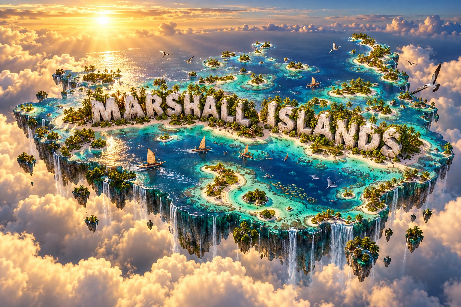
The Marshall Islands artwork combines ring-shaped coral atolls, luminous lagoons, palm-lined islets, reefs, outrigger canoes, tropical fish and seabirds. Large white “MARSHALL ISLANDS” letters identify the country.
Atolls symbolize the slow interaction of subsiding volcanoes and upward-growing reefs. Palms and pandanus evoke planted and native coastal vegetation, while canoes represent sophisticated Marshallese navigation and boatbuilding. Fish and seabirds refer to different reef, ocean and rookery habitats.
The visual compresses widely scattered atolls into one recognizable scene. In reality, the land does not form a single national outline, and individual atolls are separated by large ocean distances.
The image is a conceptual artistic composition. The atolls, lagoons, wildlife, vegetation and canoes are combined for educational visualization and are not shown at their true geographic positions or scale. It is an illustrative floating micro-world, not a satellite map.
12. Interesting Facts About the Marshall Islands
- The country contains 29 coral atolls and five separate low coral islands.
- Its land area is only about 181 square kilometers within roughly 2 million square kilometers of ocean jurisdiction.
- Ratak means “sunrise,” and Ralik means “sunset.”
- The 2021 census counted 42,418 residents.
- Most dry islets are much younger than the ancient reefs beneath them.
- Buried volcanic foundations lie below the coral atolls.
- Rain forms fragile freshwater lenses above seawater in porous island sediment.
- Marshallese stick charts represented wave patterns and relationships between islands.
- Land rights traditionally pass through matrilineal lines.
- Bikini is the country's only World Heritage property.
- The United States conducted 23 nuclear tests at Bikini and 44 at Enewetak.
- Kwajalein contains one of the world's largest atoll lagoons.
- Tuna-access fees and U.S. Compact funding are important to the economy.
- Marshallese and English are official languages.
- The republic joined the United Nations in 1991.
13. Short Quiz
-
What lies beneath the Marshall Islands' coral atolls? A. Submerged volcanic foundations B. Continental glaciers C. River deltas D. Young granite mountains
-
What do Ratak and Ralik mean? A. Sunrise and sunset B. North and south C. Reef and lagoon D. Wind and rain
-
What did traditional stick charts represent? A. Wave patterns and island relationships B. Street addresses C. Mountain elevations D. Written laws
-
Why is Bikini Atoll globally significant? A. It preserves evidence and consequences of nuclear testing B. It contains an active volcano C. It is the capital D. It has the country's only river
-
What is a freshwater lens? A. Rainwater floating above denser saltwater in island sediment B. A glass telescope C. A deep volcanic lake D. Frozen seawater
Answer key: 1-A, 2-A, 3-A, 4-A, 5-A
14. Related Learning
Suggested internal-link opportunities:
- Micronesia Explained: Islands, Reefs and Ocean Culture
- Kiribati Explained: Atolls, Equator and Climate
- Nauru Explained: Raised Coral Island and Phosphate History
- How Coral Atolls Form Above Submerged Volcanoes
- How Marshallese Navigators Read Ocean Swells
- What Traditional Marshallese Stick Charts Represent
- How Nuclear Testing Changed Bikini and Enewetak
- Why Low Atolls Have Freshwater Lenses
- How Tuna Connects Pacific Island Economies
- Can Coral Atolls Adapt to Rising Seas?
15. Sources
- Pacific Community — Marshall Islands 2021 Census Report , for the official census and population structure
- World Bank Data — Pacific Island States , for the 2025 modeled population estimate
- Marshall Islands Marine Resources Authority , for 29 atolls, five islands and the approximate ocean jurisdiction
- NOAA — How Coral Reefs Form , for atoll development above subsiding volcanic islands
- NOAA — Marshall Islands Coral Reef Ecosystems , for reef age, young islets, habitats and reef condition
- NOAA NCCOS — Majuro Benthic Habitat Mapping , for Majuro lagoon and reef-zone geography
- World Bank — Climate Risk Country Profile: Marshall Islands , for drought, freshwater lenses, sea-level rise and climate risk
- UNESCO World Heritage Centre — Marshall Islands , for World Heritage and tentative-list status
- UNESCO — Bikini Atoll Nuclear Test Site , for displacement, testing, contamination and surviving evidence
- Marshall Islands Marine Resources Authority — Resources , for fisheries governance and the Bikar and Bokak sanctuary framework
- World Bank — Marshall Islands Energy Crisis Support , for current energy, import-cost and growth context
- U.S. Department of State — U.S. Relations With the Marshall Islands , for free association, bilateral relations and migration rights
- Encyclopaedia Britannica — Marshall Islands , for stable geography, history, government and cultural background