

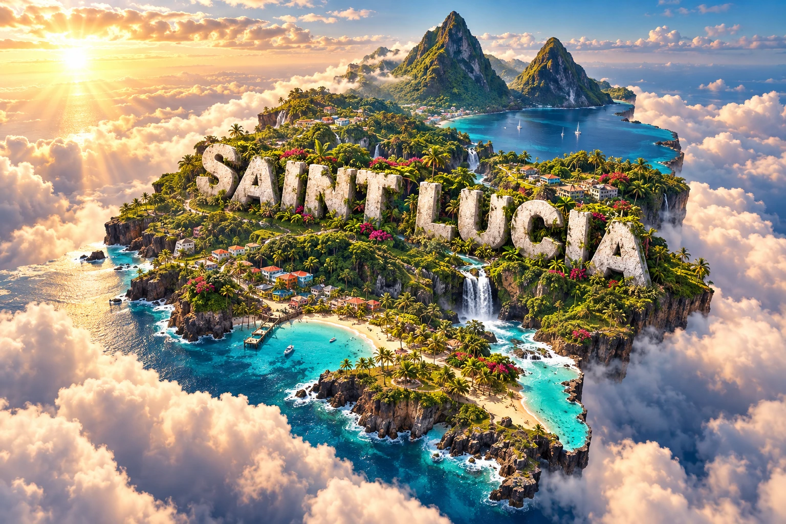
Saint Lucia is a mountainous Caribbean island shaped by volcanic eruptions, tropical rainfall and the sea. Its best-known landmarks, Gros Piton and Petit Piton, are steep lava domes rising beside the southwest coast—not matching twin volcano cones, as they are sometimes described.
The compact island contains wet highland forest, short rivers, geothermal springs, dry coastal woodland, coral reefs and busy towns. Geography shapes settlement, farming, water and natural hazards.
1. Where Is Saint Lucia?
Saint Lucia lies in the eastern Caribbean, within the Windward Islands of the Lesser Antilles. Martinique is to the north, Saint Vincent and the Grenadines to the south, and Barbados farther southeast. The Caribbean Sea borders its western coast, while the open Atlantic lies east.
The country consists of one main island and small offshore islets, including the Maria Islands. It has no land borders. Saint Lucia is approximately 43 kilometres long and 23 kilometres across at its widest, but its winding mountain roads make travel distances feel longer.
Castries, on a sheltered northwestern harbor, is the capital and main commercial center. Gros Islet and the Rodney Bay area form a large northern urban and tourism zone. Other important communities include Soufrière, Vieux Fort, Micoud, Dennery, Laborie, Choiseul and Anse La Raye.
Most large settlements occupy coastal plains and valleys because the central and southwestern interior is steep. Hewanorra International Airport lies near Vieux Fort in the flatter south, while George F. L. Charles Airport serves regional routes near Castries.
2. Quick Country Facts
- Official name: Saint Lucia
- Capital: Castries
- Region: Caribbean; Windward Islands of the Lesser Antilles
- Area: Approximately 617 square kilometres
- Population: 171,832 in the 2022 Population and Housing Census
- Currency: Eastern Caribbean dollar (XCD)
- Official language: English
- Widely spoken language: Saint Lucian Creole French, commonly called Kwéyòl
- Time zone: Atlantic Standard Time, UTC−4, with no seasonal clock change
- Highest point: Mount Gimie, approximately 950 metres
- Famous peaks: Gros Piton, 770 metres, and Petit Piton, 743 metres
- World Heritage: Pitons Management Area, inscribed in 2004
The 2022 population is a census count rather than a current estimate. Saint Lucia shares its currency and central bank with other members of the Eastern Caribbean Currency Union.
3. Geography and Landscape
Saint Lucia's interior is a chain of volcanic mountains cut by narrow valleys. Mount Gimie, in the central highlands, is the highest point. Rainforest covers many steep upper slopes, while rivers and ghauts radiate toward the coast. Their watersheds supply communities, farms and ecosystems.
The southwest contains the Soufrière Volcanic Centre. Gros Piton and Petit Piton rise beside the sea, linked inland by the Piton Mitan ridge. Behind them lies the broad Qualibou Depression, with lava domes, craters, ash deposits, hot springs and fumaroles. The town of Soufrière sits on the coast within this dramatic setting.
Northern Saint Lucia is generally lower and more developed. Castries occupies a harbor surrounded by hills, while Gros Islet and Rodney Bay have expanded across coastal lowlands. Pigeon Island is now joined to the mainland by an artificial causeway.
The southern area around Vieux Fort includes wider lowlands used for settlements, farming, transport and the international airport. The east coast faces Atlantic waves and trade winds, producing rugged headlands and energetic surf. The more sheltered Caribbean coast contains deep bays, beaches and steep underwater slopes.
Short rivers include the Roseau, Cul de Sac, Canelles and Mabouya. Heavy rain can make them rise rapidly, moving sediment and causing floods. Waterfalls form where streams descend resistant lava or cross abrupt changes in valley slope.
Coastal habitats include coral reefs, seagrass beds, mangroves, beaches, rocky shores and estuaries. Dark sand contains more volcanic minerals; pale sand contains more coral, shell and other carbonate fragments.
4. Why Does Saint Lucia Look Like This?
Saint Lucia belongs to the Lesser Antilles volcanic arc. East of the islands, Atlantic oceanic crust on the North American Plate descends beneath the Caribbean Plate. Water released from this sinking slab promotes melting in the mantle. Rising magma has built a curved chain of volcanic islands.
The island records several million years of eruptions. Lava, ash, pyroclastic flows and volcanic debris accumulated into mountains. Rain, landslides and rivers then eroded these deposits, producing deep valleys and isolated ridges. Older northern rocks have generally been weathered and eroded longer than the younger southwestern volcanic landscape.
The Pitons are remnants of large lava domes formed roughly 200,000–300,000 years ago. Viscous magma piled up near vents instead of flowing far, creating steep masses. Later erosion exposed their striking forms. They are related parts of a volcanic complex, not symmetrical cones created in one identical eruption.
The curved Qualibou Depression formed largely through a massive gravitational collapse of volcanic terrain rather than a simple explosive caldera event. Within it, the Sulphur Springs geothermal field releases steam and sulfur-rich gases, and hot water reaches the surface. This heat comes from the active volcanic system below.
There is no securely dated recent magmatic eruption, although a steam-driven event was reported in 1766. Young domes, shallow earthquake swarms and vigorous geothermal activity show that the Soufrière Volcanic Centre is potentially active. Monitoring focuses on earthquakes, ground conditions, gas and hot-spring chemistry.
Waves erode cliffs and redistribute volcanic and coral sediment. Reef organisms build limestone structures in suitable warm, shallow water, helping neighboring beaches develop different colors.
5. Climate
Saint Lucia has a tropical marine climate moderated by northeast trade winds. Coastal temperatures remain warm throughout the year, while high elevations are cooler. Humidity is generally high, although sea breezes and altitude change how heat feels locally.
Rainfall is usually greatest from roughly June through November and lower from about December through May. These are broad patterns rather than guaranteed seasons. Drought can occur during a normally dry period, and wet-season rainfall can vary sharply between years.
Mountains force moisture-laden air upward. Cooling air condenses into clouds and orographic rain, making the central highlands much wetter than some coastal lowlands. This supports rainforest and streams but also increases landslide and erosion risks on disturbed slopes.
The Atlantic hurricane season runs from June to November. Tropical storms and hurricanes can bring intense rain, damaging winds, waves and storm surge even without a direct landfall. Hurricane Tomas in 2010 demonstrated how slope failures and floods can severely affect roads, farms, water systems and communities.
Climate change increases risks from sea-level rise, coastal flooding, extreme heat, irregular rainfall and marine heatwaves. Warmer, more acidic seas stress coral reefs. Because tourism facilities, settlements, roads and farms occupy exposed coasts and valleys, forested watersheds, resilient buildings and protected shore ecosystems are important defenses.
6. Wildlife and Ecosystems
Elevation and rainfall create a sequence from dry coastal woodland through moist forest to rainforest and small areas of cloud-influenced elfin woodland. Native forests intercept rain, stabilize slopes, store carbon and release water gradually into streams. They are infrastructure as well as wildlife habitat.
The Saint Lucia parrot, or jacquot, exists naturally only on this island. Once severely reduced by forest loss, hunting and trade, it recovered through habitat protection, law enforcement and public education. It remains restricted to suitable interior forest and should not be imagined across every district.
Other island endemics include the Saint Lucia black finch, oriole and pewee. The Saint Lucia racer survives only on tiny Maria Major and is among the world's rarest snakes. The Saint Lucia whiptail is also restricted mainly to the Maria Islands and managed translocation sites. Such narrow ranges make fire, invasive predators, storms and disease serious threats.
The Saint Lucia iguana is native to the northeastern coast and nearby areas, not the entire island. Introduced mongooses, rats, cats and other invasive animals prey on native wildlife. Habitat fragmentation and hybridization with non-native iguanas add pressure.
Marine ecosystems support parrotfish, groupers, conch, lobster, corals, sponges and sea turtles. Hawksbill and green turtles use coastal waters, while leatherbacks may nest on beaches. Whales and dolphins occur offshore, but sightings and species vary by season and location.
Coral reefs in the Pitons Management Area cover much of its marine zone, yet reefs face heat bleaching, disease, sediment, sewage, anchors and overfishing. Forest protection upstream and responsible coastal development directly affect water clarity and reef survival below.
7. Famous Landmarks and Natural Features
- Pitons Management Area is Saint Lucia's sole UNESCO World Heritage property. It combines Gros and Petit Piton, volcanic features, forest and a marine zone with reefs. UNESCO recognizes both its exceptional scenery and its record of subduction-related volcanism.
- Sulphur Springs is a geothermal field of fumaroles, hot ground and mineral-rich water within the Qualibou Depression. It is evidence of an active hydrothermal system, not an open river of lava.
- Mount Gimie is the country's highest mountain and part of the wet central forested highlands.
- Diamond Falls and Botanical Gardens combine a mineral-colored waterfall, geothermal waters, cultivated plants and estate history near Soufrière.
- Pigeon Island National Landmark preserves Indigenous, French and British historical layers as well as dry-forest and coastal habitat. Fortifications reflect European warfare for Caribbean control.
- Maria Islands Nature Reserve protects exceptionally restricted reptiles and nesting seabirds. Access is controlled because small-island ecosystems are easily disturbed.
- Castries Central Market and Cathedral Basilica represent different parts of the capital's social, commercial and architectural history.
- Fond Doux and other former estates can explain cocoa, sugar, slavery and post-emancipation agriculture when interpreted without romanticizing plantation exploitation.
Waterfalls such as Toraille are visually striking, but their flow changes with rainfall. “Colorful villages” describes an artistic impression; real communities contain varied architecture shaped by income, storms, building materials and history.
8. People, Languages and Culture
Most Saint Lucians are of African descent, reflecting forced migration under plantation slavery. The population also includes people of mixed, European, South Asian, Indigenous and other Caribbean backgrounds. Identity is shaped by island, family, district, language, religion and migration rather than one cultural image.
English is the official language. Kwéyòl, a French-lexifier Creole with African and Caribbean influences, is widely spoken and is central to storytelling, music, humor and public culture. It has its own consistent grammar; describing it as broken French or English is inaccurate.
Indigenous communities lived on the island long before European arrival, with Arawakan-speaking ancestors followed by Kalinago expansion and exchange. France and Britain repeatedly contested Saint Lucia from the seventeenth century. Britain secured control in 1814, but French language and cultural influence endured.
Plantation owners used enslaved African labor to produce sugar, coffee and other crops. Britain abolished slavery in 1834, followed by apprenticeship until 1838. Freedom did not end unequal landholding, low wages or colonial rule. Saint Lucia became independent on 22 February 1979 and remains a constitutional monarchy with a parliamentary system.
The Jounen Kwéyòl season celebrates Creole language, food, dress, music and community traditions. La Rose and La Marguerite are historic flower societies with distinct songs, ceremonies and organizational traditions. Their participants preserve cultural institutions, but they do not divide the whole population into two fixed groups.
Music includes folk forms, quadrille, drumming, calypso, soca, reggae, gospel and contemporary genres. Carnival combines masquerade, steelpan, calypso and changing creative practice. Madras-derived ceremonial dress appears at cultural events but is not everyday clothing for all Saint Lucians.
Economist Sir Arthur Lewis and poet-playwright Derek Walcott were born in Saint Lucia and received Nobel Prizes. Their work connects the island to global debates about development, colonialism, history, language and imagination.
9. Food
Saint Lucian cooking combines African, Indigenous, European and wider Caribbean traditions. Green fig and saltfish—boiled green bananas served with seasoned salted cod—is widely recognized as the national dish, though preparation differs among cooks.
Bouyon is a substantial soup or stew made in many versions with meat, provisions, dumplings and vegetables. Callaloo uses leafy greens in soups or side dishes. Accra are seasoned saltfish fritters, while bakes are fried or baked breads served with fish, cheese or other fillings.
Ground provisions include cassava, yam, dasheen and sweet potato. Plantain, breadfruit, pumpkin, beans, coconut and tropical fruits are common ingredients. Cocoa is processed into traditional cocoa sticks used in spiced cocoa tea, connecting food to the island's agricultural history.
Imports are central to modern diets because limited land and changing agricultural markets make the island dependent on trade.
10. Economy and Major Industries
Tourism is a leading source of employment, foreign exchange and business for hotels, restaurants, transport, recreation, retail and construction. Cruise tourism centers on Castries, while resorts and smaller accommodations operate around the coast. Heavy reliance on visitors creates vulnerability to recessions, pandemics, airline changes and hurricanes.
Bananas once dominated agricultural exports, but competition, storms and changing trade arrangements reduced the industry. Farmers now produce bananas, plantains, cocoa, coconuts, vegetables, roots, fruit, poultry and livestock for local and export markets. Steep land, drought, storms and high input costs remain constraints.
Manufacturing includes beverages, food processing, paper and cardboard products, apparel and other light industry. Construction, public services, finance, communications and education also contribute. Fisheries support coastal livelihoods and food security but depend on healthy marine habitats.
Saint Lucia uses the Eastern Caribbean dollar, issued by the Eastern Caribbean Central Bank and pegged to the U.S. dollar. As a small island economy, it imports much of its fuel, food, machinery and construction material, exposing prices to shipping costs and external shocks.
The country also operates a citizenship-by-investment program. Such revenue can support public finances, while transparent oversight, due diligence and avoiding overdependence are important. Current growth rates change quickly, so this guide focuses on the economy's durable structure rather than a short-lived ranking.
Future resilience depends on diversified skills and businesses, renewable energy, stronger infrastructure, sustainable agriculture and fisheries, and protection of watersheds and coasts. The World Bank identifies tourism dependence, public debt and climate hazards as continuing risks.
11. What the 3D Visual Represents
The Saint Lucia artwork combines the Pitons, rainforest, waterfalls, volcanic beaches, turquoise Caribbean water, tropical flowers and colorful villages. These elements symbolize the southwest volcanic complex, wet highlands, short mountain rivers, varied coasts, cultivated plants and island communities. The embedded “SAINT LUCIA” lettering is a design feature.
The elements are not located together exactly as shown. The Pitons stand on the southwest coast; Mount Gimie and extensive rainforest lie inland; waterfalls occupy particular watersheds; and dark volcanic beaches and pale carbonate-rich beaches occur in different bays. Turquoise water depends on depth, sediment, sunlight and weather.
The image is a conceptual artistic composition. The landmarks, wildlife and landscapes are combined for educational visualization and are not shown at their true geographic positions or scale. It is a floating micro-world illustration, not a satellite map, geological hazard map or architectural survey.
12. Interesting Facts About Saint Lucia
- Saint Lucia is one of the volcanic Windward Islands of the Lesser Antilles.
- Gros Piton and Petit Piton are steep lava domes rather than matching volcanic cones.
- The Pitons rise to 770 and 743 metres beside the sea.
- Mount Gimie, at about 950 metres, is higher than either Piton.
- Sulphur Springs reveals an active geothermal system beneath the southwest.
- The Qualibou Depression formed mainly through a vast volcanic-slope collapse.
- The 2022 census counted 171,832 residents.
- Kwéyòl is widely spoken alongside official English.
- The Saint Lucia parrot exists naturally nowhere else.
- The Saint Lucia racer survives only on tiny Maria Major.
- Mountain uplift makes the interior much wetter than some coastal districts.
- UNESCO inscribed the Pitons Management Area in 2004.
- Saint Lucia became independent in 1979.
- Arthur Lewis and Derek Walcott were Saint Lucian Nobel laureates.
- Some pale beaches receive coral fragments, while darker beaches contain more volcanic material.
13. Short Quiz
-
What are Gros Piton and Petit Piton geologically? A. Ancient lava domes B. Coral atolls C. Sand dunes D. Limestone sinkholes
-
Why is Saint Lucia part of a volcanic arc? A. Oceanic crust descends beneath the Caribbean Plate B. Trade winds melt the crust C. Coral reefs turn into magma D. Rivers build volcanoes
-
Which animal occurs naturally only in Saint Lucia's forests? A. Saint Lucia parrot B. African elephant C. Polar bear D. Kangaroo
-
Why is the central highland wetter than many coastal areas? A. Rising moist air produces orographic rainfall B. Beaches block every cloud C. Volcanoes create water from lava D. The coast has no atmosphere
-
What does the visual disclaimer mean? A. Features are combined symbolically rather than mapped at exact positions and scale B. Every waterfall stands beside the Pitons C. All beaches have volcanic sand D. Every village uses identical architecture
Answer key: 1-A, 2-A, 3-A, 4-A, 5-A
14. Related Learning
- Saint Vincent and the Grenadines Explained: Active volcanoes, islands and reefs
- Martinique Explained: Comparing neighboring Lesser Antilles volcanoes
- Barbados Explained: Why a nearby island is made mainly of coral limestone
- Dominica Explained: Rainforest, rivers and geothermal landscapes
- Why the Lesser Antilles Form a Volcanic Arc
- How the Pitons of Saint Lucia Formed
- Why Sulphur Springs Steams and Bubbles
- How Mountain Forests Supply Caribbean Islands with Water
- Why Saint Lucia Has Both Dark and Pale Beaches
- How Island Endemics Evolve—and Why They Are Vulnerable
15. Sources
- Saint Lucia Central Statistical Office, 2022 Census results
- Government of Saint Lucia, 2022 census findings
- Government of Saint Lucia, history and geography
- UNESCO, Pitons Management Area
- UNESCO, Saint Lucia World Heritage profile
- University of the West Indies Seismic Research Centre, Saint Lucia volcanic profile
- UN Framework Convention on Climate Change, Saint Lucia national documents
- Convention on Biological Diversity, Saint Lucia country profile
- Saint Lucia National Trust, protected heritage
- FAO, Saint Lucia country profile
- World Bank, Saint Lucia overview
- Eastern Caribbean Central Bank, statistics
- IUCN Red List, Saint Lucia species assessments
- BirdLife International, Saint Lucia endemic birds