

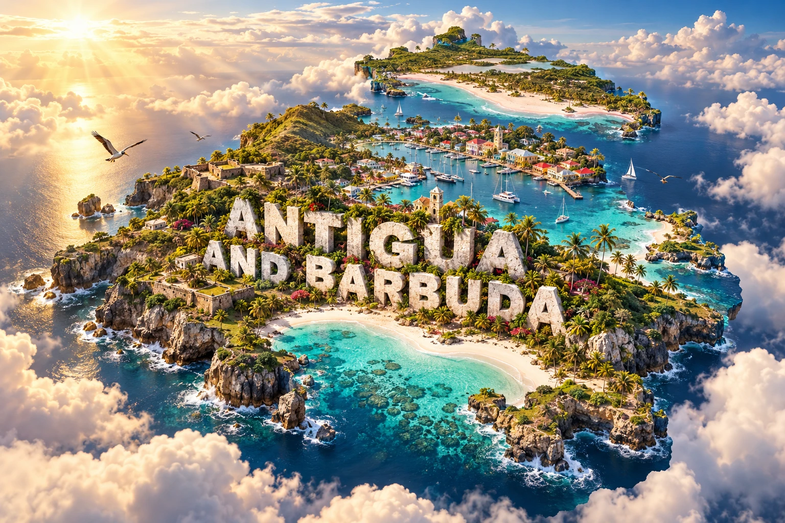
Antigua and Barbuda is a Caribbean island country whose three principal islands tell different geological stories. Antigua has old volcanic hills and younger limestone lowlands, Barbuda is a low carbonate island shaped by reefs and waves, and tiny uninhabited Redonda is a steep remnant of volcanic activity.
Those differences affect water, soil, wildlife and exposure to storms. Sheltered harbors helped make Antigua strategically important during the colonial age of sail, while Barbuda's Codrington Lagoon supports one of the Caribbean's best-known magnificent frigatebird colonies.
1. Where Is Antigua and Barbuda?
Antigua and Barbuda lies in the eastern Caribbean, within the Leeward Islands of the Lesser Antilles. It is east-southeast of Saint Kitts and Nevis, north of Guadeloupe and east of Montserrat. The islands stand near the meeting of the Caribbean Sea and the Atlantic Ocean.
The country consists of Antigua, Barbuda, Redonda and smaller offshore islets. Antigua is the largest and most populous island. Barbuda lies about 40 kilometers to its north, while rugged Redonda is roughly 50 kilometers southwest of Antigua and has no permanent settlement.
St. John's, on Antigua's northwest coast, is the capital and main port. Codrington is Barbuda's principal settlement. Ferries and aircraft connect the two inhabited islands; neither forms a single continuous landmass with the other.
2. Quick Country Facts
- Official name: Antigua and Barbuda
- Capital: St. John's
- Region: Caribbean; Leeward Islands of the Lesser Antilles
- Area: Approximately 442 square kilometers
- Population: Approximately 94,000 in the United Nations' 2025 estimate
- Currency: Eastern Caribbean dollar (XCD), fixed at EC$2.70 to US$1
- Official language: English; Antiguan and Barbudan Creole is widely spoken
- Time zone: Atlantic Standard Time (UTC−4) throughout the year
- Highest point: Boggy Peak, approximately 402 meters, on Antigua
- Main islands: Antigua, Barbuda and uninhabited Redonda
- Major wetland: Codrington Lagoon on Barbuda
- Government: Parliamentary democracy and constitutional monarchy
A new national census began in 2025 but had not produced final results when this guide was prepared. Population estimates therefore vary by model and reference date.
3. Geography and Landscape
Antigua covers about two-thirds of the country's land. Its southwest contains rounded volcanic hills, including Boggy Peak. A lower central plain and limestone terrain extend north and east. The irregular coast has many bays, headlands, beaches and sheltered natural harbors.
The island has no large permanent river. Rain drains through short seasonal channels, collects in reservoirs or seeps into limestone aquifers. Limited and variable rainfall makes freshwater scarcity a persistent issue, and desalination supplies much of the public water system during dry periods.
Barbuda is flatter and lower than Antigua. Limestone underlies much of the island, while beaches, dunes and sand ridges have been built and repeatedly rearranged by waves and currents. Codrington Lagoon occupies much of the western side and is separated from the sea by a narrow barrier beach whose openings can change during storms.
Redonda rises abruptly from the sea as a rocky volcanic island only about one square kilometer in area. Its cliffs provide nesting habitat for seabirds. Although it appears on national maps, it should not be depicted as a populated tropical beach island like Antigua or Barbuda.
Coral reefs, seagrass beds and mangroves surround parts of the islands. Reefs reduce some wave energy and create habitat for fish and invertebrates, while seagrass and mangroves serve as nursery grounds. These connected ecosystems are vulnerable to warming, pollution, sediment, disease, overfishing and coastal construction.
4. Why Do Antigua and Barbuda Look Like This?
The Lesser Antilles formed near a convergent plate boundary where Atlantic oceanic crust descends beneath the Caribbean Plate. Melting associated with this subduction built a volcanic island arc over millions of years. Antigua preserves rocks from an older phase of that arc, but it has no currently active volcano.
Antigua's southwest exposes basalt, andesite and volcanic debris from its earliest history. As volcanism waned, erosion supplied sediment to plains and shallow seas. Marine organisms later built carbonate skeletons that accumulated into limestone across the younger northern and eastern part of the island.
Barbuda exposes no volcanic rock at the surface. It consists mainly of limestone and younger sand and shell deposits. During the last ice age, sea level was lower and Antigua and Barbuda were geologically connected across a broad shallow platform. Rising seas separated them roughly 10,000 years ago.
Limestone dissolves slowly in mildly acidic rainwater, creating cavities and permeable ground. Water can therefore soak underground rather than form long surface streams. On small islands with limited catchments, this geology contributes to water scarcity and allows saltwater to enter aquifers if freshwater is overdrawn or sea level rises.
Waves and currents create beaches and barrier spits by moving sand, broken coral and shells. Hurricanes can rapidly breach, erode or rebuild these landforms. Reefs grow biologically, but they also erode and supply sediment; they are living systems rather than permanent stone walls.
The same plate boundary that generated the old volcanic arc still produces earthquakes in the eastern Caribbean. Antigua and Barbuda face seismic and tsunami hazards even though they have no active volcanic center.
5. Climate
Antigua and Barbuda has a warm tropical maritime climate moderated by northeast trade winds. Temperatures vary less across the year than in continental climates, though the hottest conditions commonly occur in late summer and early autumn.
The country is relatively dry compared with many mountainous Caribbean islands. Its 2025 National Adaptation Plan reports around 1,100 millimeters of annual rain over Antigua's lowlands, up to about 1,300 millimeters in the hilly southwest, and roughly 900 millimeters on Barbuda.
Rainfall is seasonal and highly variable. Approximately two-thirds falls from June through December, overlapping the Atlantic hurricane season. Drought can still occur during this period, and consecutive dry years place severe pressure on reservoirs, groundwater, agriculture and households.
Tropical storms and hurricanes bring destructive wind, surge, waves and intense rain. Hurricane Irma devastated Barbuda in 2017 and led to a complete temporary evacuation. That event illustrates exposure, but Barbuda's history and identity should not be reduced to one disaster.
Climate change is raising sea level and ocean temperature and increasing the risk from extreme heat, coral bleaching, coastal erosion, saltwater intrusion and intense tropical cyclones. Adaptation includes stronger buildings, protected wetlands, water storage, desalination, renewable energy and careful coastal planning.
6. Wildlife and Ecosystems
Codrington Lagoon includes mangroves, mudflats, seagrass, beaches and reef habitat. Its magnificent frigatebird colony is internationally important. The birds nest in low mangroves and feed at sea; they do not inhabit every beach or urban area in the country.
Hawksbill, green and leatherback sea turtles use surrounding waters, and females nest on selected beaches. Lobsters, conch and reef fish support fisheries but require habitat protection and sustainable harvest rules. Coral bleaching and disease can reduce the complex reef structure on which many species depend.
The Antiguan racer is one of the world's rarest snakes and survives on protected offshore islets after invasive predators caused its disappearance from Antigua itself. Conservation programs removed rats and mongooses from selected islands and expanded habitat, demonstrating how invasive species management can prevent extinction.
Redonda supports endemic ground and tree lizards and major seabird colonies. Introduced rats and feral goats severely damaged its vegetation. After rats were eradicated and goats relocated in 2017, plants, invertebrates, lizards and land birds recovered rapidly. The Redonda Ecosystem Reserve now protects the island and surrounding marine habitat.
Dry forest, scrub and seasonal wetlands occur on Antigua and Barbuda. Fallow deer were introduced to Barbuda centuries ago and are culturally significant, but they are not native wildlife. Likewise, palms in the artwork evoke tropical coasts without representing every natural plant community.
7. Famous Landmarks and Natural Features
The Antigua Naval Dockyard and Related Archaeological Sites, commonly called Nelson's Dockyard, is the country's UNESCO World Heritage property. English Harbour's deep water, narrow entrance and surrounding hills made it valuable to the British Royal Navy. Georgian buildings and fortifications survive within the cultural landscape.
The dockyard was constructed and operated through the labor and skills of generations of enslaved Africans. It protected British colonial power and the plantation economy, so its history must include those workers and the violence of slavery rather than celebrating naval architecture alone.
Shirley Heights overlooks English and Falmouth harbors from former military positions. The viewpoint helps explain why topography mattered to surveillance and defense. Betty's Hope, a former sugar plantation, preserves mill towers and archaeological remains that can be used to study plantation production and enslaved labor.
Devil's Bridge is a natural limestone arch on Antigua's Atlantic-facing coast. Waves exploit cracks and weaker rock, gradually enlarging openings. The site also carries painful oral traditions associated with enslaved people; interpretation should distinguish documented history from stories whose details are difficult to verify.
Codrington Lagoon National Park protects Barbuda's great wetland and frigatebird habitat. Its ecological importance also extends to fisheries and coastal protection. Princess Diana Beach and other Barbudan beaches are dynamic sand systems, not fixed boundaries immune to storms.
Redonda is important less as a conventional landmark than as an island-restoration case study. Removing invasive mammals allowed native vegetation and endemic animals to rebound, while protection now links land conservation with a large surrounding reef area.
8. People, Languages and Culture
Most citizens trace substantial ancestry to Africans brought through the transatlantic slave trade, alongside European, other Caribbean, Middle Eastern, Asian and mixed heritages. Antigua and Barbuda also has residents born elsewhere in the Caribbean and beyond. Identity differs between islands, families and generations.
English is the official language. Antiguan and Barbudan Creole developed through African and European language contact and is widely used in conversation, music and storytelling. It has systematic grammar and vocabulary and should not be described as “incorrect English.”
Indigenous peoples lived in the islands for thousands of years before Europeans arrived. Archaeology records Archaic Age communities and later ceramic-making societies connected across the Caribbean. Europeans applied broad labels such as Arawak and Carib, but those terms can oversimplify changing Indigenous identities and networks.
England established a colony on Antigua in 1632. Sugar plantations expanded through land seizure and enslaved African labor. The Codrington family leased Barbuda from the Crown for centuries. Britain emancipated enslaved people in 1834, but unequal access to land and wealth continued.
Antigua and Barbuda achieved independence on 1 November 1981. It remains a constitutional monarchy with an elected parliament and a prime minister as head of government. Barbuda has its own local council and distinct traditions of communal land use, which have been central to modern debates about development and recovery.
Carnival celebrates music, masquerade and community and is strongly linked with emancipation history. Calypso, soca, steelpan and the Antiguan folk form benna carry social commentary and dance traditions. Cricket is especially popular, and sailing reflects both working maritime history and modern sport.
9. Food
Fungee, often spelled fungi, is a cornmeal-and-okra staple served with pepperpot, a slow-cooked dish of vegetables and sometimes meat. Together they are widely treated as a national pairing, though recipes differ among cooks.
Ducana is a sweet dumpling commonly made from grated sweet potato, coconut and spices, wrapped and boiled. It may accompany saltfish. Goat water is a seasoned meat stew, while seafood dishes use lobster, conch and locally caught fish when available and legally harvested.
Antigua's small, sweet black pineapple has a strong local reputation. Food traditions also reflect wider Caribbean, African and European connections. Because the country imports much of its food, water security, transport costs and resilient local agriculture affect what households can obtain.
10. Economy and Major Industries
Tourism is the leading economic activity. Hotels, restaurants, cruise services, sailing and marinas, transport, retail and entertainment connect much of the service economy. The natural coast and heritage sites are therefore productive assets as well as places requiring protection.
Construction is closely tied to hotels, housing and infrastructure. Financial and professional services, communications, public administration and education also contribute. A citizenship-by-investment program provides government revenue but requires transparent oversight and changing international compliance standards.
The Eastern Caribbean dollar is issued by the Eastern Caribbean Central Bank and shared with several neighboring economies. Its fixed exchange rate provides monetary stability, while the country's small size and import dependence make it sensitive to fuel, food and construction prices.
Agriculture produces vegetables, fruit, livestock and specialty crops on a modest scale. Limited freshwater, shallow or degraded soils, labor costs, storms and competition for land constrain expansion. Fisheries—particularly lobster around Barbuda, conch and reef fish—support livelihoods and food supply.
The IMF estimated that the economy grew 4.3 percent in 2024, driven mainly by tourism and major events. Heavy dependence on visitors, construction and imported goods creates vulnerability to recessions, pandemics and disasters. Renewable energy, resilient infrastructure, fisheries management and broader skills can strengthen diversification.
11. What the 3D Visual Represents
The Antigua and Barbuda artwork combines Caribbean beaches, coral reefs, historic harbor architecture, rolling green hills, palm trees, sailing boats and tropical birds. Monumental “ANTIGUA AND BARBUDA” lettering and a single floating terrain compress several islands and marine settings into one composition.
The actual geography is discontinuous. Antigua contains the main hills and the historic dockyard; low Barbuda contains Codrington Lagoon and the frigatebird colony; Redonda is a steep, uninhabited volcanic island. Reefs, beaches and mangroves also occur in particular locations and differ in condition.
The image is a conceptual artistic composition. The landmarks, wildlife and landscapes are combined for educational visualization and are not shown at their true geographic positions or scale. It is not a satellite map, a nautical chart or an exact map of reefs and wildlife.
12. Interesting Facts About Antigua and Barbuda
- The country consists principally of Antigua, Barbuda and uninhabited Redonda.
- Antigua and Barbuda are separated by about 40 kilometers of sea.
- Boggy Peak on Antigua is the highest point at approximately 402 meters.
- Antigua combines old volcanic rocks with younger marine limestone.
- Barbuda consists mainly of limestone and younger beach and shell deposits.
- Lower ice-age sea level once connected Antigua and Barbuda across a shallow platform.
- The country has no large permanent river and relies heavily on desalination during dry conditions.
- Codrington Lagoon supports a major magnificent frigatebird nesting colony.
- The Antiguan racer survives on predator-managed offshore islands rather than mainland Antigua.
- Redonda's vegetation and endemic lizards rebounded after invasive rats and goats were removed.
- English Harbour's shape made it a protected naval anchorage during the age of sail.
- The naval dockyard depended on the labor and skills of enslaved Africans.
- The Eastern Caribbean dollar is shared with several neighboring states and territories.
- Antigua and Barbuda became independent in 1981.
- Coral reefs are living ecosystems that protect coasts while also producing sand through biological and physical breakdown.
13. Short Quiz
-
Which island contains the national capital, St. John's? A. Redonda B. Antigua C. Barbuda D. Guadeloupe
-
Why does Antigua have few permanent streams? A. Permeable limestone and limited rainfall reduce surface flow B. The island is permanently frozen C. All water flows to a continental river D. It receives no rain
-
What is Codrington Lagoon especially known for? A. A glacier colony B. Magnificent frigatebirds and coastal wetlands C. An active volcano D. A large freshwater waterfall
-
What helped shape the natural harbor at the UNESCO dockyard? A. Deep narrow bays enclosed by hills B. A desert dune field C. A continental ice sheet D. A modern concrete island
-
How should the 3D visual be interpreted? A. As an exact nautical chart B. As one continuous real island C. As a conceptual combination of separated features D. As a coral health survey
Answer key: 1-B, 2-A, 3-B, 4-A, 5-C.
14. Related Learning
Suggested internal-link topics:
- Saint Kitts and Nevis Explained: Volcanoes, Islands and Culture
- Dominica Explained: Volcanoes, Rainforest and Rivers
- Barbados Explained: Coral Limestone, Coasts and Culture
- How the Lesser Antilles Island Arc Formed
- How Coral Reefs Build and Protect Caribbean Coasts
- Why Antigua and Barbuda Faces Water Scarcity
- How Hurricanes Reshape Barrier Beaches
- How Redonda's Ecosystem Recovered
- Why Frigatebirds Nest at Codrington Lagoon
- How English Harbour Shaped Antigua's Colonial History
15. Sources
- United Nations Data — Antigua and Barbuda country profile
- Antigua and Barbuda National Bureau of Statistics — census information
- International Monetary Fund — 2025 Article IV Consultation
- World Bank — Organisation of Eastern Caribbean States overview
- UNESCO — Antigua Naval Dockyard and Related Archaeological Sites
- University of the West Indies Seismic Research Centre — Antigua and Barbuda geology and seismicity
- UNFCCC — Antigua and Barbuda National Adaptation Plan 2025
- Ramsar Sites Information Service — Codrington Lagoon
- Fauna & Flora — Redonda Restoration Programme
- Fauna & Flora — conservation in Antigua and Barbuda
- FAO — climate adaptation in Antigua and Barbuda's fisheries
- FAO — resilient water and agriculture initiatives