

Portugal occupies the Atlantic edge of the Iberian Peninsula and includes the volcanic archipelagos of Madeira and the Azores. Its geography ranges from rainy northern mountains and terraced river valleys to dry southern plains, limestone cliffs, oceanic islands and deep Atlantic waters.
The ocean moderates climate, supports fisheries and helped connect Portuguese ports to the world. It also brings coastal erosion, powerful waves and storm risk. Rivers shared with Spain supply farms, cities, wetlands and hydropower, making water management an international as well as national issue.
1. Where Is Portugal?
Portugal is in southwestern Europe. Continental Portugal occupies the western side of the Iberian Peninsula, with Spain along its northern and eastern land border and the Atlantic Ocean to the west and south. It has only one neighboring sovereign country.
The country includes two autonomous Atlantic regions. The Azores are nine volcanic islands roughly 1,400 kilometres west of the mainland. Madeira, including inhabited Madeira and Porto Santo, lies southwest of continental Portugal.
Lisbon, on the Tagus estuary, is the capital and largest metropolitan center. Porto stands near the mouth of the Douro in the northwest. Braga, Coimbra, Aveiro, Setúbal and Faro are other important mainland cities, while Funchal is Madeira's capital and Ponta Delgada is the largest city in the Azores.
Continental Portugal is elongated but narrow. Atlantic influence is widespread, yet mountains and distance from the coast produce strong regional differences.
2. Quick Country Facts
- Official name: Portuguese Republic
- Capital: Lisbon
- Region: Southwestern Europe; mainland and North Atlantic archipelagos
- Area: Approximately 92,226 square kilometres
- Population: 11,424,031 estimated residents on 31 December 2025
- Currency: Euro
- Official language: Portuguese; Mirandese has official recognition in its traditional area
- Time zones: Mainland and Madeira use UTC in winter and UTC+1 in summer; the Azores are one hour behind
- Highest point: Mount Pico, 2,351 metres, in the Azores
- Highest mainland point: Torre, 1,993 metres, in Serra da Estrela
- Major rivers: Tagus, Douro, Guadiana, Minho and Mondego
- Longest river entirely within Portugal: Mondego
- World Heritage: 17 UNESCO properties—16 cultural and one natural
INE's 2025 population estimate used integrated administrative data and a new “signs of residence” method. That methodological change means comparisons with earlier totals require care.
3. Geography and Landscape
The Tagus River divides mainland Portugal approximately into a hillier, wetter north and a generally lower, drier south, although local exceptions are numerous. North of the river, mountains and plateaus are cut by the Minho, Lima, Cávado, Douro, Vouga and Mondego systems. Granite villages, forest, vineyards and small farm plots occupy many slopes and valleys.
Serra da Estrela contains mainland Portugal's highest ground. Its upland plateaus, steep valleys, glacial landforms and headwater streams contrast with the coastal lowlands. To the northeast, Trás-os-Montes contains high plateaus and deeply incised river valleys, including sections of the Douro.
The Douro Valley is famous for vineyards built on steep slopes. Terraces reduce workable angles and help manage soil, but they are cultural landforms requiring constant maintenance. Downstream, the river reaches the Atlantic between Porto and Vila Nova de Gaia.
South of the Tagus, the Alentejo contains rolling plains, cork-oak and holm-oak woodlands, cereal country, reservoirs and historic towns. The Guadiana forms part of the Spanish border before turning through southeastern Portugal. Alqueva, created by a large dam, is a major reservoir rather than a natural lake.
The Algarve includes an upland interior and a varied southern coast. In the west and center, waves and groundwater erode limestone into cliffs, caves, arches and isolated sea stacks. The eastern Ria Formosa is a lagoon system protected by barrier islands and tidal flats.
Madeira rises steeply from the ocean, with deep valleys, sea cliffs and humid laurel forest. The Azores contain volcanic cones, calderas, crater lakes, lava fields and geothermal areas. Mount Pico is both Portugal's highest point and a young basaltic volcano.
4. Why Does Portugal Look Like This?
Mainland Portugal lies on old Iberian crust. Much of its interior contains granite and metamorphic rock deformed during Variscan mountain-building hundreds of millions of years ago. Erosion reduced those mountains, while later fault movement and rivers renewed parts of the relief.
As the Atlantic Ocean opened, crust stretched along western Iberia. Sedimentary basins accumulated layers that later became sandstone and limestone. In limestone regions, weakly acidic water dissolves rock along fractures, creating karst caves, sinkholes and underground drainage. Atlantic waves enlarge cracks at the Algarve coast until arches and stacks form; collapse and erosion continually rearrange the cliffs.
The Serra da Estrela landscape also records cold periods. Mountain glaciers carved U-shaped valleys, cirques and polished rock during the Pleistocene. Ice never covered all Portugal, but its local mountain effects remain visible.
Portugal's islands have different origins from its mainland. Madeira and the Azores are volcanic archipelagos formed above oceanic crust. The Azores lie near a complex meeting zone involving the North American, Eurasian and Nubian plates, the Mid-Atlantic Ridge and the Terceira Rift. Eruptions and earthquakes remain real hazards there.
Rivers carry eroded material toward the Atlantic and build floodplains and estuaries. At the coast, waves, tides and currents redistribute sand. Beaches and barrier islands move naturally, while dams reduce sediment delivery and buildings restrict shoreline adjustment, increasing management challenges.
5. Climate
Most mainland areas have a Mediterranean climate influenced by the Atlantic: rain is concentrated in the cooler part of the year, while summers are usually dry. Ocean influence makes the west coast milder than inland places at similar latitude.
Northern Portugal and high ground are cooler and wetter. Parts of the northwest receive abundant Atlantic rain, supporting green landscapes and dense river networks. Interior northeastern valleys experience hotter summers and colder winter nights because mountains reduce maritime influence.
The Alentejo and Algarve are generally warmer and drier, though the Algarve's coast is moderated by the sea. A small part of lower Alentejo meets a steppe-climate classification. Heat waves, drought and wildfire weather can affect large areas, especially when dry vegetation and strong winds combine.
Madeira has mild subtropical conditions shaped by elevation and exposure. Moist trade winds make many northern and upland slopes wetter than southern lowlands. Madeira's levadas—human-made water channels—help redistribute water across steep terrain.
The Azores have a humid oceanic climate with mild temperatures, frequent cloud and rapidly changing weather. Elevation and windward exposure create strong variation within individual islands. Atlantic storms can bring intense rain, high seas and damaging winds.
Climate change is increasing heat and drought risk, aggravating wildfire conditions and raising sea level. Water scarcity is particularly important in southern Portugal. Adaptation requires efficient irrigation, resilient forests, restored rivers and dunes, urban heat planning and cooperation with Spain across shared basins.
6. Wildlife and Ecosystems
Portugal spans Mediterranean, Atlantic and island ecosystems. Mainland habitats include oak woodland, mountain scrub, river forest, estuary, dune, lagoon and offshore water. The island groups add laurel forest, volcanic cliffs and oceanic breeding sites with many endemic plants and invertebrates.
The montado landscape of Alentejo combines cork oak or holm oak with grazing, crops and woodland habitat. It is a managed cultural ecosystem, not untouched forest. When managed carefully, its varied structure supports birds, insects and mammals while producing cork and livestock products.
The Iberian lynx was reintroduced to the Guadiana Valley after disappearing from Portugal. Monitoring recorded 291 individuals in Portugal in the 2023 Iberian census, but the population is concentrated rather than nationwide. Rabbits are its principal prey, and roads, disease, fire and habitat fragmentation remain concerns.
Iberian wolves persist mainly north of the Douro, with smaller and vulnerable populations in some areas south of it. Serra da Estrela streams support the rare Pyrenean desman and Lusitanian salamander. Estuaries such as the Tagus and Sado provide feeding grounds for migratory birds; Ria Formosa supports waterbirds, seagrass and nursery habitat for fish.
Madeira's UNESCO-listed laurisilva is a large surviving area of evergreen laurel forest from a vegetation type once more widespread around the region. Endemic birds include the Madeira firecrest and threatened Zino's petrel. The Azores support endemic birds such as the Azores bullfinch and internationally important seabird colonies.
Atlantic waters around Portugal host dolphins, whales, sharks, turtles and commercially important fish. The Sado estuary has a resident common-bottlenose dolphin community, but such animals should not be implied to inhabit every river or beach. Bycatch, ship traffic, underwater noise, warming and plastic pollution affect marine life.
7. Famous Landmarks and Natural Features
Portugal has 17 UNESCO World Heritage properties. They include places on the mainland, Madeira and the Azores:
- Historic Centre of Porto, Luiz I Bridge and Monastery of Serra do Pilar records two millennia of urban growth on steep slopes beside the Douro.
- Monastery of the Hieronymites and Tower of Belém stands at Lisbon's historic harbor entrance and represents royal maritime power. Its story should include the trade, conquest and enslavement that financed and accompanied overseas empire.
- Historic Centre of Évora preserves urban layers from Roman, medieval and later periods.
- Cultural Landscape of Sintra combines gardens, villas and palaces shaped by Romantic design and a humid mountain microclimate.
- Alto Douro Wine Region is a working cultural landscape where generations reshaped steep slopes for viticulture.
- University of Coimbra—Alta and Sofia documents the development of one of Europe's old universities and its relationship with the city.
- Convent of Christ in Tomar, Batalha, Alcobaça, Mafra, Guimarães, Elvas and Bom Jesus do Monte illustrate different religious, royal, military and civic histories.
- Laurisilva of Madeira, Portugal's only natural World Heritage property, protects native evergreen forest and ecological processes.
- Angra do Heroísmo and the Pico Island Vineyard Culture show how Azorean communities adapted settlement and farming to Atlantic islands.
Major natural features outside or beyond these inscriptions include Serra da Estrela, Peneda-Gerês, the Algarve cliffs, Ria Formosa, the Tagus and Sado estuaries, Madeira's peaks and the volcanic calderas of the Azores. Nazaré's huge waves result from Atlantic swell interacting with a deep submarine canyon, although wave height changes with conditions.
8. People, Languages and Culture
Portuguese is the official language and is spoken in many regional varieties. Mirandese, an Astur-Leonese language, has legal recognition in the Miranda do Douro area. Portuguese Sign Language is constitutionally protected as a means of cultural expression and education.
Portugal's population includes longstanding regional communities, Roma people, island identities, migrants and citizens with family connections across Europe, Africa, Asia and the Americas. Immigration from Brazil, Portuguese-speaking African countries, South Asia, Ukraine and elsewhere has shaped contemporary neighborhoods, workplaces, food and arts.
The kingdom of Portugal emerged in the twelfth century, and its continental borders became relatively stable early by European standards. From the fifteenth century, Portuguese navigators, merchants and armed expeditions created trading networks and an overseas empire. That history involved scientific and navigational exchange, but also conquest, forced labor, slavery, religious coercion and extraction across Africa, Asia and the Americas.
The 1755 Lisbon earthquake, tsunami and fires devastated the capital and influenced European debates about disaster and society. A republic replaced the monarchy in 1910. The authoritarian Estado Novo lasted from 1933 until the Carnation Revolution of 25 April 1974. Decolonization followed, and democratic institutions were consolidated. Portugal joined the European Economic Community, now the EU, in 1986.
Azulejos are glazed tiles used in religious, civic and domestic settings; they vary across centuries and are not simply blue-and-white decoration. Fado is associated especially with Lisbon and Coimbra, with distinct traditions in each. Cante Alentejano, northern percussion, island festivals, literature, film and contemporary music demonstrate cultural variety beyond these familiar symbols.
9. Food
Portuguese cuisines reflect coast, farming, preservation and global exchange. Bread, olive oil, beans, greens, seafood, pork and rice recur in many regions, while island and mainland traditions differ substantially.
Bacalhau dishes use salted, dried cod historically obtained from North Atlantic fisheries rather than Portuguese coastal waters. Caldo verde combines finely cut greens with potato and often sausage. Grilled sardines are seasonal and especially associated with summer festivities.
The Algarve's cataplana refers both to a hinged cooking vessel and dishes prepared in it, often with seafood. Alentejo cooking makes creative use of bread, herbs, pork and olive oil. Pastéis de nata are custard tarts, while Madeira is known for espetada and bolo do caco. Azorean foods include dairy products, seafood and the São Miguel stew cozido das Furnas, cooked with geothermal heat in designated places.
10. Economy and Major Industries
Services dominate Portugal's economy. Commerce, health, education, finance, public administration, transport, digital services and tourism employ large shares of the workforce. Lisbon and Porto host technology and business-service clusters, while smaller cities and islands have distinct economic structures.
Manufacturing includes vehicles and components, machinery, chemicals, pharmaceuticals, paper, ceramics, glass, textiles, clothing, footwear and food products. Portuguese firms are important cork processors because cork-oak landscapes supply a renewable bark harvested without cutting down healthy trees.
Agriculture produces wine, olives, fruit, vegetables, cereals and livestock. The Douro, Alentejo, Dão, Vinho Verde and island regions have different grape varieties and production systems. Irrigation supports output in dry areas but raises questions about river flow, reservoirs and drought resilience.
Fishing and aquaculture have economic and cultural importance, although catches require management because stocks and marine conditions change. Atlantic ports support shipping, logistics, ship repair and marine research. Portugal has expanded wind and solar power and also relies on hydropower, whose output varies with rainfall.
Tourism supports jobs and restoration but can increase housing pressure, seasonal employment, water use and congestion. Other challenges include population aging, regional disparities, productivity, wildfire and climate adaptation. The Azores and Madeira face added costs and opportunities associated with remoteness, aviation, maritime space and renewable energy.
11. What the 3D Visual Represents
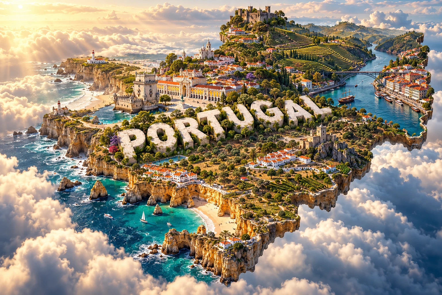
The Portugal artwork combines Lisbon-inspired tiled architecture, Porto's riverside, Douro vineyards, Algarve cliffs, Atlantic beaches, castles and fishing villages. Together they symbolize cities, maritime connections, cultivated river slopes, historic defenses and coastal livelihoods. The embedded “PORTUGAL” lettering is a graphic element.
These places are widely separated. Lisbon stands on the Tagus estuary; Porto and Douro vineyards are in the north; the best-known Algarve limestone cliffs lie along the south; and fishing settlements occur in several distinct coastal regions. The visual prompt emphasizes continental Portugal and does not adequately show the distant Azores and Madeira.
The image is a conceptual artistic composition. The landmarks, wildlife and landscapes are combined for educational visualization and are not shown at their true geographic positions or scale. It is an illustrative floating micro-world, not a satellite map, nautical chart or reconstruction of one real town.
12. Interesting Facts About Portugal
- Portugal includes continental territory and the autonomous archipelagos of the Azores and Madeira.
- Spain is Portugal's only land-border neighbor.
- INE estimated 11,424,031 residents at the end of 2025 using a revised administrative-data method.
- Mount Pico in the Azores is Portugal's highest point at 2,351 metres.
- Torre in Serra da Estrela is the highest point on the mainland at 1,993 metres.
- The Mondego is the longest river lying entirely within Portugal.
- The Tagus, Douro, Guadiana and Minho all cross or follow the border with Spain.
- Pleistocene glaciers carved valleys and cirques in Serra da Estrela.
- The Azores lie near a complex zone involving three major tectonic plates.
- Portugal has 17 UNESCO World Heritage properties, including one natural property.
- Madeira's laurisilva preserves an important surviving laurel-forest ecosystem.
- Iberian lynx have returned to the Guadiana Valley through conservation and reintroduction.
- Cork can be harvested repeatedly from mature cork oaks without felling healthy trees.
- Nazaré's submarine canyon helps focus exceptionally large breaking waves under suitable swell conditions.
- Mainland Portugal and Madeira use a different time zone from the Azores.
13. Short Quiz
-
What is Portugal's highest point? A. Torre on the mainland B. Mount Pico in the Azores C. Cabo da Roca D. Mount Etna
-
Why do parts of the Algarve have caves and sea arches? A. Water and waves dissolve and erode fractured limestone B. Glaciers cover the coast every winter C. Coral reefs built every cliff D. The Guadiana deposited lava
-
Which river is entirely within Portugal? A. Douro B. Tagus C. Mondego D. Minho
-
What is Portugal's only natural UNESCO World Heritage property? A. Laurisilva of Madeira B. Historic Centre of Porto C. Alto Douro Wine Region D. Tower of Belém
-
Why is the 3D visual not a literal map? A. It combines distant mainland places and underrepresents the islands B. Portugal has no Atlantic coast C. Lisbon and Porto are one city D. The Algarve lies in the Azores
Answer key: 1-B, 2-A, 3-C, 4-A, 5-A
14. Related Learning
- Spain Explained: Iberian mountains, shared rivers and Mediterranean climate
- Cabo Verde Explained: Atlantic islands and Portuguese colonial history
- Brazil Explained: Portuguese language, migration and Atlantic connections
- How Atlantic Rifting Shaped Portugal's Coast
- Why the Azores Have Volcanoes and Earthquakes
- How the Douro Valley Became a Terraced Landscape
- Why the Algarve Has Cliffs, Caves and Sea Stacks
- How Serra da Estrela Preserves Ice-Age Landforms
- How Cork-Oak Landscapes Support Nature and Farming
- Why Nazaré Produces Such Large Waves
15. Sources
- Statistics Portugal, 2025 resident population estimate
- Statistics Portugal, Iberian Peninsula in Figures
- Portuguese Institute for Sea and Atmosphere, climate classifications
- Portuguese Institute for Sea and Atmosphere, climate extremes
- LNEG, Portuguese geology and geological resources
- LNEG, geological maps of the Azores
- ICNF, Serra da Estrela Natural Park
- ICNF, Iberian lynx monitoring and conservation
- UNESCO, Portugal World Heritage profile
- UNESCO, Laurisilva of Madeira
- UNESCO, Historic Centre of Porto
- UNESCO, Alto Douro Wine Region
- European Environment Agency, Portugal climate adaptation profile
- World Bank, Portugal data