

Ghana is a West African country where the Gulf of Guinea coast, humid southern forests, the enormous Volta river basin and northern savannas meet. Much of the country is low or gently rolling, but climate and vegetation change strongly from the wet southwest to the drier north and southeast coast.
Rivers of the Black, White and Red Volta systems feed Lake Volta, a vast reservoir created by the Akosombo Dam. The coast connects fishing towns, lagoons, ports and forts linked to commerce and the transatlantic slave trade. Inland, cocoa farms, gold mining, cities and protected ecosystems reveal a country far more varied than one tropical image can show.
1. Where Is Ghana?
Ghana lies in West Africa on the Gulf of Guinea, part of the Atlantic Ocean. It borders Côte d'Ivoire to the west, Burkina Faso to the north and Togo to the east. Its southern coastline extends for roughly 550 kilometers.
Accra, the capital and largest metropolitan center, lies on the southeastern coast. Kumasi is the largest city of the interior and an important center of Asante history and commerce. Tamale anchors much of the north, while Tema is the principal industrial port.
Ghana lies only a few degrees north of the Equator, but no part of the country is crossed by it. The Prime Meridian passes through Tema, so Ghana spans both eastern and western longitudes while using Greenwich Mean Time throughout the year.
The country is coastal, not landlocked. Its ports and fishing communities connect it to the Atlantic, while north–south roads link coastal markets with the Sahel and neighboring states.
2. Quick Country Facts
- Official name: Republic of Ghana
- Capital: Accra
- Region: West Africa; Gulf of Guinea
- Area: approximately 238,533 square kilometers
- Population: approximately 33,742,380 in 2025, Ghana Statistical Service medium projection
- Currency: Ghana cedi (GHS)
- Official language: English
- Widely spoken Ghanaian languages: include Akan varieties such as Asante Twi and Fante, Ewe, Ga, Dangme, Dagbani and many others
- Time zone: Greenwich Mean Time, UTC+0 throughout the year
- Highest area: the Mount Afadja–Aduadu ridge in the Akwapim-Togo ranges, roughly 880–890 meters; published naming and elevation figures vary
- Largest river system: Volta
- Largest lake: Lake Volta, a human-made reservoir
- Independence: 6 March 1957, from Britain
Population estimates differ between institutions. The national projection based on Ghana's 2021 census is lower than the World Bank's 2025 international estimate, so the source and year are stated here.
3. Geography and Landscape
The broad Volta Basin occupies much of central and northern Ghana. Low plateaus and gently rolling plains surround rivers that eventually join Lake Volta. The Black Volta forms parts of the western border, the White Volta flows from Burkina Faso, and the Oti enters from the northeast.
Lake Volta stretches through the country's center. It is not a natural lake: filling began after the Volta River was dammed at Akosombo in the 1960s. Its many branching arms reflect flooded river valleys. The reservoir supports hydropower, transport and fisheries but also displaced tens of thousands of people and transformed river ecosystems.
The Akwapim-Togo ranges extend from southeastern Ghana into Togo. They contain Ghana's highest ground, including the Mount Afadja and Mount Aduadu area, and create waterfalls where streams descend resistant rock and steep slopes. Wli Falls lies near the Togo border in this hill country.
Southern Ghana includes several ecological belts. The southwest has the wettest climate and remnants of evergreen and semi-deciduous forest. Farther east, the coastal savanna around Accra is unexpectedly dry. Lagoons, beaches, estuaries and wetlands interrupt the coast.
Northern Ghana is mainly Guinea and Sudan savanna, with grasses, scattered trees and gallery forest along rivers. The transition between forest and savanna is gradual and affected by rainfall, soils, fire, farming and land use rather than being one sharp line.
Waves and eastward-moving currents carry coastal sand, while dams reduce some river sediment reaching the sea. Erosion is severe near Keta, and protective structures can shift problems farther alongshore.
4. Why Does Ghana Look Like This?
Most of Ghana sits on old continental crust belonging to the West African Craton and adjacent ancient rock belts. These rocks have been weathered and eroded for hundreds of millions of years, which helps explain why much of the modern landscape is low rather than mountainous.
The ancient Birimian volcanic and sedimentary rock belts later hosted gold-bearing mineral systems. This inheritance helps explain Ghana's mining industry, although ore deposits are localized.
The Volta Basin developed as sediments accumulated in a broad depression over older crust. Rivers cut into those sedimentary rocks and organized drainage toward the Volta. Building the Akosombo Dam then drowned valleys and converted a river network into the branching Lake Volta reservoir.
The Akwapim-Togo ranges are remnants of ancient mountain-building. Long erosion left resistant ridges and escarpments, with waterfalls where streams cross steep drops or harder rock.
Climate completes the landscape. Moist southwesterly monsoon winds bring rain, but totals are greatest in the southwest and lower in the north and southeastern coastal rain shadow. Forest develops where moisture is sufficient; long dry seasons and frequent fire favor savanna. Human cultivation, logging and burning have also changed the vegetation pattern substantially.
5. Climate
Ghana has a tropical climate governed by the seasonal movement of the West African monsoon and the boundary between moist maritime and dry continental air. Temperatures remain warm through the year, but rainfall and humidity vary by region and season.
Southern Ghana usually has two rainy seasons: a major season from roughly March to July and a shorter season from September into November. August often brings a relative “little dry season.” Northern Ghana has one main rainy season, generally from April or May to October.
The main dry season occurs from about December to February. Northeasterly harmattan winds can carry Saharan dust, lower humidity and reduce visibility. Northern areas are generally hottest before the rains, with temperatures sometimes reaching around 40°C.
The southwest receives the greatest annual rainfall, supporting humid forest. Accra and parts of the southeast coast are much drier because regional winds, currents and topography suppress rainfall relative to the southwest. “Tropical coast” therefore does not always mean rainforest.
Climate change is raising temperatures and sea level while increasing concern about rainfall variability, drought, floods and coastal erosion. These risks affect cocoa, food crops, cities, hydropower and fishing differently. Lake Volta inflows depend on rain across an international basin, not only weather inside Ghana.
6. Wildlife and Ecosystems
Ghana's ecosystems range from moist forest to savanna, wetlands and marine waters. Wildlife distribution follows those habitats. Elephants in northern savanna parks and small forest-elephant populations in the south are not interchangeable or widespread across the country.
Mole National Park, Ghana's largest wildlife refuge, protects Guinea savanna and riverine habitat. African savanna elephants, buffalo, kob, roan antelope, hartebeest, waterbuck, warthogs, baboons and many birds occur there. Large predators are much rarer and should not be promised as common sightings.
Kakum National Park and the adjoining Assin Attandanso Resource Reserve conserve moist evergreen forest. They support forest elephants, bongo, duikers, several primates, hornbills and hundreds of butterfly species. Dense vegetation makes mammals difficult to see; the canopy walkway represents forest structure more readily than wildlife abundance.
The endangered white-necked rockfowl nests at suitable rocky forest sites. Marine turtles use selected beaches, lagoons support migratory waterbirds, and dolphins and whales occur offshore by season and species.
Forest conversion, illegal logging, mining, hunting, wildfire, pollution and habitat fragmentation threaten biodiversity. Artisanal and small-scale gold mining, including illegal operations widely called galamsey, can remove vegetation and contaminate rivers with sediment and chemicals.
Wildlife corridors, community-managed areas, sustainable farms and cleaner rivers are also needed beyond park boundaries.
7. Famous Landmarks and Natural Features
The UNESCO property Forts and Castles, Volta, Greater Accra, Central and Western Regions contains coastal trading posts built and occupied by several European powers between 1482 and 1786. Cape Coast Castle and St George's Castle at Elmina are among the best known. These places document gold commerce, European-African contact, colonial power and the transatlantic slave trade; they should be interpreted as sites of difficult history, not picturesque scenery alone.
The Asante Traditional Buildings near Kumasi are Ghana's other World Heritage property. Their courtyard plans, earthen walls, timber, bamboo and symbolic relief decoration preserve evidence of Asante architectural and spiritual traditions. They are vulnerable to humidity, termites and shortages of traditional materials.
Lake Volta and Akosombo Dam represent one of Africa's most consequential twentieth-century engineering projects. Hydropower supported industry and electrification, but reservoir creation flooded land, displaced communities and changed disease and ecological conditions. Its educational value lies in these tradeoffs.
Kakum National Park protects southern forest and has a canopy walkway among tall trees. It represents one forest layer, not the whole southern landscape.
Mole National Park illustrates northern savanna shaped by seasonal water, fire and grazing, with gallery forest along waterways.
Wli Falls, near the Togo border, descends from the Akwapim-Togo highlands. The falls are usually described in upper and lower sections, and water volume changes with rainfall.
Nzulezu, a settlement built over Lake Tadane in western Ghana, is known for wooden structures and walkways above water. It remains a living community, not merely an attraction, and visitor descriptions should respect residents' privacy and authority.
8. People, Languages and Culture
Ghana is culturally and linguistically diverse. Akan peoples, including Asante and Fante communities, form the largest broad ethnolinguistic grouping, while Mole-Dagbani, Ewe, Ga-Dangme, Guan, Gurma and other communities have distinct histories. These categories contain internal diversity and do not determine every individual's identity.
English is the official language and the main language of national government and formal education. Akan varieties, Ewe, Ga, Dangme, Dagbani, Dagaare, Gonja, Kasem, Nzema and many other languages are used in homes, media, markets and local education. Multilingualism is common.
Christianity, Islam and Indigenous religious traditions all shape Ghanaian life, often alongside one another within extended families and communities. Festivals such as Homowo, Hogbetsotso, Aboakyir and Damba belong to particular peoples and places rather than every Ghanaian.
Kente is made by weaving narrow strips from silk, cotton or rayon and joining them into larger cloth. Asante and Ewe weaving traditions have different histories, designs and terminology. Colors and patterns can communicate proverbs, events or social meanings. UNESCO inscribed Ghana's kente craftsmanship on the Representative List of Intangible Cultural Heritage in 2024.
Music includes highlife, hiplife, gospel, traditional drumming, xylophone traditions, dance music and contemporary Afrobeats-related styles. Instruments and rhythms vary regionally. Adinkra symbols likewise have specific Asante origins and meanings even though they now circulate widely.
Precolonial Ghana contained many states and trading networks, including Asante, Fante, Dagbon and Gonja polities. The British colony was called the Gold Coast. Ghana gained independence under Kwame Nkrumah in 1957, the first sub-Saharan African colony to do so in the postwar wave. After several coups, constitutional multiparty government returned in 1992.
9. Food
Ghanaian food reflects ecological and cultural regions. Cassava, plantain, yam, maize, millet, sorghum, rice, beans, groundnuts, vegetables, fish and meat appear in different combinations.
Fufu is made by pounding cooked starchy foods such as cassava and plantain or yam and is eaten with soup. Banku and kenkey use fermented maize dough, often with cassava dough in banku, and are commonly paired with fish, pepper sauce or soup.
Waakye combines rice and beans, traditionally colored and flavored during cooking, and is served with varied accompaniments. Red red is a bean stew commonly eaten with fried plantain. Jollof rice is part of a wider West African food tradition and has many national and household versions; it does not belong exclusively to one country.
Coastal diets feature marine fish, while northern foods make greater use of millet, sorghum, groundnuts and dishes such as tuo zaafi. Urban food culture combines all these traditions and new influences.
10. Economy and Major Industries
Services are the largest economic sector. Trade, transport, information and communication, finance, education, health, government and hospitality are major activities.
Gold is Ghana's leading mineral export. Large mines and small-scale operations both produce it. Mining creates jobs and revenue but can also displace land uses, damage forests and pollute water when regulation or restoration fails.
Ghana is one of the world's major cocoa producers. Cocoa grows mainly in the forest zone and supports many smallholder households. Ageing trees, crop disease, changing rainfall, low farm incomes and deforestation challenge the sector. Cocoa agroforestry can retain shade trees, but outcomes depend on management and farmer rights.
Oil and natural gas are produced offshore. Manufacturing includes food and beverages, cement, textiles, metals, pharmaceuticals and petroleum-related processing. Tema and Takoradi are important ports and industrial areas.
Agriculture also produces cassava, yams, plantain, maize, rice, oil palm, fruit and livestock. Fisheries operate in the Atlantic, Lake Volta and rivers but face overfishing and environmental pressures.
The World Bank recorded real GDP growth of 6% in 2025, led by services and an agricultural recovery. Ghana was still working through debt restructuring and recovery from a severe macroeconomic crisis, so growth did not remove inflation, unemployment, debt or inequality concerns.
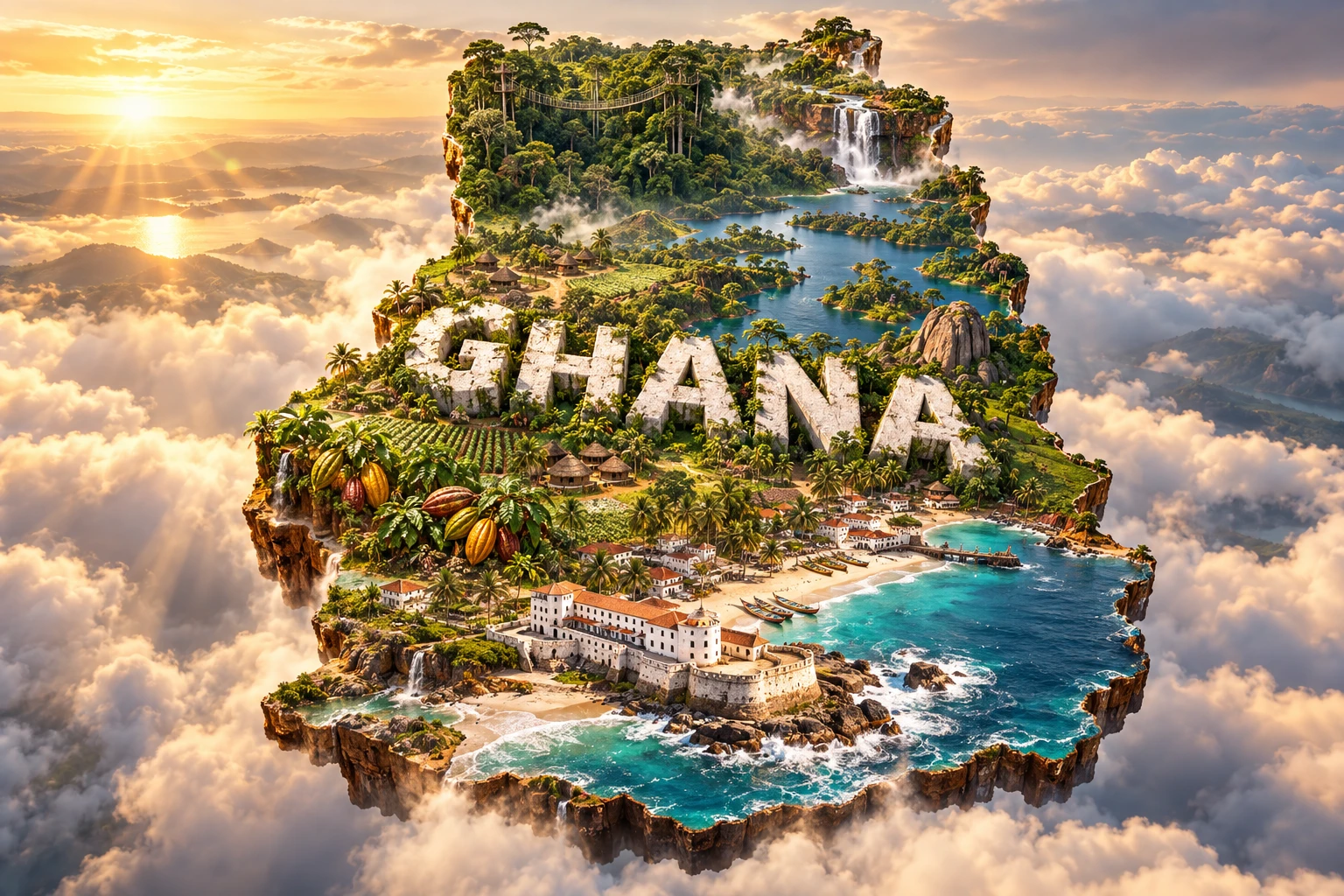
11. What the 3D Visual Represents
The Ghana artwork combines a Cape Coast-inspired fort, tropical coastline, Lake Volta, a Kakum-style rainforest canopy, cocoa farms, waterfalls and kente-inspired motifs. The fort evokes coastal sites connected to trade, enslavement and colonial history. Lake Volta represents the central reservoir and hydropower system, while forest and cocoa refer especially to southern ecological zones.
The waterfall suggests highland sites such as Wli rather than Ghana's generally low relief. Kente-inspired patterns reference particular Asante and Ewe weaving traditions, not a decorative design shared identically by every community. The artwork does not show northern savanna, dense cities, mining areas or the human costs of the reservoir and slave-trade sites.
The image is a conceptual artistic composition. The landmarks, crops, cultural motifs and landscapes are combined for educational visualization and are not shown at their true geographic positions or scale. It is not a satellite map, and Lake Volta is a human-made reservoir rather than a natural lake.
12. Interesting Facts About Ghana
- Ghana borders the Gulf of Guinea, but its wettest region is the southwest rather than the Accra coast.
- The Prime Meridian passes through Tema.
- The Volta basin drains most of the country.
- Lake Volta filled after completion of the Akosombo Dam in the 1960s.
- The branching shape of Lake Volta follows valleys flooded by the reservoir.
- Ghana has mostly low relief; its highest ridge is under 900 meters.
- Southern Ghana generally has two rainy seasons, while the north has one.
- Harmattan winds carry dry Saharan dust southward during part of the dry season.
- Mole protects savanna elephants, while Kakum holds a small forest-elephant population.
- The coastal forts were involved first in commodity trade and later centrally in the transatlantic slave trade.
- Asante Traditional Buildings use symbolic wall reliefs as well as earth, timber and other organic materials.
- Kente cloth is assembled from narrow woven strips and patterns can carry names and meanings.
- Cocoa grows mainly in humid and semi-humid southern zones, not across all Ghana.
- Ghana became independent in 1957 and adopted the name of a much earlier West African empire located farther northwest.
- Gold, cocoa and oil remain major exports, while services produce most economic output.
13. Short Quiz
-
What is Lake Volta? A. A glacial lake B. A reservoir created by damming the Volta River C. A saltwater lagoon D. A volcanic crater lake
-
Why is southwestern Ghana wetter than the Accra coast? A. Regional winds, ocean conditions and topography distribute rainfall unevenly B. Lake Volta creates every rainstorm C. Cocoa trees produce clouds D. Accra is north of the Sahara
-
Which ecosystem is mainly protected by Mole National Park? A. Alpine tundra B. Guinea savanna and riverine habitat C. Coral atolls D. Temperate rainforest
-
How is traditional kente constructed? A. Narrow woven strips are joined into larger cloth B. Stone is carved into fabric C. Palm leaves are used without weaving D. It is printed only by machines
-
What historical context is essential when discussing Ghana's coastal forts? A. Their role in trade and the transatlantic slave trade B. Their construction as modern airports C. Their use as volcanic observatories D. Their location beside Lake Volta
Answer key: 1-B, 2-A, 3-B, 4-A, 5-A
14. Related Learning
Suggested internal-link opportunities:
- Côte d'Ivoire Explained: Forests, Cocoa and Atlantic Geography
- Burkina Faso Explained: Sahel Climate and Inland Geography
- Togo Explained: A Narrow Country from Coast to Savanna
- How the Akosombo Dam Created Lake Volta
- Why Accra Is Drier Than Southwestern Ghana
- How Cocoa Grows in Ghana's Forest Zone
- How Kente Cloth Communicates Meaning
- Why Ghana's Coast Is Eroding
- How Gold Forms in Ghana's Birimian Rocks
- What Ghana's Coastal Forts Teach About the Slave Trade
15. Sources
- Ghana Statistical Service — Population projections 2021–2050 , for the 2025 national population projection
- World Bank — Ghana overview , for recent economic conditions and sector context
- World Bank Data — Ghana , for comparable demographic and economic indicators
- Ghana Meteorological Agency — Ghana Climate Atlas , for northern and southern rainfall patterns and temperatures
- Ghana Meteorological Agency — Climate change , for climate drivers, warming and sea-level risk
- Ghana Energy Commission — Integrated Power Sector Master Plan , for Lake Volta and hydropower context
- UNESCO World Heritage Centre — Forts and Castles , for coastal sites, trade and enslavement history
- UNESCO World Heritage Centre — Asante Traditional Buildings , for construction, symbolism and conservation
- UNESCO Intangible Cultural Heritage — Kente craftsmanship , for materials, techniques, meanings and 2024 inscription
- Forestry Commission of Ghana — Kakum National Park , for forest habitat and wildlife
- Forestry Commission of Ghana — Mole National Park , for savanna habitat and wildlife
- FAO — Ghana plant genetic resources report , for agro-ecological zones and major crops