

Grenada is a small Caribbean country built from volcanic islands at the southern end of the Lesser Antilles. Its largest island rises steeply from narrow coastal plains to a wet, forested interior, while the smaller islands of Carriacou and Petite Martinique are lower and drier. Those differences shape water supply, farming, ecosystems and community life.
Nutmeg and mace helped earn Grenada the name “Spice Isle,” but the country cannot be reduced to one crop. It includes crater lakes, short mountain rivers, mangroves, coral reefs, fishing and boatbuilding traditions, a service-based economy and communities rebuilding after Hurricane Beryl struck the northern islands in 2024.
1. Where Is Grenada?
Grenada lies in the eastern Caribbean, where the Caribbean Sea meets the Atlantic Ocean. It is the southernmost independent country in the Windward Islands and part of the Lesser Antilles. Saint Vincent and the Grenadines lies to the north, Trinidad and Tobago to the south, and Venezuela is farther southwest across the sea. Grenada has no land borders.
The country consists of the main island of Grenada, the inhabited islands of Carriacou and Petite Martinique, and several smaller islands and islets. Some islands in the Grenadines chain belong to Grenada, while those farther north belong to Saint Vincent and the Grenadines.
St. George's, the capital, surrounds a sheltered harbor on the southwest coast of the main island. Grenville is an important town on the east coast, while Hillsborough is the main settlement on Carriacou.
Grenada is a multi-island coastal state rather than a single island. The country's land is small, but its surrounding waters are economically and ecologically important.
2. Quick Country Facts
- Official name: Grenada
- Capital: St. George's
- Region: Eastern Caribbean; southern Windward Islands
- Area: approximately 344 square kilometers
- Population: approximately 117,303 in 2025, World Bank estimate
- Currency: Eastern Caribbean dollar (XCD), shared with several regional states and territories
- Official language: English
- Other widely used language: Grenadian Creole English; French-lexifier Creole survives in more limited use
- Time zone: Atlantic Standard Time, UTC−4 throughout the year
- Highest point: Mount Saint Catherine, commonly reported at about 840 meters; official and scientific sources publish slightly different elevations
- Notable lake: Grand Etang, a volcanic crater lake
- Independence: 7 February 1974, from the United Kingdom
- Government: parliamentary democracy and constitutional monarchy
Population figures differ by model and reference year. The figure here is a current international estimate; it should not be confused with an older census count.
3. Geography and Landscape
The main island of Grenada is about 34 kilometers long and 18 kilometers wide. A rugged volcanic spine runs roughly north to south. Mount Saint Catherine is the highest summit, while Mount Qua Qua, Mount Sinai and other peaks rise in the wet interior.
Steep slopes divide the island into small watersheds. Short rivers and streams descend quickly to the coast, forming waterfalls where resistant volcanic rock creates sharp drops. Annandale, Concord and the Seven Sisters are well-known examples, but their flow changes with rainfall.
Grand Etang occupies an explosion crater in the central highlands. Forest around it protects headwaters that supply streams and reservoirs. The lake is a volcanic landform, not an opening filled with molten lava, and Grenada's old volcanic centers are distinct from the active submarine volcano north of the island.
Coastal plains are narrow. Bays, beaches and cliffs alternate around the main island, and St. George's developed beside a naturally sheltered harbor. Rain and gravity can move soil rapidly down cleared slopes, so upland land use affects sediment and water quality at the coast.
Carriacou and Petite Martinique sit on the Grenadine island shelf. They are lower, smaller and drier than the main island. Freshwater storage is therefore especially important, and household cisterns are common. Shallow seas around the islands contain coral reefs, seagrass beds and sandy bottoms.
Mangroves shelter selected bays and lagoons. Reefs and seagrass reduce wave energy, trap or produce sediment and provide nursery habitat for marine life. These systems connect land and sea: eroded soil, wastewater and pollutants from shore can damage reefs offshore.
4. Why Does Grenada Look Like This?
Grenada is part of the Lesser Antilles volcanic island arc. Atlantic oceanic crust moves westward beneath the Caribbean plate. Water and other materials released from the descending slab help generate magma, which rose over millions of years to build a chain of volcanoes from the seafloor.
Repeated eruptions constructed Grenada's main mountains from lava, ash and fragmented volcanic rock. Faulting, weathering, landslides and rivers later carved the volcanic mass into steep ridges and valleys. Explosion craters formed where magma, gas and sometimes groundwater interacted violently; Grand Etang Lake now occupies one such crater.
Volcanism has not ended in the region. Kick-'em-Jenny, about 8 kilometers north of Grenada, is an active submarine volcano monitored by the University of the West Indies Seismic Research Centre. Its summit remains below sea level. It is not a mountain on Grenada and should not be confused with the island's older volcanic landforms.
The different appearance of the northern islands reflects size, elevation and geology. Grenada's high interior forces moist trade-wind air upward, encouraging heavy rain and dense forest. Lower Carriacou and Petite Martinique produce less orographic rainfall. Coral growth and marine sediment also contribute to their coastal landscapes.
Tropical rain chemically weathers volcanic rock into deep soils. Those soils can support productive spice agroforestry, but steep slopes become erosion-prone when vegetation is removed. The same relief that creates waterfalls therefore also makes roads, farms and settlements vulnerable to landslides and flooding.
5. Climate
Grenada has a warm tropical maritime climate moderated by northeast trade winds. Temperatures vary less through the year than in temperate regions, though highlands are cooler than the coast.
The wetter season generally runs from June through December, overlapping the Atlantic hurricane season. The drier season is roughly January through May. These are broad patterns rather than guarantees: rain occurs in dry months, and short dry spells can interrupt the wet season.
Mountains create strong rainfall contrasts. Moist air rising over the main island cools and releases heavy rain in the central uplands, while some coastal areas receive much less. Carriacou and Petite Martinique lack comparable high terrain and are more exposed to drought and water shortages.
Tropical cyclones are a major risk even though Grenada lies near the southern part of the main Atlantic hurricane region. Hurricane Ivan devastated the country in 2004. In July 2024, category 4 Hurricane Beryl severely damaged Carriacou and Petite Martinique and harmed housing, agriculture, infrastructure and ecosystems.
Climate change raises sea level and increases heat and marine heatwaves. It can intensify coastal flooding, coral bleaching, drought and extreme rainfall risks. For a small island state, damage to a few roads, ports, reefs or water systems can affect a large share of the country at once.
6. Wildlife and Ecosystems
Grenada's habitats include montane rainforest, drier woodland, scrub, mangroves, beaches, seagrass and coral reefs. Each supports a different community; rainforest species should not be presented as widespread across the dry northern islands.
The Grenada dove is endemic, meaning it occurs naturally nowhere else. It survives in fragments of dry forest and scrub, especially in southwestern Grenada, and is critically endangered. Habitat loss and fragmentation make its very small range especially vulnerable.
The Grenada hook-billed kite is another extremely restricted bird, usually treated as a Grenadian subspecies or sometimes proposed as a distinct species. It depends heavily on native land snails and suitable forest. Its uncertain taxonomy does not lessen the conservation importance of its tiny population.
Mona monkeys live in the central forest but were introduced from West Africa during the colonial period; they are not native Caribbean primates. Armadillos, mongooses and several other land mammals were also introduced. Native fauna is especially rich in birds, bats, reptiles, amphibians and invertebrates.
Leatherback, hawksbill and green turtles use Grenadian waters, with turtles nesting on particular beaches. Levera Beach is associated especially with leatherback nesting. Reefs support corals, sponges, reef fish and invertebrates, while seagrass provides feeding and nursery habitat.
Grand Etang Forest Reserve protects wet upland habitat and water catchments. Levera and marine protected areas conserve coastal or marine systems. Hurricanes, invasive species, development, hunting, overfishing, sediment, pollution and ocean warming remain connected threats.
7. Famous Landmarks and Natural Features
St. George's and the Carenage show how a town developed around a protected natural harbor. Georgian-era buildings, churches, warehouses and steep streets reflect colonial history, fire, hurricanes and later rebuilding. The city is historically significant but is not currently a UNESCO World Heritage property.
Fort George, first built by the French as Fort Royal and renamed after Britain gained Grenada in 1763, overlooks St. George's. It represents European imperial competition and colonial military control. The fort also became a key site during the violent end of the Grenada Revolution in October 1983.
Fort Frederick stands on Richmond Hill and offers evidence of changing French and British defenses. Its landward-facing design reflects the route by which French forces captured the position during an earlier conflict.
Grand Etang National Park and Forest Reserve protects volcanic highlands, rainforest, headwaters and the crater lake. Nearby trails reveal how elevation changes vegetation and rainfall.
Levera National Park includes beach, mangrove, lagoon and offshore island scenery in the northeast. It is important turtle-nesting and coastal habitat, not simply a beach landscape.
The Molinière Underwater Sculpture Park places artworks on the seabed within a marine protected area. It connects art with reef awareness, but sculptures do not replace natural coral ecosystems.
Carriacou's traditional wooden boats are living cultural landmarks in motion. UNESCO added the knowledge and skills of wooden boatbuilding in Carriacou and Petite Martinique to its Representative List of Intangible Cultural Heritage in 2023. Grenada still had no property on the World Heritage List as of September 2026, although three places appeared on its Tentative List.
8. People, Languages and Culture
Most Grenadians descend primarily from Africans brought to the islands through slavery, alongside Indigenous, European, South Asian and more recent influences. Individual identity is more complex than any single origin, and culture varies among Grenada, Carriacou and Petite Martinique.
English is official and used in government and education. Grenadian Creole English is widely spoken in everyday life. A French-lexifier Creole reflects the period of French rule but now has fewer speakers. Language use varies by family, community and generation.
Christian traditions are influential, while belief and practice remain diverse. Music and performance include calypso, soca, reggae, steelpan, drumming, string bands and older dance traditions. Spicemas, Grenada's Carnival, includes several masquerade traditions; no single costume represents every participant or island.
Carriacou's Shakespeare Mas' combines competitive recitation, costume and public theater during Carnival. UNESCO inscribed it in 2024. Carriacou also sustains Big Drum traditions shaped by African ancestry and community memory. These are locally rooted practices, not generic customs shared identically throughout the Caribbean.
Indigenous peoples inhabited the islands before European invasion. French settlement began in the seventeenth century after violent dispossession of Kalinago communities. Enslaved Africans labored on plantations under French and later British rule. Emancipation took effect in the British Empire in the 1830s, but unequal land and labor systems continued.
Grenada became independent in 1974. A revolution overthrew the government in 1979; internal conflict and killings in October 1983 were followed by a United States-led military intervention. Parliamentary government was restored in the 1980s. These events remain part of living memory and deserve careful treatment rather than simplified Cold War storytelling.
9. Food
Grenadian cooking uses local provisions such as breadfruit, green banana, yam, dasheen, sweet potato and cassava, together with fish, chicken, pork, pigeon peas, coconut and spices.
Oil down, widely regarded as the national dish, cooks breadfruit and other provisions with coconut milk, turmeric and seasonings; salted meat, fish or vegetarian ingredients vary by cook. Its name refers to coconut milk cooking down and releasing its oil.
Nutmeg is the seed of the fruit, while mace is the red aril surrounding that seed. Both become spices with different flavors. Cinnamon, cloves, ginger, bay leaf and turmeric are also grown. Cocoa supports chocolate and cocoa-tea traditions.
Carriacou and Petite Martinique have food traditions connected to fishing, boat travel and drier farming conditions. Grenadian cuisine also shares dishes and techniques with neighboring Caribbean societies, so similar foods need not have one exclusive national origin.
10. Economy and Major Industries
Services dominate Grenada's economy. Tourism supports accommodation, restaurants, transport, recreation and retail, while St. George's University brings international students and demand for housing and services. Government, education, finance and communications are also important.
Construction has played a major role in recent growth and in rebuilding after Hurricane Beryl. A small economy can grow quickly during reconstruction, but that does not erase the storm's losses or household hardship.
Agriculture produces nutmeg, mace, cocoa, fruit, vegetables and root crops. Spice trees often grow in mixed agroforestry systems under taller vegetation. Hurricanes can destroy mature trees in hours, and replacement orchards require years to recover. Fisheries provide food, exports and coastal livelihoods.
Manufacturing includes food and beverages, flour, animal feed and spice or cocoa products. Grenada imports much of its fuel, manufactured goods and food, making prices and shipping disruptions important.
The Eastern Caribbean dollar is issued by the Eastern Caribbean Central Bank and fixed to the US dollar. Grenada also receives remittances and revenue from a citizenship-by-investment program. The World Bank estimated 4.5% growth in 2025, led by construction, while emphasizing vulnerability to tourism shifts, external prices and natural disasters.
11. What the 3D Visual Represents
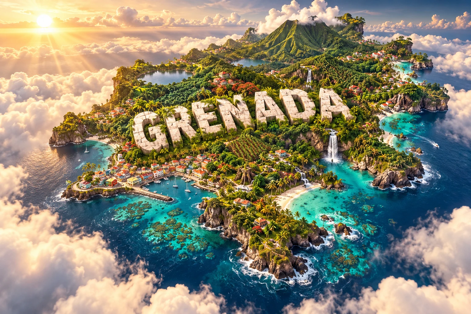
The Grenada artwork combines lush volcanic mountains, spice plantations, waterfalls, turquoise coves, coral reefs and colorful Caribbean-style villages. The high relief and waterfalls evoke the wet main island, especially its central volcanic spine and forested watersheds. Spice plots represent nutmeg, mace, cocoa and mixed agriculture.
The reefs and coves refer to coastal ecosystems and sheltered bays, while the villages symbolize communities on Grenada, Carriacou and Petite Martinique without reproducing one settlement. The composition makes all three islands appear equally lush even though the northern islands are lower and drier.
The image is a conceptual artistic composition. The landmarks, reefs, farms and landscapes are combined for educational visualization and are not shown at their true geographic positions or scale. It is a floating micro-world illustration, not a satellite map, and no reef should be assumed healthy merely because it appears colorful in the artwork.
12. Interesting Facts About Grenada
- Grenada is the southernmost of the volcanic islands in the active Lesser Antilles arc.
- The country includes Grenada, Carriacou, Petite Martinique and smaller islands—not only the main island.
- Mount Saint Catherine is the highest point, though published elevation figures vary slightly.
- Grand Etang is a lake inside a volcanic explosion crater.
- Kick-'em-Jenny is an active submarine volcano north of Grenada, not a peak on the island.
- Carriacou and Petite Martinique are drier because they are lower and produce less mountain-induced rainfall.
- Nutmeg and mace come from different parts of the same fruit.
- The Grenada dove occurs naturally nowhere else and is critically endangered.
- Mona monkeys in Grenada were introduced; they are not native to the Caribbean.
- Coral reefs, seagrass beds and mangroves all support coastal fisheries in different ways.
- Traditional wooden boatbuilding in Carriacou and Petite Martinique entered UNESCO's intangible heritage list in 2023.
- Shakespeare Mas' became UNESCO-listed intangible heritage in 2024.
- Hurricane Beryl struck Carriacou in July 2024 and caused severe destruction across Grenada's northern islands.
- The Eastern Caribbean dollar is shared with several other Caribbean economies.
- Grenada had no inscribed UNESCO World Heritage property as of September 2026, but it had three tentative sites.
13. Short Quiz
-
Why is Grenada volcanic? A. Atlantic oceanic crust descends beneath the Caribbean plate B. The islands sit on the Mid-Atlantic Ridge C. Every coral reef becomes a volcano D. Rivers produce magma
-
Why are Carriacou and Petite Martinique generally drier than Grenada? A. They are covered by glaciers B. Their lower relief produces less orographic rain C. They have no ocean nearby D. Nutmeg trees stop rainfall
-
Which species is endemic to Grenada? A. Mona monkey B. Grenada dove C. African elephant D. Polar bear
-
What are nutmeg and mace? A. Two parts of the same fruit B. Two names for cocoa C. Types of coral D. Volcanic rocks
-
What does the artwork's reef represent? A. A verified map of every living coral colony B. Grenada's marine ecosystems in a conceptual composition C. A freshwater mountain lake D. The location of Kick-'em-Jenny
Answer key: 1-A, 2-B, 3-B, 4-A, 5-B
14. Related Learning
Suggested internal-link opportunities:
- Saint Vincent and the Grenadines Explained: Islands, Volcanoes and Reefs
- Trinidad and Tobago Explained: Energy, Wetlands and Island Geography
- Why the Lesser Antilles Form a Volcanic Arc
- How Kick-'em-Jenny Is Monitored Beneath the Sea
- Why Carriacou Is Drier Than Grenada
- How Nutmeg and Mace Grow on the Same Tree
- How Coral Reefs, Mangroves and Seagrass Work Together
- How Hurricanes Reshape Small Caribbean Islands
- The Grenada Dove and the Importance of Dry Forest
- How Traditional Caribbean Wooden Boats Are Built
15. Sources
- Government of Grenada — About Grenada , for area, island composition, climate and independence context
- World Bank Data — Grenada , for the 2025 population and comparable indicators
- World Bank — Grenada overview , for 2025 economic performance, Hurricane Beryl damage and economic structure
- Government of Grenada Climate Resilience Portal — Climate Change Risk Profile , for topography, crater lakes, rainfall and ecosystems
- Government of Grenada Climate Resilience Portal — Water availability , for wet–dry season contrasts and water storage on the northern islands
- UWI Seismic Research Centre — Grenada island profile , for island-arc geology, volcanic centers and seismicity
- UWI Seismic Research Centre — Kick-'em-Jenny , for the submarine volcano's location, form and monitored activity
- FAO — Grenada country profile , for current agriculture, fisheries and resilient nutmeg initiatives
- Grenada Tourism Authority — Grand Etang National Park and Forest Reserve , for crater, watershed and reserve geography
- UNESCO World Heritage Centre — Grenada , for zero inscribed properties and the three tentative sites as of 2026
- UNESCO Intangible Cultural Heritage — Grenada , for wooden boatbuilding and Shakespeare Mas' inscriptions
- UNESCO — Grenada living heritage case study , for Shakespeare Mas' and community context