

The Dominican Republic occupies the eastern part of Hispaniola, a large Caribbean island it shares with Haiti. Its landscape is far more varied than its famous beaches suggest: high mountain chains cross fertile valleys, dry thorn forest surrounds a lake below sea level, and tropical rivers descend toward both the Atlantic Ocean and Caribbean Sea.
Pico Duarte, the highest mountain in the Caribbean, and Lake Enriquillo, the region's lowest exposed basin, occur within the same country. This dramatic relief reflects a complicated plate boundary where compression, faulting and uplift continue to create earthquake hazards and reshape the island.
1. Where Is the Dominican Republic?
The Dominican Republic lies in the Greater Antilles of the Caribbean. It occupies roughly the eastern two-thirds of Hispaniola; Haiti occupies the western part and is its only land neighbor. The Atlantic Ocean lies to the north, the Caribbean Sea to the south, and the Mona Passage separates the country from Puerto Rico to the east.
Santo Domingo, on the south coast at the mouth of the Ozama River, is the capital and largest metropolitan area. Santiago de los Caballeros anchors the fertile Cibao region. Other important cities include Santo Domingo Este, La Romana, San Pedro de Macorís, Puerto Plata, San Francisco de Macorís and Higüey.
The Dominican Republic must not be confused with Dominica, a much smaller independent island in the Lesser Antilles. “Dominican” can describe people from either country in English, so the full country name or context matters.
2. Quick Country Facts
- Official name: Dominican Republic
- Capital: Santo Domingo
- Region: Greater Antilles, Caribbean
- Land neighbor: Haiti
- Area: Approximately 48,671 square kilometers
- Population: 11,520,487 in 2025, according to the World Bank
- Currency: Dominican peso (DOP)
- Official language: Spanish
- Time zone: Atlantic Standard Time (UTC−4), without seasonal clock changes
- Highest point: Pico Duarte, about 3,098 meters
- Lowest point: Lake Enriquillo, with its surface normally tens of meters below sea level
- Longest river: Yaque del Norte
- Government: Presidential republic
- Independence proclaimed: 27 February 1844
Population and lake level are changing measurements. Lake Enriquillo expands and contracts substantially with rainfall, evaporation and groundwater conditions, so its precise elevation and area vary.
3. Geography and Landscape
Several mountain chains run mainly northwest to southeast. The Cordillera Central is the highest and contains Pico Duarte. Pine forest and cool upland grassland replace tropical lowland vegetation near its summit. The Cordillera Septentrional rises north of the Cibao Valley, while the lower Cordillera Oriental extends across the east.
The Cibao Valley between northern ranges contains productive soils and the Yaque del Norte and Yuna river systems. Rice, cacao, tobacco, plantains and other crops grow in different sections according to rainfall, irrigation and elevation. The Yaque del Norte flows toward the northwest coast; the Yuna drains into Samaná Bay.
In the southwest, the Sierra de Neiba and Sierra de Bahoruco flank the Enriquillo depression. Lake Enriquillo is a saline, landlocked lake below sea level. Its basin continues west into Haiti as the Cul-de-Sac depression. Dry forest, cactus and scrub here contrast sharply with humid northeastern and mountain forests.
The coast includes sandy beaches, mangroves, coral reefs, rocky headlands, lagoons and broad bays. Samaná Peninsula projects into the Atlantic in the northeast. Offshore territories include Saona, Catalina and Beata islands, while Silver Bank and Navidad Bank are shallow submerged platforms north of Hispaniola.
Limestone areas contain caves, sinkholes and underground drainage. Los Haitises National Park is known for rounded limestone hills called mogotes, mangrove-fringed waterways and caves with Indigenous rock art.
4. Why Does the Dominican Republic Look Like This?
Hispaniola sits in the complex boundary zone between the Caribbean and North American plates. Their motion is highly oblique: part of the movement compresses crust, while part is taken up by sideways motion along major faults. Crustal fragments and old volcanic-arc rocks have been folded, faulted and uplifted into parallel mountain ranges.
The Septentrional fault crosses northern Hispaniola near the Cibao Valley. The Enriquillo–Plantain Garden fault system passes through the southern part of the island and Haiti. These strike-slip systems accommodate sideways plate motion and can generate damaging earthquakes. Offshore thrust faults also contribute earthquake and tsunami hazards.
Uplift raised marine limestone above sea level. Rainwater becomes weakly acidic as it absorbs carbon dioxide, slowly dissolving that limestone along cracks. Caves, sinkholes and the mogotes of Los Haitises developed through this process, called karstification.
The Enriquillo basin formed as faulting lowered land between mountain blocks. It has no outlet to the sea, so water and dissolved salts collect in the depression and leave mainly through evaporation. Geological evidence shows that the basin was connected to the sea in the past.
High mountains intercept moist trade winds. Their windward slopes receive abundant rain, whereas descending air dries on the leeward side. This rain-shadow effect helps explain the arid southwest even though lush forests grow elsewhere on the island.
5. Climate
The Dominican Republic has a tropical maritime climate, but elevation, wind direction and mountain barriers create strong local differences. Lowland temperatures remain warm through the year, while nights in the Cordillera Central can be cool and the highest peaks occasionally experience frost.
Northeastern trade winds bring moisture from the Atlantic. North- and east-facing slopes and the Samaná area are generally humid. Valleys and southwestern districts behind mountain barriers are much drier and may support cactus and thorn forest.
Rain seasons vary by region rather than following one exact national calendar. Much of the country has a wetter period from roughly May through November, while northern districts can receive substantial winter rain. Short, intense downpours can trigger floods and landslides.
The Atlantic hurricane season runs from June through November. Hurricanes can bring destructive wind, storm surge and extreme rain, even when the storm center does not cross the country. Climate change increases heat and sea-level risk and can intensify rainfall in the strongest tropical cyclones. Drought also threatens water supplies and agriculture.
6. Wildlife and Ecosystems
Habitats range from coral reefs and mangroves to dry forest, broadleaf rainforest, pine woodland, cloud forest, wetlands and high mountain grassland. Isolation on Hispaniola allowed many species to evolve nowhere else.
The Hispaniolan solenodon is a nocturnal, venomous-insectivore relative whose lineage reaches deep into mammalian history. The Hispaniolan hutia is an endemic tree-climbing rodent. Both occur in suitable forest rather than across every part of the country and face habitat loss, invasive predators and hunting.
Rhinoceros iguanas occur in dry rocky environments on Hispaniola and nearby islands. Ricord's iguana has an even more restricted range in the island's southwest. Lake Enriquillo supports American crocodiles, including nesting populations, but crocodiles are not widespread through ordinary Dominican rivers.
The palmchat, the national bird, builds large communal stick nests and is the only living member of its bird family. Other endemic or regionally restricted birds include the Hispaniolan woodpecker, Hispaniolan parrot and Ridgway's hawk. The hawk is critically endangered and has been the focus of conservation work in the east.
North Atlantic humpback whales migrate into Dominican waters mainly in winter to mate, give birth and nurse calves. Silver Bank, Navidad Bank and Samaná Bay are particularly important. The whales spend feeding months farther north; they are not permanent residents of every Dominican coastal area.
Marine ecosystems face overfishing, warming, coral disease, pollution and coastal development. On land, agriculture, roads, charcoal production and invasive species fragment habitats. Protected areas such as Jaragua, Sierra de Bahoruco, Los Haitises and Cotubanamá conserve different pieces of this diversity.
7. Famous Landmarks and Natural Features
The Colonial City of Santo Domingo preserves an early Spanish colonial grid, fortifications, churches and public buildings near the Ozama River. UNESCO recognizes its enormous influence on later colonial urban planning. Its history also includes conquest, forced labor and enslavement; “first in the Americas” claims refer to European colonial institutions, not the first human communities.
Pico Duarte and Armando Bermúdez National Park protect high Cordillera Central landscapes. The mountain's pine forests, valleys and headwaters show how dramatically altitude changes a tropical island.
Lake Enriquillo is the Caribbean's largest lake and lies below sea level between dry mountain ranges. Its salinity and shoreline shift over time. American crocodiles, iguanas and waterbirds use parts of the basin.
Los Haitises National Park contains limestone mogotes, caves, mangroves and coastal inlets. Rain and groundwater sculpted the karst terrain, while cave art records Taíno use of the landscape.
Samaná Bay and the offshore banks are seasonally important breeding and calving areas for humpback whales. This is a migratory biological event, not a year-round spectacle.
Jaragua National Park and Bahía de las Águilas protect dry forest, lagoons, beaches and marine habitat in the southwest. The region supports threatened iguanas and nesting sea turtles and forms part of the Jaragua–Bahoruco–Enriquillo biosphere landscape.
Damajagua's cascades descend through limestone near Puerto Plata, while Salto del Limón falls through humid terrain on the Samaná Peninsula. They represent different watersheds and should not be combined into one geographic site.
8. People, Languages and Culture
Spanish is the official and overwhelmingly dominant language. Dominican speech has regional variation and vocabulary shaped by African, Taíno, Canary Island and wider Caribbean influences. Haitian Creole is used among Haitian immigrants and Dominican communities of Haitian ancestry, while English and other languages appear in tourism and diaspora connections.
Dominican identity reflects Indigenous Taíno foundations, European colonization, African enslavement and later migration. Taíno political societies occupied Hispaniola before Spanish invasion in 1492. Warfare, forced labor and introduced diseases devastated Indigenous populations, though Taíno ancestry and cultural practices continued through mixed communities rather than disappearing completely.
Santo Domingo became the center of early Spanish expansion in the Americas. Enslaved Africans were brought to work in sugar and other activities. The eastern colony declared independence from Haiti in 1844 after 22 years under a unified Hispaniolan state. Spain briefly reannexed the country in 1861, but the Restoration War re-established sovereignty in 1865.
The twentieth century included United States occupation from 1916 to 1924 and Rafael Trujillo's dictatorship from 1930 to 1961. Trujillo's regime committed severe repression and ordered the 1937 massacre of thousands of Haitians and Dominicans of Haitian descent near the border. Modern discussion of migration and citizenship should recognize both national law and the human rights of affected people.
Merengue and bachata developed through Dominican social history and are now heard worldwide. Merengue combines African-derived rhythms with European instruments and later ensembles; bachata grew from guitar-based popular music once stigmatized by elites. Baseball is extremely popular, but it does not define every Dominican person.
Carnival traditions vary by city and region. Masks, diablos cojuelos and characters such as Guloyas have specific histories; they are not generic costumes worn in ordinary daily life.
9. Food
La bandera dominicana, “the Dominican flag,” commonly combines rice, beans and stewed meat with salad or plantain. The name describes a familiar meal pattern rather than one fixed recipe.
Mangú is mashed boiled green plantain, often served with eggs, cheese and salami in a breakfast known as los tres golpes. Sancocho is a celebratory stew that may combine several meats with root crops, plantain and squash. Ingredients vary by household and budget.
Mofongo, made from fried plantain mashed with garlic and other ingredients, is shared across the Spanish-speaking Caribbean and should not be claimed as exclusively Dominican. Pastelón layers sweet plantain or other starch with seasoned filling. Cassava bread, called casabe, preserves an Indigenous food technology.
Coastal communities use fish and shellfish, while rice, beans, chicken, pork, yucca, yautía, avocado, cacao and tropical fruits connect daily food to local farming and imports.
10. Economy and Major Industries
Services dominate the economy. Tourism supports hotels, restaurants, transport and entertainment, especially in Punta Cana, Puerto Plata, La Romana and Samaná. The sector creates jobs and foreign exchange but also places pressure on coasts, water supplies and housing.
Free-trade-zone manufacturing produces medical devices, electrical products, pharmaceuticals, textiles, tobacco products and other goods. Construction, telecommunications, finance, retail and transport are also important. Remittances from Dominicans abroad support many households and equaled 9.7 percent of GDP in 2025 according to World Bank data.
Mining includes gold and ferronickel. Pueblo Viejo is a major gold operation, but mining creates debates about water, waste, land and local benefits. Environmental safeguards and transparent regulation matter alongside export revenue.
Agriculture produces rice, plantains, sugarcane, cacao, bananas, coffee, tobacco, vegetables, avocados and livestock. The country is a significant organic banana and cacao producer. Small farms remain important even as agriculture's share of total output has declined.
The World Bank recorded 2.1 percent economic growth in 2025 after decades of comparatively strong expansion. That current indicator should be revised as new data appear. Income inequality, informal work, service access, climate hazards and differences between regions remain significant challenges.
11. What the 3D Visual Represents
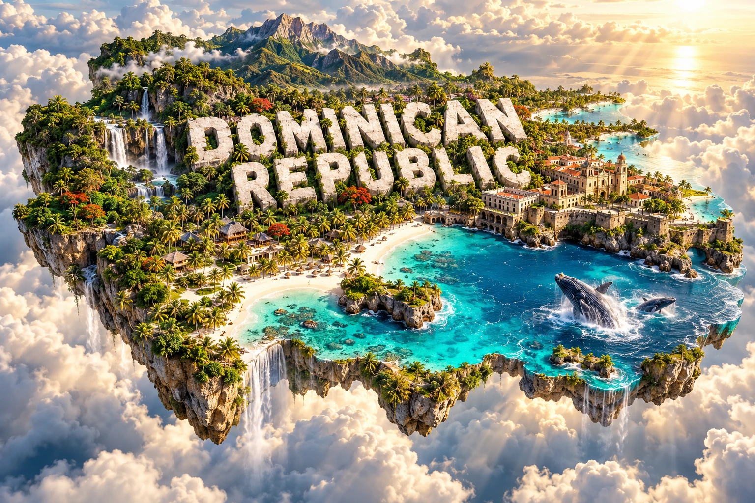
The artwork combines Caribbean beaches, Pico Duarte-inspired mountains, tropical forests, waterfalls, Santo Domingo-inspired colonial architecture, palm groves and humpback whales. Together they represent the country's coastal environments, high interior, river systems, historical capital and seasonal marine migration.
The elements come from different regions. Pico Duarte is deep in the Cordillera Central, colonial buildings are concentrated in Santo Domingo, and major humpback gatherings occur mainly around Samaná and offshore northern banks during the winter breeding season. Palm-lined beaches are only one of many coastal types.
The image is a conceptual artistic composition. The landmarks, wildlife and landscapes are combined for educational visualization and are not shown at their true geographic positions or scale.
12. Interesting Facts About the Dominican Republic
- The Dominican Republic shares Hispaniola with Haiti.
- It is a different country from Dominica in the Lesser Antilles.
- Pico Duarte, about 3,098 meters high, is the Caribbean's highest summit.
- Lake Enriquillo lies below sea level and has no outlet to the ocean.
- Parallel mountain ranges reflect compression and faulting along a complex plate boundary.
- The Septentrional fault crosses the northern Dominican Republic and presents earthquake risk.
- Dry cactus landscapes and humid rainforest occur within a relatively short distance because mountains create rain shadows.
- The Hispaniolan solenodon represents an ancient mammal lineage and survives only on Hispaniola.
- The palmchat is the only living species in its bird family.
- Humpback whales use Silver Bank, Navidad Bank and Samaná Bay mainly for winter breeding and calving.
- Santo Domingo's colonial grid influenced later Spanish-planned cities in the Americas.
- Merengue and bachata developed in the Dominican Republic.
- Casabe preserves a cassava-processing tradition with Indigenous roots.
- The country proclaimed independence in 1844 and restored it after Spanish reannexation in 1865.
- Los Haitises' hills and caves formed through dissolution of limestone.
13. Short Quiz
-
Which country shares Hispaniola with the Dominican Republic? A. Cuba B. Haiti C. Jamaica D. Dominica
-
Why is the southwest much drier than some northern slopes? A. Mountain rain shadows reduce moisture B. It lies inside the Arctic Circle C. Ocean water cannot evaporate there D. The land is covered by permanent ice
-
What type of landscape characterizes Los Haitises? A. Glacial fjords B. Limestone karst C. Sand dunes only D. Active lava lakes
-
Why do humpback whales gather in Dominican waters mainly in winter? A. To build coral reefs B. To breed, give birth and nurse calves C. To feed on mountain plants D. To remain there permanently
-
What is the highest point in the Caribbean? A. Pico Duarte B. Lake Enriquillo C. Los Haitises D. Samaná Bay
Answer key: 1-B, 2-A, 3-B, 4-B, 5-A.
14. Related Learning
- Dominica Explained: Volcanoes, Rainforest and Wildlife
- Haiti Explained: Hispaniola, Mountains, History and Culture
- How Plate Tectonics Built Hispaniola
- Why the Dominican Republic Has the Caribbean's Highest Mountain
- Why Lake Enriquillo Lies Below Sea Level
- How Limestone Creates the Caves and Mogotes of Los Haitises
- Why Humpback Whales Gather Near Samaná
- How Mountain Rain Shadows Create Caribbean Dry Forest
- The Hispaniolan Solenodon: An Ancient Island Mammal
- How Merengue and Bachata Developed
15. Sources
- World Bank — Dominican Republic overview , for current economic and development context
- World Bank Data — Dominican Republic , for dated population, growth and remittance indicators
- UNESCO World Heritage Centre — Colonial City of Santo Domingo , for the city's history, plan and global significance
- UNESCO World Heritage Centre — Dominican Republic , for the country's current World Heritage record
- U.S. Geological Survey — Northern Caribbean plate boundary at Hispaniola , for oblique convergence, faults and microplate tectonics
- U.S. Geological Survey — Septentrional fault , for northern fault behavior and earthquake hazard
- NOAA Institutional Repository — North Atlantic humpback whales , for Dominican breeding areas at Silver Bank, Navidad Bank and Samaná Bay
- Convention on Biological Diversity — Dominican Republic fifth national report , for endemic mammals, iguanas, turtles and conservation programs
- FAO — Dominican Republic agricultural activity , for major crops and farming context