

Solomon Islands is a Pacific country of volcanic islands, raised coral platforms, atolls, lagoons and reefs. An active plate boundary explains its mountains, earthquakes and volcanoes, while island isolation produced remarkable biological and linguistic diversity.
Most people live outside the capital and depend partly on gardens, forests and coastal waters. Geography shapes transport, food, land relationships and the economy.
1. Where Is Solomon Islands?
Solomon Islands lies in Melanesia in the southwestern Pacific Ocean, east of Papua New Guinea and northwest of Vanuatu. It is an archipelago rather than one island. Its islands and sea area stretch roughly 1,450 kilometres from the Shortland Islands in the northwest to the Santa Cruz Islands in the southeast.
The country includes six large high islands—Choiseul, New Georgia, Santa Isabel, Guadalcanal, Malaita and Makira—plus many smaller volcanic islands, raised coral islands and low atolls. Only a fraction are permanently inhabited. Bougainville lies nearby but belongs to Papua New Guinea, not Solomon Islands.
Honiara, the capital, sits on Guadalcanal's north coast. Provincial centers include Auki on Malaita, Gizo in Western Province and Noro on New Georgia. Sea and air transport link settlements separated by channels and rugged interiors.
The Solomon Sea lies west and southwest, and the country has no land borders. Its Exclusive Economic Zone is far larger than its land area, making the ocean central to livelihoods and governance.
2. Quick Country Facts
- Official name: Solomon Islands
- Capital: Honiara
- Region: Melanesia, southwestern Pacific Ocean
- Land area: Approximately 28,446 square kilometres
- Population: 721,455 in the 2019 census
- Currency: Solomon Islands dollar (SBD)
- Official language: English
- Widely used lingua franca: Solomon Islands Pijin
- Local languages: More than 60 living Indigenous languages
- Time zone: Solomon Islands Time, UTC+11, year-round
- Highest point: Mount Popomanaseu, about 2,335 metres, on Guadalcanal
- Government: Parliamentary democracy and constitutional monarchy
- Independence: 7 July 1978
- Largest population center: Honiara
- World Heritage: East Rennell, a natural property on the List of World Heritage in Danger
The census is the strongest measured baseline; later estimates and projections are not new head counts.
3. Geography and Landscape
The main island chain forms a double northwest-to-southeast arc. Many large islands have narrow coastal plains around rugged, forested interiors. Guadalcanal contains the highest relief, including Mount Popomanaseu, and short rivers descend rapidly from mountains to the sea.
Volcanic islands such as Kolombangara have recognizable cones, though erosion and vegetation soften their profiles. Tinakula is an active island volcano in the Santa Cruz group. Kavachi, south of Vangunu, is a submarine volcano whose eruptions can build temporary material above the sea before waves remove it.
Not all islands are volcanic. Rennell is an uplifted coral atoll: tectonic movement raised an old reef and lagoon above normal sea level. Its former lagoon is now brackish Lake Tegano. Low coral atolls such as Ontong Java have very little elevation and face different freshwater and coastal risks from mountainous islands.
Coral reefs fringe many coasts and enclose lagoons. Marovo Lagoon contains reefs, islands, mangroves and channels within a large double-barrier system. Reefs support food and reduce some wave energy but cannot stop tsunamis.
Dense tropical forest covers much of the high-island interior. Mangroves occupy sheltered coasts and river mouths, stabilizing sediment and providing fish nurseries. Rivers are generally short because watersheds are narrow and steep; heavy rain can make them rise quickly.
Fragmentation makes roads and public services expensive, while boats depend on weather, fuel and landing places. The same separation helped islands develop distinct species, languages and cultures.
4. Why Do Solomon Islands Look Like This?
Solomon Islands sits within one of Earth's most complex plate-boundary regions. Along the Solomon Islands subduction zone, oceanic crust associated with the Australian, Woodlark and Solomon Sea plates descends beneath the Pacific-side upper plate. Friction and deformation generate frequent earthquakes.
As a slab sinks, water released from its minerals helps melt mantle rock above it. Magma rises and can feed volcanoes, building an island arc over millions of years. This process produced many high volcanic islands and remains visible at active centers such as Tinakula and Kavachi.
Locked faults store strain and rupture, sometimes displacing the seabed. A magnitude 8.1 earthquake generated a destructive tsunami in 2007. Coastal communities must heed warnings and natural signs such as strong shaking or sudden sea change.
Uplift and erosion reshape the volcanic arc. Rivers cut deep valleys into tropical rock, landslides move weathered soil downhill and sediment spreads onto small coastal plains. Coral organisms build reefs in sunlit shallow water around island margins.
Where tectonic uplift raises a coral reef, a limestone island can emerge. Rennell's reef structure and former lagoon were lifted to form the world's largest raised coral atoll, according to UNESCO. On other coasts, subsidence or rising seas may allow reef growth upward, provided corals can keep pace and survive heat, pollution and sediment.
Thus, steep volcanic islands, uplifted limestone islands and low atolls have different origins and hazards.
5. Climate
Solomon Islands has a hot, humid tropical climate. Its position within 12 degrees of the Equator keeps temperatures fairly uniform through the year. Rain is abundant in most places, but mountains and prevailing winds produce strong local differences.
The equatorial trough shifts seasonally and helps organize clouds and rainfall. Northwestern monsoon conditions generally become more influential from about November to April, while southeasterly trade winds are more common during the rest of the year. There is no universal dry season for every island.
Mountain slopes facing moist winds can receive far more rain than sheltered coasts. Intense downpours cause flash floods and landslides, especially where slopes are cleared or drainage is restricted. High humidity and warm nights are normal rather than exceptional.
Tropical cyclones occur less often than in some parts of the Southwest Pacific because much of the country lies close to the Equator, but they remain serious threats. Cyclone Namu in 1986 and other storms caused destructive wind, rain, floods and waves.
Climate change raises sea level, warms and acidifies the ocean and stresses corals. Low islands, freshwater lenses and gardens face erosion and saltwater intrusion. Relocation is complex because land carries kinship, authority and identity.
6. Wildlife and Ecosystems
Solomon Islands belongs to the East Melanesian Islands biodiversity hotspot. Isolation has encouraged endemism, meaning species evolved in limited areas and occur nowhere else. Some birds and mammals live on only one or a few islands, so habitat loss in a small range can threaten an entire species.
Forests support parrots, fruit doves, kingfishers, monarch flycatchers, megapodes, bats and giant rats. The Solomon sea eagle is restricted to the archipelago. Megapodes bury eggs in warm sand or volcanically heated ground on certain islands; they are not present in every forest.
East Rennell has exceptional island biodiversity, including endemic birds, a bat, land snails and plants. Lake Tegano holds brackish-water life within a former lagoon. UNESCO placed the property on the World Heritage in Danger list in 2013 amid threats including logging outside its boundary, invasive species, resource pressure and management limitations; it remained listed in 2026.
Reefs contain hundreds of hard-coral species alongside reef fish, mollusks, crustaceans and sea cucumbers. Seagrass and mangroves support juvenile fish, dugongs and coastal food webs. Green and hawksbill turtles use feeding or nesting areas, but distribution and abundance vary among islands.
Forest and reef systems are connected from ridge to sea. Logging or poorly managed earthworks increase sediment in rivers; that sediment can shade or smother corals. Overfishing, destructive harvest, invasive species, plastic and sewage add pressure, while ocean warming causes bleaching.
Customary owners manage most land and many nearshore resources. Conservation therefore depends on local knowledge, consent and benefits as well as national law.
7. Famous Landmarks and Natural Features
- East Rennell and Lake Tegano: The country's only World Heritage property occupies the southern third of Rennell. It protects forest, limestone, a vast former atoll lagoon and endemic wildlife under customary ownership.
- Marovo Lagoon: This large lagoon system in Western Province contains coral reefs, mangroves, forested islands and communities whose livelihoods connect land and sea.
- Mount Popomanaseu: Rising to about 2,335 metres on Guadalcanal, it is the country's highest point and part of a rugged interior with high biological importance.
- Kavachi: One of the southwest Pacific's active submarine volcanoes, Kavachi periodically erupts beneath or above the sea surface. Any temporary island material is vulnerable to erosion.
- Mataniko River and Falls: The river flows through Honiara from Guadalcanal's hills. Its landscape is linked both to urban water and flood issues and to fighting during the Second World War.
- Guadalcanal battle sites and memorials: Bloody Ridge, the American Memorial, Japanese memorials and offshore wrecks preserve evidence of the 1942–1943 campaign. They are places of remembrance, not adventure props.
- Skull Island and other sacred sites: Some places hold ancestral remains or ritual significance and require community permission and respectful interpretation. Their importance cannot be reduced to visual spectacle.
- Honiara Central Market: The market brings produce, fish, betel nut, handicrafts and vendors from different communities together, illustrating the capital's role in an island-wide exchange network.
8. People, Languages and Culture
Most Solomon Islanders identify with Melanesian communities, while Polynesian peoples live particularly on outlying islands such as Rennell, Bellona, Tikopia, Anuta, Sikaiana and Ontong Java. There are also Micronesian and migrant communities. “Melanesian village” is therefore too broad to describe every settlement or custom.
English is official and used in government and formal education, but Solomon Islands Pijin is the main shared language for many daily interactions. More than 60 Indigenous languages are spoken. Several may coexist within one province, and language is closely tied to kinship and place.
Archaeological evidence connects early settlement with wider movements through Near Oceania, followed by Austronesian-speaking and Lapita-associated peoples more than 3,000 years ago. Later voyaging created Polynesian communities on several outlying islands. These histories were networks of movement, not a single migration event.
Spanish navigator Álvaro de Mendaña reached the islands in 1568 and applied the biblical name “Islands of Solomon.” Britain declared a protectorate over much of the archipelago in the 1890s. Colonial labor recruitment, missions, plantations and administration changed local economies and beliefs, while customary systems persisted.
The Guadalcanal campaign began in 1942 after Japanese forces built an airfield. Fighting on land, sea and air made the islands a major Second World War theater and caused severe losses and disruption for local people. Islanders served as scouts, carriers, coastwatchers and laborers, contributions often underrepresented in overseas accounts.
Solomon Islands became independent from Britain on 7 July 1978. From 1998 to 2003, armed conflict known as “the Tensions” grew from disputes involving land, migration, inequality and political authority, especially on Guadalcanal and Malaita. The Regional Assistance Mission to Solomon Islands operated from 2003 to 2017. Reconciliation remains a continuing social process.
Kastom refers broadly to customary knowledge, authority and practice, but it differs between language groups. The wantok system centers obligations and support among relatives and people linked through language or origin. Both evolve in towns, churches, schools and modern institutions.
Music, panpipes, slit drums, dance, carving, weaving and shell valuables have distinct regional forms. Canoes range from everyday fishing craft to elaborately built ceremonial vessels. Presenting one canoe or house style as national would conceal that diversity.
9. Food
Food traditions depend on island ecology and household gardens. Taro, yam, sweet potato, cassava, banana, breadfruit and coconut are important staples. Fish, shellfish and other marine foods are central in coastal communities, while pigs have ceremonial and social importance in many—but not all—places.
Foods may be roasted over fire, boiled or cooked in an earth oven with heated stones. Coconut milk enriches root crops, greens, fish and puddings. Poi can refer to a thick preparation made by pounding or cooking starchy crops; recipes and names vary locally.
Ngali nuts, from native Canarium trees, are eaten fresh, roasted or incorporated into dishes and oil. Cocoa and coconut are also cash crops. Urban diets include imported rice, flour, canned fish, noodles and processed foods, creating cost and nutrition challenges alongside traditional foods.
No single meal represents more than 60 language communities. Seasonal availability, reef access, gardening land, religious practice and family preference all influence what people eat.
10. Economy and Major Industries
The economy combines subsistence and cash activity. Many rural households garden, fish and use forest resources while selling cocoa, copra, vegetables, fish or other products. This work provides food and value that formal GDP and wage statistics do not fully capture.
Logging has long generated exports and government revenue, but harvest rates have exceeded sustainable regrowth. Declining commercial forests make diversification urgent. Poorly controlled logging can also damage rivers, reefs, roads and community land relationships.
Mining has become more prominent: World Bank reporting indicates minerals accounted for more than half of exports in 2025, compared with a much smaller share in 2019. Gold, nickel and bauxite prospects can bring revenue but also create environmental, land-rights and governance risks.
Fisheries include village reef fishing, commercial tuna and processing. Agriculture produces cocoa, copra, coconut oil, oil palm, root crops, fruit and livestock. Tourism remains modest and focuses partly on diving, natural landscapes, culture and Second World War history.
Services, construction, public administration, retail and transport are concentrated around Honiara and provincial centers. Remittances, development assistance and seasonal labor abroad also support households. Imported fuel, machinery, rice and manufactured goods contribute to high living costs.
Long distances, limited infrastructure, disasters and a narrow export base constrain development. Sustainable forestry, value-added production, energy, education and transport can broaden benefits when customary owners share decisions and returns.
11. What the 3D Visual Represents
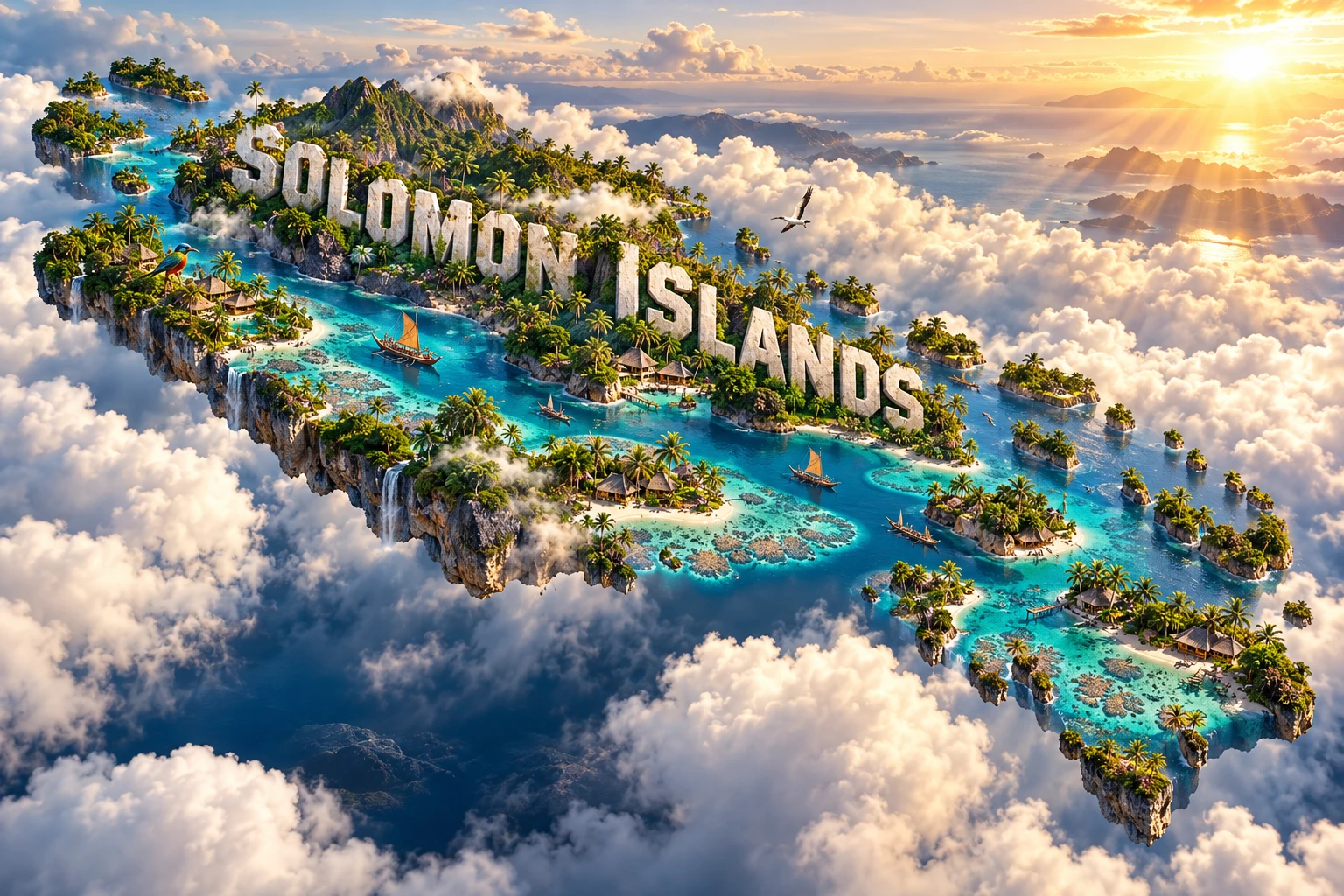
The Solomon Islands artwork combines dense tropical forest, volcanic mountains, turquoise lagoons, coral reefs, traditional canoes, tropical birds and village buildings. These elements symbolize high islands, reef systems, marine travel, endemic wildlife and diverse community life. The large “SOLOMON ISLANDS” lettering is graphic typography.
The country cannot literally form one continuous floating landmass: it consists of many dispersed islands separated by ocean. Its volcanoes, raised atolls, low coral islands, bird ranges, canoe traditions and house styles occur in different places. A single village scene cannot represent all language communities.
The image is a conceptual artistic composition. The landmarks, wildlife and landscapes are combined for educational visualization and are not shown at their true geographic positions or scale. It is an illustrative floating micro-world, not a satellite map, navigation chart or exact reef survey.
12. Interesting Facts About Solomon Islands
- Solomon Islands stretches roughly 1,450 kilometres across the southwestern Pacific.
- Its land area is about 28,446 square kilometres, but its ocean territory is vastly larger.
- Mount Popomanaseu on Guadalcanal is the highest point at about 2,335 metres.
- English is official, while Pijin is the main shared language in many everyday settings.
- More than 60 Indigenous languages are spoken across the country.
- The islands include volcanic peaks, uplifted coral limestone and low atolls.
- Kavachi is an active submarine volcano south of Vangunu.
- Strong subduction-zone earthquakes can generate destructive tsunamis.
- Rennell is recognized by UNESCO as the world's largest raised coral atoll.
- Lake Tegano is the former lagoon of Rennell's uplifted atoll.
- East Rennell is the country's only World Heritage property and has been on the Danger List since 2013.
- Many species are endemic to a single island or small group of islands.
- The Guadalcanal campaign made the archipelago a major Second World War theater.
- Solomon Islands gained independence on 7 July 1978.
- Most land is held under customary ownership, making community consent central to resource management.
13. Short Quiz
-
What kind of country is Solomon Islands? A. A Pacific archipelago B. A landlocked plateau C. One continental island D. A peninsula in the Atlantic
-
Why are earthquakes common? A. Several tectonic plates interact along a subduction zone B. Coral reefs shake during low tide C. Monsoon clouds move the crust D. Rivers freeze beneath the mountains
-
What is Lake Tegano? A. The former lagoon of an uplifted coral atoll B. A crater lake in Honiara C. A reservoir on Malaita D. A freshwater lake created by a glacier
-
Which language commonly links people from different language groups? A. Solomon Islands Pijin B. Latin C. Icelandic D. Swahili
-
Why is the visual conceptual? A. It combines separate islands and traditions into one symbolic scene B. Every island forms one solid landmass C. All birds occur on every island D. The reefs float above clouds in reality
Answer key: 1-A, 2-A, 3-A, 4-A, 5-A
14. Related Learning
- Papua New Guinea Explained: Bougainville and the western Pacific plate boundary
- Vanuatu Explained: Island arcs, volcanoes and Melanesian cultures
- How Subduction Built the Solomon Islands
- Why Earthquakes Can Generate Tsunamis
- How Coral Reefs Grow Around Volcanic Islands
- How Rennell Became a Raised Coral Atoll
- Why Island Isolation Creates Endemic Species
- How Ridge-to-Reef Ecosystems Connect Forests and Corals
- How the Guadalcanal Campaign Changed the Pacific War
- Why Customary Land Matters in Pacific Island Economies
15. Sources
- Solomon Islands Government — country profile
- Solomon Islands National Statistics Office — 2019 census population
- Solomon Islands Government — census reports and projections
- Solomon Islands Meteorological Services — climate in brief
- U.S. Geological Survey — Solomon Islands tectonics and 2007 tsunami
- UNESCO World Heritage Centre — East Rennell
- UNESCO — 2026 East Rennell conservation decision
- UNESCO World Heritage Centre — Solomon Islands
- SPREP Solomon Islands Environment Data Portal — coral reefs
- SPREP — Solomon Islands species and endemism
- FAO — Solomon Islands climate, land use and agriculture
- FAO — revitalizing agriculture
- World Bank — Solomon Islands economic recovery and jobs
- Solomon Islands Truth and Reconciliation Commission — condensed report